Mt. Gould

September is usually the best time of year to visit the Sierra. Weather ain't too cold, snow ain't too high. Wanted to get at it while the goin' was good so on the 7th Grace and I took a little trip up to Kearsarge Pass. We drove up the 395 the day prior, noticing the major construction being done on several parts of the highway. Pulled up to the parking lot at Onion Valley and slept the whole night through. We were lucky to find a parking spot there; on the way up we saw several cars parked along the side of the road leading into the lot.
We woke up the next morning just as the sun was cresting the Inyo Mountains to the east. Little bits of early morning light could be seen reflecting off the tippy tops of the high peaks. We gobbled down some energy bars, put on the layers, and headed out on the pleasantly graded trail. As we moseyed on up the trail we saw the light percolate down the sides of the mountains, painting the valley with a delicate, golden radiance.

We took our time, running into the occasional hiker who was walking down the trail back to civilization. We walked by Little Pothole Lake, Gilbert Lake, Flower Lake. Not a lot of people were out and about which was a surprise to me. Given the popularity of the trail, I was expecting a whole lot of traffic.
We made it to the switchbacks that pass above the aptly named Heart Lake and after surpassing those we caught our first glimpse of Kearsarge Pass and Mount Gould. I mentioned to Grace that if we felt good at the Pass then maybe we could take a shot at climbing Mount Gould since it's basically right next to it. Mount Gould was not in the schedule but the day was looking to be a good one and there wasn't a single cloud in the sky so might as well climb it, you know? On our way up the final switchbacks to the Pass we were gifted with fantastic views of Big Pothole Lake, which was mostly frozen over. I'll admit that a part of me wanted to boot ski down the slope to the lake and goof around on the ice...but I thought better. We made it to the Pass, stopping to chat with a handful of JMTer's who were heading into town. One of them was wearing these 2inch synthetic neon shorts with ducks on em. We complimented his shorts and he was very grateful.
We took a ten minute break. I asked Grace if she felt good and she said yes and I asked if she wanted to climb Gould and she said yes and then I said something like "okay!" and we started the climb. I had summited Gould the previous year with Liam and had learned that it's actually a pretty straightforward climb. There's a well defined use trail from the Pass that leads all the way to the summit block, which requires a class three move. It's an easy peak to climb for the inexperienced, which is great because inexperienced is my middle name.
 |
| Climbing Gould, University Peak in the background |
It was a lot easier climbing Gould this time around, probably because we took our time. The altitude was definitely present but it never made us feel queasy or dizzy or whatnot. We took a lot of breaks, stopping to take in the incredible views of the Owens Valley to the east and the Great Western Divide to the west. We made it to the bottom of the false summit and took one last break before the final bit of the climb. Grace decided to call it quits there. I told her that the true summit was quite literally just behind the false summit, barely even 200 meters away. She said she was good and that ending there was just fine with her so I said something like "okay!" and continued on my merry way. I weaved around the false summit and got my first good view of Gould.
 |
| Mt Gould |
I stuck to the left of the summit and then turned right and carefully scrambled up the class three blocks to the top. I signed the register, noticing that a lot of people who climb this peak do it in tandem with Dragon Peak which lays a little ways to the north. Ain't no way am I doing that, at least for a while. The route to Dragon Peak from the summit of Gould looks extremely intimidating. No thank you. Imma stick to the easy stuff for now.

I didn't stay too long on the summit. I climbed back down, met up with Grace and then the two of us kinda just sauntered back down to Kearsarge Pass. Going down Gould was much easier than going up, and as soon as we hit the pass it was smooth sailing all the way back to the parking lot. We saw a lot more people as we walked down the trail. Seemed like a lot of people enjoyed getting a late start that day. We made it to the car and then hit the road back home. It was an absolutely fantastic day. Always great to accomplish more than what you originally set out to do.
 |
| Big Pothole Lake |

Cirque Peak and Environs

A week after climbing Gould, on the 14th, I asked Grace if she wanted to join me on an adventure up to Cirque Peak. She told me that she had got her fill of the high Sierra so I said something like "okay!" and went at it alone, driving up the 395 to Horseshoe Meadow in solitude. Like Onion Valley, this parking lot was also quite full but I luckily managed to nab a spot a few feet from the trailhead.
It was freezin' in the morning. I waited until the sun had risen a little bit before heading out. All was quiet in the parking lot, not a soul was about. I geared up and race walked down the trail, trying to get the blood pumping. At the meadow I heard a pack of coyotes yipping and yowling some ways off. I never saw them. In fact, I saw nothing that morning. No animals, no people. It was just quiet, cold walking. The switchbacks up to Cottonwood Pass helped warm me up a bit and before long I was at the top of the Pass shedding layers and preparing to climb the first peak of the day: Trailmaster Peak.
 |
| Cottonwood Pass |
 |
| Trailmaster Peak, from Cottonwood Pass |
After taking a short breather at the Pass I continued along the trail. Not too much later I left the trail and started zig zaggin' up to the peak. I never found a use trail but there were a few cairns that I assumed marked the "easiest" way to the summit. Frankly, every possible route looked the same, all of it being class one. I thought the cairns unnecessary as it was quite obvious, even to a dullard like me, where to proceed. I trucked on up through the boulders and eventually gained the summit ridge.

 |
| Chicken Spring Lake |
From the summit ridge I was gifted with a nice view of Chicken Spring Lake, which looked a lot more full than when I saw it last year. I saw two little neon tents near the camping area by the lake. No one was out and about. I followed the rocky ridge the rest of the way to the summit, sometimes straying to the right when things got a little too spicy.
 |
| The Summit |
 |
| Horseshoe Meadow and such |
 |
| On the summit |
I never found a register at the top but, then again, I wasn't lookin' for one. Trailmaster Peak was a bonus for the day as the main objective was Cirque Peak, which was clearly visible from the summit. It was a tad chilly at the top so I put on the ol' sweater and made my way off the summit towards Cirque Peak.
 |
| Cirque Peak on the right |
The walk from Trailmaster to Cirque was surprisingly pleasant as I soon discovered that it was relatively flat. I would say that it was kind of like walking on the moon given how empty and rocky and dry the terrain was but I won't. Why? I saw a few yellow and pink flowers hiding in the cracks between the rocks and last time I checked there are no flowers on the moon so making the comparison is quiet silly, you know? Plus I was breathin' just fine and I know there ain't no oxygen on the moon either so there you go. I walked around peak 12525 and got a good look at Cirque, scanning the south face for the easiest route to the summit.
 |
| Walking on the moon |
 |
| Cirque Peak, Mt. Langley to the right |
I made it to the base of the summit and felt a little disheartened as I looked up at the peak. It looked steeper than a bill at a fancy restaurant. I took a break, drank some water, and began the inevitable slog. Walking up this peak was about as hard as walking up the final rock hop of Whitney in terms of aerobic exertion, despite the fact that this peak is several thousand feet lower in elevation. I was huffin' and puffin', feeling like I was sprinting at full speed even though I was just walking. But no matter. Like I always say, puttin' one foot in front of the other got me to the summit sooner enough.


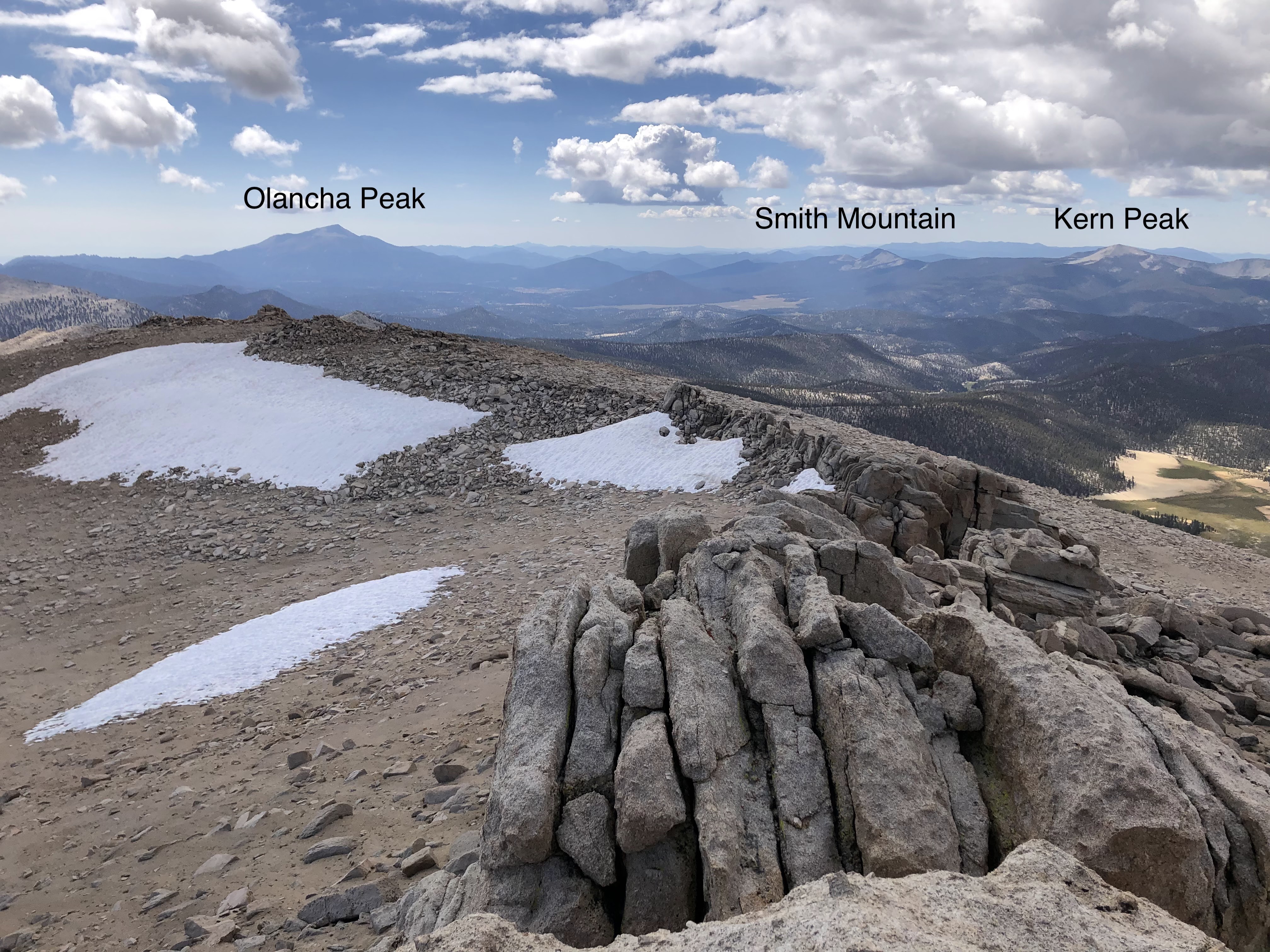
I found the register and signed my name. I discovered that this was a fairly popular peak; the last person summited just two days prior. I hung around at the top for a little bit, enjoying the views of Mount Langley and Mount McAdie to the North, the Kaweahs to the west, Olancha Peak to the south, the several Cottonwood Lakes and Owens Valley to the east. I could not see the summit of Whitney as it was obscured in clouds.
 |
| View West(ish) |
 |
| View East |
 |
| View North |
I hung around for a bit until it started getting cloudy and cold and then I knew that it was time to go. On my way back towards Chicken Spring I decided to take a different route, this time moving around Peak 12525 to the west. This would create a bit of a loop and would save me the trouble of navigating around Trailmaster Peak.
 |
| Heading back, view South(ish) |

As I was walking along I looked up at Peak 12525 and debated whether or not I should climb it. It was, after all, "right there!" and after thinking it over I said something like "okay!" (despite the fact that no one was around to hear it) and made for the summit.
 |
| Peak 12525 |
The going was easy until it wasn't. The summit blocks were particularly tricky and after scoping around for a bit it seemed like there was nothing easier than class 5 up to the summit. I picked the easiest looking group of boulders with the least amount of exposure and cautiously made my way to the top. When I got to the top I realized that I wasn't actually on the true summit, which was about 50ft to the north. I could of rock hopped over there but that was a bit too sketchy for my taste. I stayed were I was, enjoying the same views that I'd seen all day.

I made it off Peak 12525 without issue. The area around the peak has some very interesting rock formations so I took a little time to explore and goof around. After having my fill I steadied my course and made a bee line to Chicken Spring.


 |
| Chicken Spring Lake, Trailmaster Peak on the left |
I found a descent chute that looked like it dumped out on Chicken Spring so I boot skied down that and I was on my way. I walked around the east side of the lake, trying to remember where the water level was last year. I noticed some boulders that I recall leaning on that were almost completely submerged in water. I poked around the camping areas and found nobody. The two neon tents that I had spotted that morning were gone. I hadn't seen anyone all day, which was surprising given the popularity of the area.
 |
| The Chute |

 |
| The PCT |
I made it back to the parking lot in good time. On the drive back I stopped along the road and kinda just sat and stared at Owens Lake for a while. I ain't never seen it full, and I'm fairly sure that most people (before the biblical rains earlier this year) haven't seen it full either. When Grace and I drove back from Onion Valley we saw it along the side of the highway but couldn't take in the scale. But sitting on the road, way up in the mountains, I could see the lake in its entirety, just one big turquoise reflecting pool. It was a neat way to end a neat trip, and I couldn't have asked for better weather. September in the Sierra. There ain't nothin' like it.


