
Things don't always work out. That's just the way it goes. I was planning on a 90+ mile section hike of the JMT this week. Eight full days. I got the permit, got the food, got the gear. Everything was ready. And then I checked the weather and that's where things turned south. There was a snow storm blowing in the day I was supposed to start. And it would continue on into the next day. Highs in the 40's, lows in the upper 20's. Strong icy winds. Snow accumulation. This wasn't no winter storm, but it was still concerning. I didn't really feel like luggin' up all my gear into the mountains in the middle of a snowstorm. If I was already on the trail, well, then I'd just have to deal with it. But I wasn't on the trail. So I had to make a choice. Be cold for a few days and then enjoy perfect weather, or cancel the whole thing. I chose the latter. I don't like the cold. It's one of my weaknesses.
So there I was, stuck in town with nothing to do. And then I got this brilliant idea to climb White Ledge Peak. I was hesitant at first. White Ledge Peak ain't for the faint of heart. I'd climbed it only once before, about three years ago on October 9, 2021. At the time it was the second hardest hike I'd ever done. As of today it sits at #3, its spot taken by the horrors of Cobblestone earlier this year. The route to White Ledge Peak is ridiculously long, sitting at 25+miles with who knows how much elevation gain. I was sore for a whole week. It put me out of commission for a while. And I said I'd never do it again.
And I almost stuck to that assertion. I woke up on the morning of the 18th and sat there pondering. I sat in bed for half an hour, full of trepidation for the hike that I didn't have to do. But I had to do something. So I rolled out of bed, filled up three liters of water, grabbed a handful of bars and a freeze-dried meal, a stove, some gas, and a cooking pot. I was out on the trail by 7:20am.

 |
| Kennedy Ridge |
I'd decided to take the Kennedy Ridge trail from the Ventura River Preserve. This was the way that I took last time. It's long, steep, and very exposed. The thing's like 98% in the sun. Hardly any shade at all. There exists another way up White Ledge, by way of the Murietta Divide from Matilija Canyon. This way, being shorter, is the much more appreciated route. But the dang road is still closed. I was left with no other choice. Kennedy Ridge, here I come.
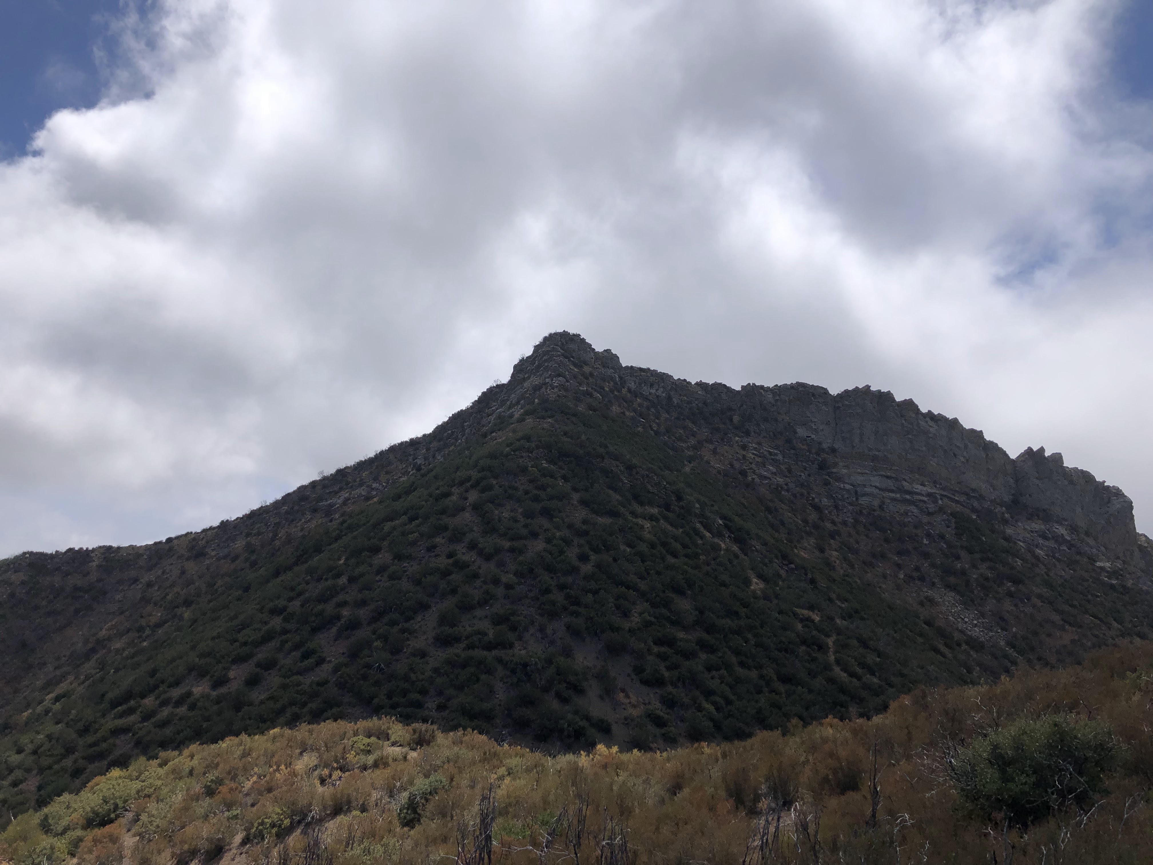
I could see White Ledge Peak from the parking lot. It stood a long ways off. Doubt creeped into my mind. All those memories from my last trip flooded my mind. The long approach. The bushwhacking. The aching legs. The muscle cramps. Dehydration, sunburn, fatigue. I stopped looking at it and kept my head down. I knew that putting one foot in front of the other would take me there sooner or later. So I trucked on, following the signs to the beginning of the Kennedy Ridge Trail.
There was one other person out and about. She stuck to the river bottom, following the well-maintained trails that loop around the River Preserve. Once I was on the Kennedy Ridge trail I had the whole thing to myself. Didn't see a single soul until I made it back to the Preserve later in the day.
I busted through the initial switchbacks very slowly. These things are probably the worst switchbacks I've ever trekked. They're short, steep, and weave up the hills in an erratic manner. I passed a kiosk that showed the position and mileage of the several benches that serve as checkpoints along the trail. These things are a godsend. They help break up the mileage into something manageable. Plus they're a great place for taking breaks.
 |
| Bench #2 |

I took a quick break at Bench #2 and then pressed on. The section from Bench #2 to Bench #3 is, in my opinion, the worst part of the day, excepting the bushwhack to the summit. It's steep, steep, steep. But the trail was in great shape, the brush looked to have been recently cut, and I zoomed up there in no time. From Bench #3 it's a nice steady uphill walk to the top of the ridgeline of the Santa Ynez Mountains.
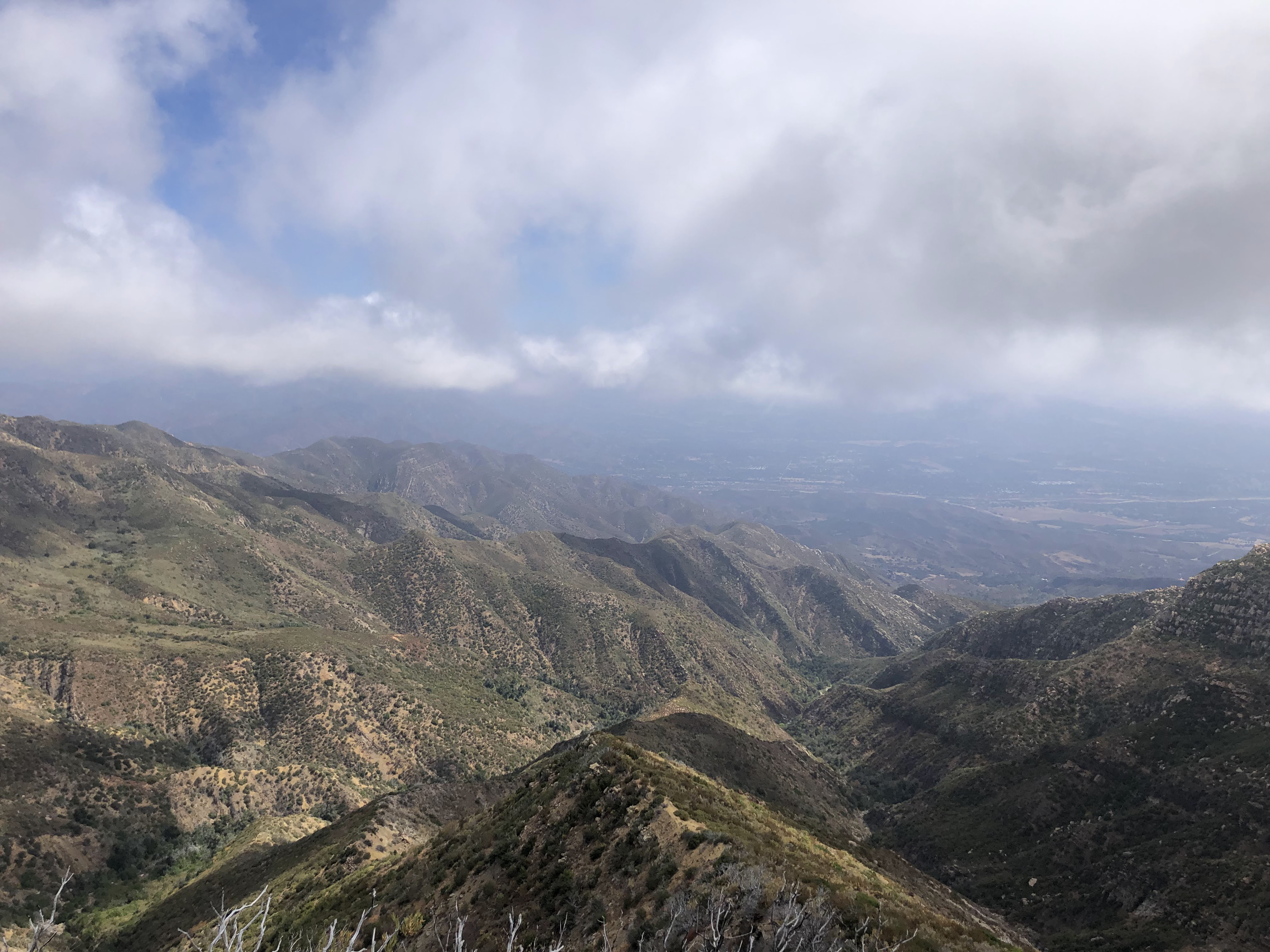
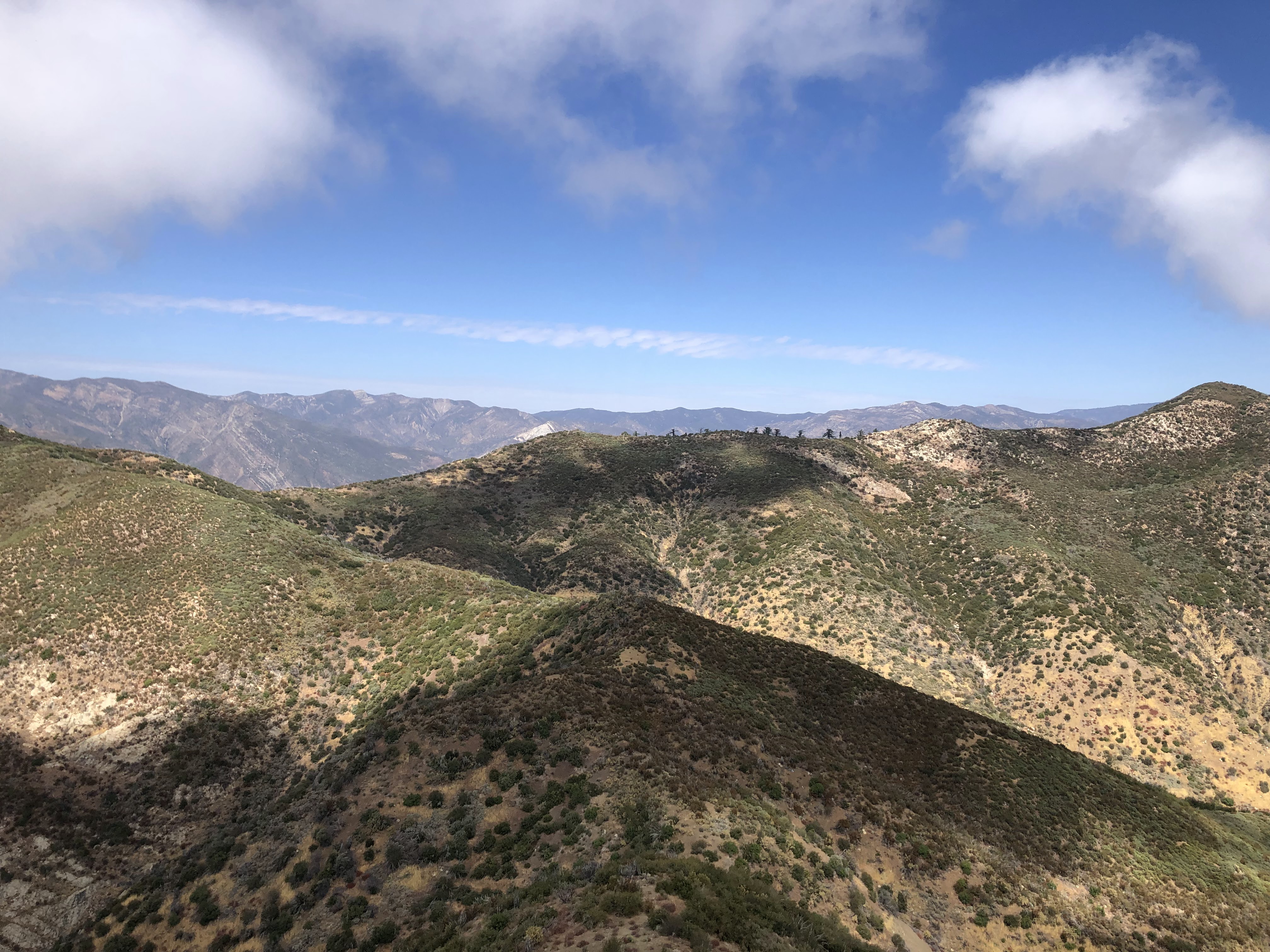
The views were starting to come in now. These are what make the trek worth it. The trail hangs on the southern side of the ridge, offering tremendous views of the Ojai Valley, Oak View, Sulphur Mountain, Lake Casitas, Ventura, the Channel Islands and the vast Pacific Ocean. To the east sit Nordhoff Ridge, the TopaTopa Bluffs and Santa Paula Peak. And whenever the trail weaved onto the northern side of the ridge, I could see most of Matilija Canyon (dam included), Highway 33, Cobblestone Mountain, Thorn Point, Haddock Mountain, Reyes Peak, Dry Lakes Ridge, Cara Blanca, Old Man Mountain, and a good swath of the Matilija Wilderness. It's a unique ridge with unique views. And the lack of foliage means that there's less things to obstruct the view. Good for the eyes, not so much for the skin.
 |
| Looking West |
 |
| Looking East |
I took another break at Bench #4. From there a long, pleasant ridge walk awaited me until I reached the junction with the Ocean View Trail. It's a good section to turn off the brain and soak in the views. The miles will melt under the feet. I downed some calories and trucked on, the weather extremely pleasant.
I saw a big scary bug on the trail. Looked like a big ol' wasp. It was loud, buzzing around on the ground in an angry manner, looking for something to sting. I hopped over it, avoiding its wrath. The bugs were out. Butterflies, gnats, bumblebees, flies, beetles. And birds. Lots of birds. The vultures and hawks were the only ones I saw with my eyes. My ears heard the rest. Heard all their calls and hoots and hollers. The farther I went, the less footprints I saw in the dirt. Soon I started seeing more bear and deer tracks than anything else, along with a good amount of animal scat. I didn't see a bear or deer all day, but I knew they were out there, watching me, waiting for me to go away.
 |
| Lake Casitas |

I made it to Bench #8, aka "The Golden Bench," and dropped my stuff. On the day prior, while at work, I happened to meet the leader of the Ojai "Get It Done Trail Crew," Mike Gourley. What are the odds of that? Him and his crew have been restoring and maintaining the abandoned Ocean View Trail for decades, the very trail I was about to walk. And they've done a hell of a good job doing it. What was once impassible is now wide open, the impenetrable brush cut away and tossed aside. If it weren't for them, a trek to White Ledge Peak would be impossible. Unless one were to take Stillman's crazy route. But who would do that?
We chatted a bit and he told me about the water caches along the trail. Apparently there was a tarn near bench #8 that contained several gallons of bottled water. Mike said, "You might have some trouble lifting the lid by yourself, but you could probably do it." So back at Bench #8, after inhaling more calories, I set off on a use trail in search of this alleged tarn. I found it without much difficulty; the trail led right to it. But that lid was a real pain. Thing probably weighed 160+lbs. I was able to lift it a bit, able to gaze at the several bottles of water that lay inside. It was nice to know that this was here, given that there is no water on the entire route. But if I were severely dehydrated I don't think I'd be able to lift that lid. Thing's damn heavy.
 |
| On the Ocean View Trail |

I set off on the Ocean View Trail, immediately hitting steep switchbacks. This is my favorite part of the entire trail, the section from Bench #8 to Bench #9. The Ocean View Trail lives up to its name, offering spectacular views of the Pacific to the south. Only this time, the ocean was covered with puffy clouds. Oh well. At least it wasn't blazing hot.
The wind kicked up a bit, wicking the sweat off my drenched shirt. The trail was in excellent shape, much better than when I last did it. I could stretch my arms out to my sides and only touch air, the brush masterfully cleared. Little sprouts were growing back in the middle of the trail, but they wouldn't be an issue until next spring. I weaved up and down across the ridge, surpassing the elevation of White Ledge Peak. That's another fun thing about this one. You have to climb higher than the peak itself, descend a bit, bushwhack, and then climb it.
I weaved around Peak 4821 (AKA "Heron Peak"), observing the views to the west, gazing upon the vast expanse of the Dick Smith Wilderness. I'm not familiar with the geography of this wilderness. I didn't know what I was looking at. Nothing had a name. Couldn't make out landmarks. But it sure was pretty. Rugged mountains, canyons, dusty chaparral, distant peaks. Wild, wild country. Hardly anyone goes back there.
I reached Bench #9 (AKA "The Pink Bench") at 10.40 miles. I still had a ways to go. I could see White Ledge Peak, I could see the approach. The brush looked a whole lot worse than the last time I was up there. But I could do it. I'd made it this far. Ain't no way I was turning back now.
 |
| Bench #9 |
Last time, the section of trail from Bench #9 to White Ledge Camp was nonexistent. I had to bushwhack extra far, though it wasn't too hard given that the area was still recovering from the Thomas Fire. Now, thanks to the Get It Done Crew, this section of trail is wide open. I made it to the remnants of White Ledge Camp in no time, the spot where I'd leave the trail for the summit.
There's not much left of the ol' White Ledge Camp. It hasn't been restored. It's overgrown. Practically nonexistent. The only evidence of it being there is a lone ice can stove that sits off-trail in the bushes. I used this stove as a waypoint, traveling south through the brush.
Oh boy. The brush. I was amazed by how much it's been able to grow in three years. I was bustin' my way through head-high chaparral, scratching up my arms and legs on buckthorn and scrub oak, gettin' poked in the stomach by charred branches that were hidden underneath the green curtain. It was slow work. But luckily, the densest brush was in the beginning. The rest of the way actually wasn't that bad, with most of the brush ranging from knee to chest-high. I moved through it like water through a canyon, trying to find the path of least resistance.
 |
| Gettin' closer... |
 |
| Almost there! |
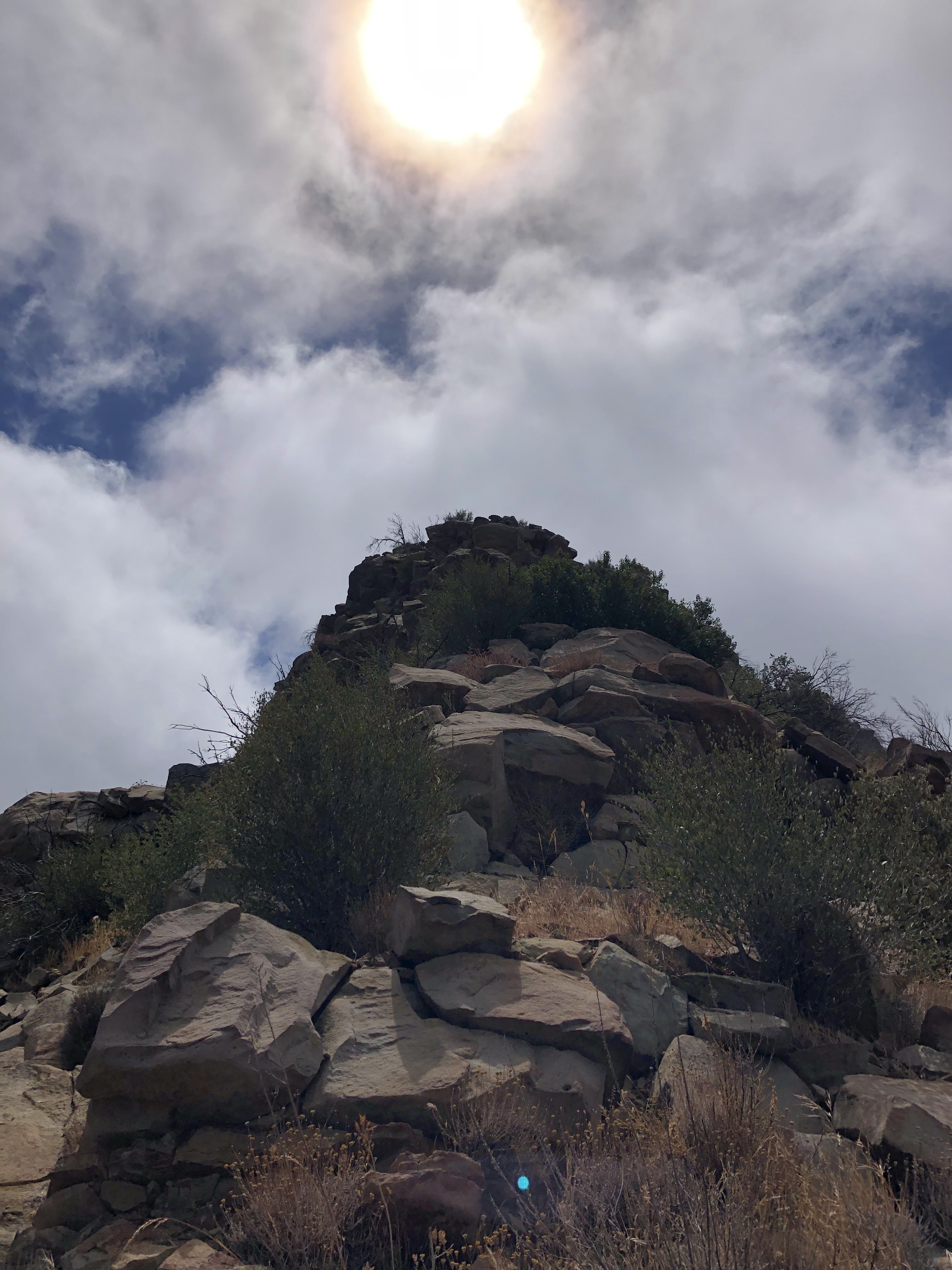
I passed a man-made contraption along the way to the final push to the summit. I believe it to be a rain gauge or something like that. I descended a steep hill, reached a low point, and then bushwhacked up another steep hill. It was nice and cloudy, the weather cool, but I was still sweating my butt off. I made it to the top of this hill and then pressed on, now maneuvering up some class 2 rocks and ledges. I found that I could avoid a lot of this scrambling by hanging to the right (west) of the ridge. The rock is loose and crumbly—not ideal for scrambling. I hopped up the last couple of ledges and boulders and made it to the summit a little after 12:20pm. Yahoo!
 |
| View West(ish) |
 |
| View South |
 |
| View East |
 |
| View Northeast |
It looked exactly how I remembered it, although this time there were more clouds. The summit cross had been moved, this time poking out of two rocks on the tippy-top of the summit. I found the register, but there was nothing in it. It's a lonely, windy, rocky, isolated, awesome summit. I'd argue that it has the 2nd best views of any peak in the Los Padres, after Old Man Mountain. On a good day, without any clouds, you'd get 360° unobstructed views of much of Ventura and Santa Barbara Counties. That's pretty insane.
I hung out on the summit for almost an hour. I cooked up my freeze-dried meal, wolfing down the protein and sodium it provided. I spent a good long while soaking in the views, traversing across the southwest ridge to another highpoint. I saw "trespass gully," the route Stillman took before the Ocean View Trail was made accessible. The thing looked gnarly. Can't believe that people had actually been down there.
 |
| View North |
 |
| Southwest Ridge |

I lingered for a bit, put the stove away, and then said my goodbyes. I took one last look at the summit and then made my way for the inevitable bushwhack back to the trail. As per usual, I found an easier way through the brush on my way back than on my way in. Don't know why it works like that. I made it back to the trail, my hands and arms covered in scratches and char. I had done it. I had successfully reached the summit for a second time. The worst part of the day was over. Now all I had to do was walk out of there. I still had a long, long way to go.


I turned my brain off, guzzled down more calories, hummed some tunes, did anything that could take my mind of the endless miles. The clouds were clearing up, creeping away from the coast, revealing the piecing blue of the ocean. The trail is a lot more scenic on the way back. I could fully enjoy it now without worrying about climbing some silly mountain. I took many pictures, mostly of the full Lake Casitas, which hasn't reached capacity in some 25 years. The last time I saw it from up on that ridge, it looked like a puddle.
 |
| Strange Yucca |
 |
| Miles to go... |
I reached Bench #8, my water supply still running strong. No need to use the tarn. I started jogging, my stove rattling around in my pack with every step. I tripped on a bunch of burnt stumps, almost eating it on several occasions. My legs started cramping up so I stopped jogging, deciding to walk the rest of the way. I put my legs in cruise control and coasted the whole rest of the way out.
The benches passed before my eyes one after the other. I didn't stop. I didn't look back. I just put my head down and trucked out of there. I reached Bench #4, took a brief break, downed some Liquid IV, and continued on trucking out of there. I trucked down the steady grade to Bench #3. I trucked down the disgusting switchbacks to Bench #2. I trucked down the undulating Kennedy Ridge, zooming on the downhills, powering through the uphills. I reached the kiosk, briefly started jogging again, tripped on my shoelace, and then gave up on running. I slowed it down to a quick walk, zooming down the last few disgusting switchbacks, reaching the river preserve, reaching the home stretch.
 |
| Back on Kennedy Ridge |
 |
| Ventura River |
I crossed the Ventura River, which still had a surprising amount of water in it. I made it back to the trailhead a little after 5:30pm. I was over an hour slower than my last time up to White Ledge Peak. But that hour made all the difference. I felt good. My legs weren't entirely dead. That achy, sickly feeling wasn't there, the kind where your body feels like its gonna fall apart. Dare I say it was actually a rather pleasant hike? Yep, yep it was. It was still a ridiculously long day. Not something that I'd particularly want to do again. But the mountains were kind to me that day. And the trail was in excellent shape.
I still ain't done with ol' White Ledge. I still have to check out that route from Matilija Canyon, up to the Murietta Divide. Once I've done that, I'll have done all I needed to do with that blasted mountain. But who knows when I'll do that. Just gotta wait for the road to open.

No comments:
Post a Comment