05/15/25

I've been spending too much time in the Sespe Wilderness as of late. Needed to change things up, see some different sights, visit a part of the forest I ain't ever been. Particularly one with plenty of trees, views, and pointy summits.
The giant swath of the Santa Barbara backcountry came to mind. I've only visited that country just once, and that was a very long time ago. Eleven years to be precise. Gnarly trip. Walked from Nira all the way up the Sisquoc to Madulce Station, then attempted to make it to Dutch Oven Camp but got turned around. Backtracked to Madulce Station, went from there to Bluff Guard Station, down to Pens Camp, through the Indian Narrows and "The Perfect Ten," and then out to Mono and P-Bar Flats. Most people will have absolutely no idea what a trip like that even means, but for those who know the country or have even been to some of the spots I've mentioned know what I'm talking about when I say that that trip was rough. That trip was my first and last good taste of the San Rafael and Dick Smith Wildernesses. I loved it, but it scared me a little. Well, it ain't scarin' me no more. There's some peaks out there that I needed to check out, peaks that could help me observe this country of which I know so little about.
Peaks are a great way to get to know an area. They give you expansive views of the surrounding country, helping you understand the lay of the land. When I was truckin' it on the Manzana and Sisquoc trails all those years ago, I recall looking to the south and seeing these high, snow dusted peaks. I've always wondered what was up there ever since, what kind of views they had, what could be seen from the summits. Recently, I discovered three prominent peaks in them mountains: Cachuma Mtn, McKinley Mtn, and San Rafael Mtn. These were my desired summits. And as a bonus, almost all of them could be accessed via bike. And you know I just love a good bike ride. So I loaded up the ol' bike and drove off towards Santa Barbara.

I took Hwy 154 to San Marcos Pass, noticing tall flames and thick smoke hovering near Painted Cave. It looked like a controlled burn, at least that's what I hoped it was. I drove on, coasting down the pass until exiting on Armour Ranch Rd. From there I turned right and took Happy Canyon Rd the rest of the way to the trailhead. I don't know what was so happy about that canyon, but it was a very pleasant drive nonetheless. Lots of lazy oak trees, tall grass that was just beginning to turn golden yellow, sleepy cows, ancient barbed wire fences, and ranches and houses that looked like they came right out of a Steinbeck novel. There were two cyclists with very muscular legs suffering their way up the steep grade to who knows where. I looked at them and thought, "gee, that doesn't look like any fun at all." Funny thing was that I was about to do the same thing on a dirt road in just a few moments.
I made it to the trailhead and pulled off the side of the road. There was a lot of construction going on everywhere, with several trailers and heavy equipment taking up the entirety of the dirt parking lot. A construction guy politely informed me that I had to move my car, so I drove a little ways up forest route 8N08.1 to the closed gate. There was one other car parked there. I got out the bike, drank some water, and then set off on my journey into the mountains a little before 11am.
I rounded a corner and was gifted views of the Hurricane Deck. I've only seen the Deck once, so it was a little weird seeing it again after all these years. Looked exactly how I remembered it, just a little farther away. I stopped pedaling, got off the bike, and took the time to enjoy the view.
 |
| Hurricane Deck |
The grade lessened a little ways after this viewpoint, giving my quads and calfs a chance to breath. I could see my first objective, Cachuma Mountain, looming ahead of me. It looked like a great little summit. I rounded another corner, now gifted with views to the east. Mission Ridge, San Rafael and McKinley Mountains were in plain view, big and green and distant. I pedaled to the eastern base of Cachuma Mountain, stashed my bike, and then began the short climb to the summit.
 |
| Cachuma Mountain |

On my way up, I noticed a small speck making its way down the road. This must be the owner of the vehicle I saw parked by the gate. They were walking at a slow pace, carrying what looked like a 50L backpack. A small part of my mind was screaming "I hope that sonuvagun doesn't nab my bike" but I silenced it, knowing that such an event would be highly unlikely. People are generally very kind in the woods. Why negative thoughts come to mind must be a result of spending too much time in civilization. The figure walked along, passed my bike, and continued down the road without breaking stride. I never saw them again, nor did I see anyone else for the rest of the day.
The climb to the top of Cachuma Mountain was short but very steep. It took me a minute to swap my biking muscles for my hiking muscles. I stumbled up the steep slope, following the occasional cairn. I topped out on the summit in good time, enjoying the nice 360° views of the surrounding country.
 |
| West |
 |
| East |
 |
| South |
To the west I could see Ranger Peak, Figueroa Mountain, Zaca Peak, and the large burn scar of the 2024 Lake Fire that devastated much of that area. Down below, looking like a toy set, I could see the construction sight. Heavy equipment rolled about, the sound of diesel engines and shouting voices reaching my ears. To the east were lovely views of the two additional peaks I had yet to climb. I was more concerned with the thin line of the road snaking its way towards those peaks. Looked long, steep, and fully exposed to the sun.
To the north were improved views of the Hurricane Deck and the Sierra Madre Mountains, and to the south I could see the wide expanse of the Santa Ynez Range stretching from east to west. San Marcos Pass looked tiny from the summit, the sharp glint of the occasional car reaching my eyes. Lake Cachuma was a lovely blue jewel, filled close to capacity thanks to last year's rains. I spent most of my time on the summit looking at this southern view, noticing that there was no longer any smoke rising from the Painted Cave area. Must have been a controlled burn after all.
I located the register, made my marks, and found out I was the first person to summit the peak this year. The booklet was placed on Feburary 13th of 2016; the most recent entry was from November 30th of 2024. Seems like most people skip this peak in favor of McKinley and the other high peaks. I don't see why anyone would do such a thing; Cachuma was a great little climb with marvelous views.
I spent a good chunk of time on the summit, drank some water, shoveled down some food. The bugs were out in full force, trying to suck the water out of my eyes. I paid them no mind. I put the register away, waved goodbye to the summit, and then made my way back down to my bike. Once there, I saddled up and kept on truckin' along the road, coasting the downhills and powering through the inclines.
 |
| Hell's Half Acre |
I eventually made it to a spot known as Hell's Half Acre. Passed right next to it on the side of the road. Not too sure why it's got such a spooky name or if it's even a true half acre in size. From what I could see, the place looked like a cool collection of rocky boulders surrounded by mean, pokey brush. Worth exploring? Maybe. I had bigger fish to fry, so I gave it a pass.
It wasn't long after passing Hell's Half Acre where the road deteriorated quite significantly. Ruts, divots, big ol' rocks everywhere. It was also at this point where my quads decided to give up. I'd been biking steady all morning and the steep grade wasn't agreeing with my legs anymore. My experience biking to work on a paved road helped at first, but this was a whole other animal. I walked my bike a lot from that point on, pushing it up the steep grade, slipping every so often, the sweat pouring through my eyebrows and into my eyes. I thought about ditching the bike and just walking the rest of the way—that would be much easier. But I knew I'd want it for that sweet, sweet downhill, so I kept at it, pushing the contraption up the road one step at a time.

I took a break in some glorious shade, sitting in the dirt amongst the oaks. Much of the ground was littered with dry acorns and their caps, crunching loudly every time I shifted my weight. It couldn't have been more then 80℉, but I was absolutely soaked in sweat. Good thing I brought plenty of water. Ain't gonna make that mistake again, I tell you what!
Back on the bike, back to the grade, the acorn caps popping under my tires, the miles passing slowly one after the other. I'd ride a little, walk a little, drink more water, sweat it out, repeat, repeat, repeat. I'd go up, then down a little, then back up, then down a little, and then up a steep incline so crazy that it must've been specifically designed to make my calfs cry and my quads whimper. Eventually, I passed McKinley Springs, a nice little campsite in the shade of several old oak trees. No time to stop, though. I had a mountain to climb. I pushed onward, not stopping until I topped out on McKinley saddle.
 |
| Santa Cruz Peak |
I could see Santa Cruz Peak from McKinley Saddle, distant and brushy and foreboding. I've heard of a local challenge known as "The Big 3," which involves climbing McKinley, Santa Cruz, and San Rafael all together. It's a 30+ mile trek with wayyy too much elevation gain for my liking. Most people do it over a day or two, others bike it, and some crazy freaks walk it on foot in a single day. Looking at it from the saddle, I briefly thought about venturing down the abandoned and brushy road to the summit, but I knew I didn't have enough time. I basically started the day at 11am for cryin' out loud. If I had started earlier, then maybe, just maybe Santa Cruz would be in the cards. But not today. I stashed my bike in the shade, adjusted my pack, and then set off on the short trail to the summit of McKinley.
 |
| On the way to McKinley |
It was a lot more gentle of a climb to the summit of McKinley than it was to the summit of Cachuma. The trail was steep at first, but then it leveled out; nothing but a nice, easy walk to the top. A breeze had kicked up, sparing me from the thirsty bugs. I made it up with minimal effort, sitting on the summit rocks and soaking in the impressive views.

Someone had mentioned in the Cachuma register that the views on McKinley were worse than those on Cachuma. I don't know what they were on about, because the views from McKinley were far superior. More grand, more wide, more expansive, more "airy." Though the climb to the summit wasn't as interesting, the views from the summit more than made up for it. It was basically the same view as that on Cachuma, the same landmarks and everything, but with a little extra zing. McKinley was essentially "Cachuma Premium." I spent a good 20 minutes on the summit, the breeze keeping the bugs away, the clouds twirling in the sky. Very peaceful up there; the sounds of civilization never met my ears. For the first time that day, I felt like I was finally out there. And it felt damn good.

There was a shiny new register on the summit, placed on April 27th of 2024. The last entry was from April 8th of 2025. A lot of the entries were from those attempting "The Big 3." Crazy folks. I won't be doing that any time soon, believe that!
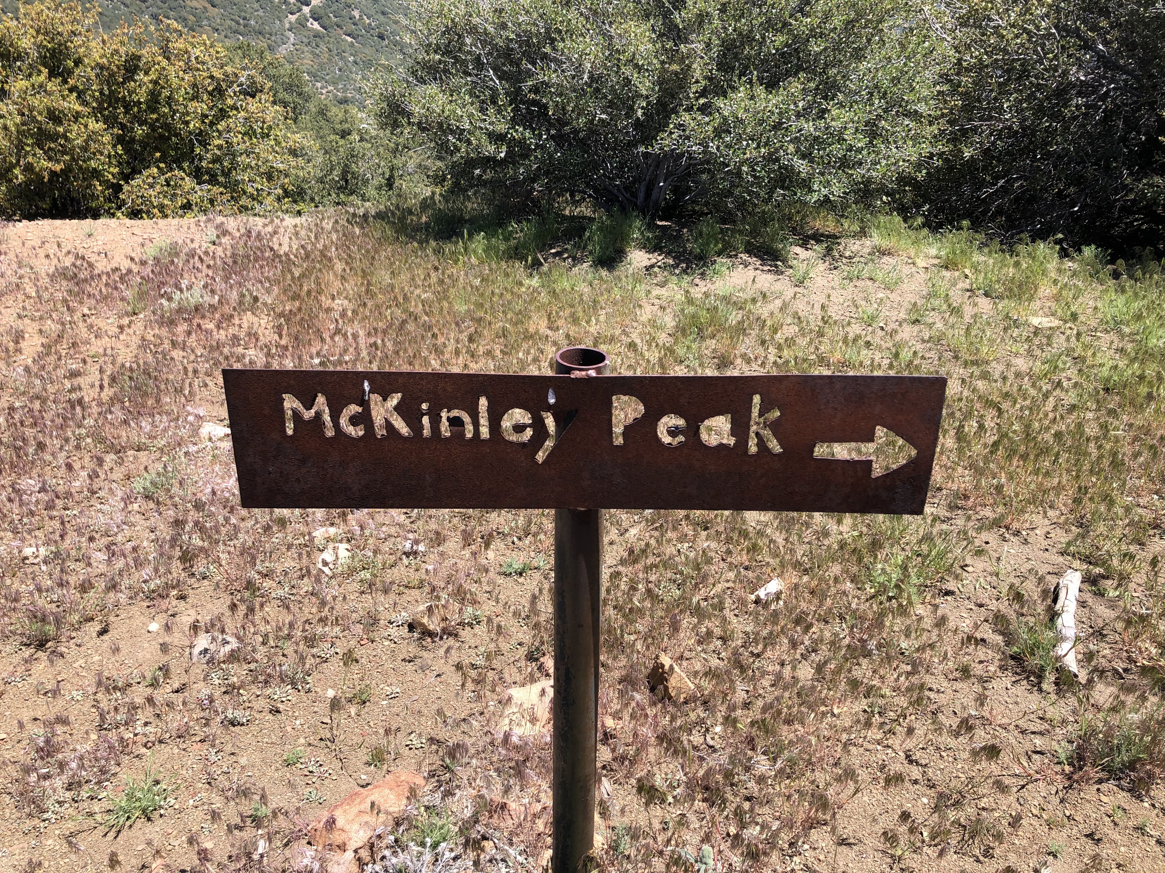
I gathered my things, ate an energy bar, and then left the summit. Two down, one to go. I spent much of the descent looking at San Rafael Mountain to the east. It was close, but I knew it was still a two mile trail walk to the top. Suits me. A break from biking and a shift to hiking was music to my ears.

 |
| Not much left of the ol' sign... |
I started on the Mission Pine trail, a welcome relief from the endless road miles I'd been traveling for most of the day. The trail was absolutely exquisite, slowly gaining elevation through a dense forest of hardy chaparral. Buckthorn, scrub oak, chamise, manzanita and more—it was all there and it smelled heavenly. The clouds in the sky had grown more puffy, casting large shadows on the surrounding country. It's crazy how something as simple as a cloud can make an area 10x more scenic. I stopped often, snapping one photo after another, observing the clouds and their shadows and the chaparral and the purple patches of lupine shining brilliantly in the afternoon sun.
 |
| San Rafael Mountain |
The trail passed right next to the summit of San Rafael Mountain, making it the easiest climb of the day. I was more curious with the rest of the ridge though, so I ventured a little farther down the trail through the pines to this little outcrop of sandstone boulders that caught my eye. I scaled the boulders, took a seat, and enjoyed the best views I had seen all day. Before me lay the rest of Mission Ridge, isolated, rugged, full of scraggly pines and sandstone formations. It looked a lot like the area between Reyes Peak and Thorn Point, just a lot more wild. Way off in the distance, I could see Big Pine Mountain, Samon Peak, and Monte Arido and Old Man Mountain. Even farther away sat the Cuyama Badlands, Cerro Noroeste, and Mt. Pinos—the highest point in Ventura County.


I nibbled on a granola bar, taking in the scene one chunk at a time. Ah yes, now this is what I was looking for, this is what it was all about. I absorbed the lay of the land, pointing with my finger the various landmarks I recognized and those of which I was unfamiliar. I felt so small up there on those boulders, so isolated, so free. It was a strange sensation, one that I haven't experienced in a long, long time.
I only spent about 10 minutes on those boulders, but it felt much longer. Once I'd had my fill, I packed up my things, waved goodbye to the vast expanse of wilderness that lay before me, and turned back towards San Rafael Mountain.

I took my time, traveling silently amongst the pines. I had no idea I would be walking in such an environment that morning, so I savored every moment of it. I'm a sucker for Jeffrey Pines; I love the way they look, I love their vanilla smell. The way the wind moves through their needles and the crunchiness of their pinecones and the roughness of their bark—I love it all. I walked slow, taking pictures of these quiet, wonderful trees. But soon they disappeared and I was back to the regular scene of rugged chaparral.

 |
| View east |

I reached the summit, took a seat. There were three booklets in the register. The one I signed was placed on November 25th of 2023. The most recent entry was from May 10th, just five days prior. I didn't spend too much time on the summit, taking only enough time to snap a few pictures and do a quick sweep of the area. I still had a long way to go, worrying that it could be even longer if one of my tires deflated. Man, that would totally suck. I trotted down the trail, praying that I didn't run over a thorn on the way up.

Back at McKinley saddle, I stopped for a moment to sign the trail register. Lots of hikers and bikers and backpackers had made their entries, all of them loathing the dreaded miscreant who rides their dirt bike on the Mission Pine Trail. Someone warned that they'd personally boobytrapped the trail specifically for bikers. That gave me a little chuckle. I signed my name, thanking those who go through the effort of maintaining the trail. Without their efforts, cool backcountry trails like this one would soon disappear.
I returned to my bike, relieved to find both of the tires full. Hallelujah. Now all I had to do was to take it slow and try not to crash on the way down. I said my goodbyes to the saddle, kicked the bike into gear, and then set off down the road.
Along the way, I made a quick stop at McKinley Spring. There were two sites, the western one being the nicer of the two. Both of the tubs were full of clear, cold water. I poured some on my head, washing away the lines of salt that had accumulated there throughout the day.


From then on it was an adrenaline-fueled, white-knuckled descent down the crazy road. It was a good thing I'd brought my helmet because, despite my best efforts, I still managed to crash a few times. I'd slow down to a crawl, hands tight on the breaks, and then I'd hit a rock or fall into a small divot and have to ditch the bike. If I didn't, I'd fly right over the handle bars. I've already done that plenty of times in middle school, and I didn't feel like doing it again on this glorious day in the mountains. I got off the bike and walked down some of the steeper sections, not wanting to risk the chance of another crash.


Walking, biking, walking biking. I walked much of the way around Hell's Half Acre, taking the time to really look at all the formations and whatnot. After that, I hopped on the bike and was able to ride it most of the way back to the car. The last little bit from Cachuma Mountain to the gate was especially fun, reminding me of Shelf Road in some spots. Man, bringing the bike was a fantastic idea. Zooming down that road without pedaling, the wind ripping across my face, everything passing by in a blur—it was plain awesome.
When I returned to my car the other vehicle was gone, the sounds of construction no more. The whole day had taken 6½ hours, but it felt much longer. It was a good day in the woods. Saw some stuff I ain't ever seen, saw some old spots from a new vantage point, got to enjoy a little solitude. All good stuff.

No comments:
Post a Comment