Contrary to what the citizens of the People's Republic of China may believe, this year most certainly was NOT the year of the Dragon. It was the year of CONSTRUCTION. From January 1st all the way to today, from sunup to sundown, day in, day out, there was always construction going on somewhere. Everywhere I went I saw it. Every time I drove up the 33 it was there. Every time I drove past Nordhoff High it was there. The school tore down the bleachers, started building a new pool, and now the city's messin' with the sidewalk. And not only that, but the city also done torn up main street and replaced all the damn pipes. Back in 2022, while working the music festival, I remember talking to a construction worker who mentioned a project like that. He said they were supposed to do it that year. I guess it got postponed. And why not? This was the year of construction after all. Perhaps all construction projects got postponed to this year. If there was any time for construction, this was the time to do it.
So many projects, so much paving, scraping, demolishing, rebuilding. Saw it driving to work everyday, saw it happening on the promenade by Surfer's Point. Saw it on the bike path, Ventura Avenue, the Botanical Gardens and the Serra Cross. Construction workers on the move, sweeping, paving, riding in the back of massive vehicles, tearing up the ol' skate park and putting in a new one, digging up the ol' pipes on Seaward after a gas leak. Hell, they even reopened the Ojai theater. It was a gawl dang miracle. That thing's been under construction longer than the Pyramids of Giza and this was the year they finally finished it. Of course this was the year they finished it. It's the year of construction after all!
And when I thought I could escape it by leaving town, escape the noise, the traffic, the ruckus, I quickly found that this was impossible. This was the year of construction. There was no escape. Santa Barbara, Los Angeles, Santa Clarita—in all of these places I saw major construction on highways, byways and sidewalks. Even driving up to the Sierra and out to Death Valley proved futile. The 395 is adding in another lane, Whitney Portal Rd near Lone Pine is being replaced after having been washed away, and Wildrose Rd, west of the Panamint Range, was closed due to flood damage. I've said it once and I'll say it again: this was the year of construction. There was no escape.
Perhaps that was a good thing. Because this year of construction not only set the precedent for improving the local infrastructure, it also set the precedent for improving myself. I engaged in my own personal construction. Worked on my mind and body. Ran three half marathons, climbed twenty-three mountains, read twenty books, wrote a sixty-five page, 40,000 word manuscript, and biked to work almost every day from March to October. I was on one this year. Felt obligated to do stuff, mostly out of fear that if I didn't time would slip by all too fast. And so I did a whole lotta stuff this year, some of which I documented on this blog. But there were a few things that I didn't mention.
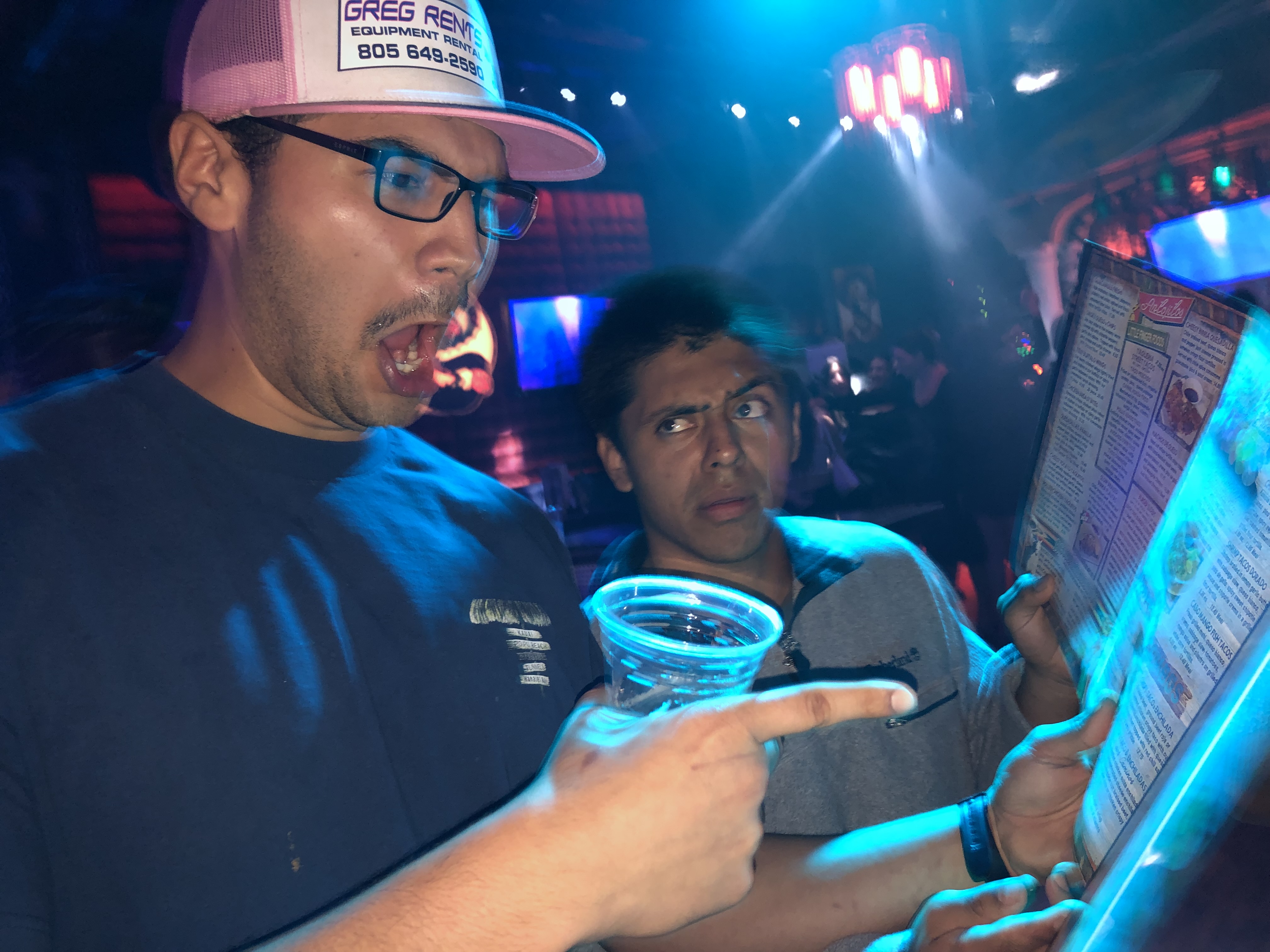
Back in January, a solid group of hooligans high-tailed it to State Street to celebrate John's birthday. It was a partly cloudy night with a bright moon, perfect weather to engage in some buffoonery. The evening's festivities began at a Mexican restaurant of which I cannot recall the name. There were six of us, half wearing cozy sweaters, half wearing short-sleeved shirts. Half had mustaches, half didn't. All of those wearing short-sleeved shirts had mustaches, all of those in cozy sweaters did not. When we sat at the table we subconsciously split into groups: those in cozy sweaters and no mustaches sat on one side of the table and the rest sat on the other. Those with mustaches consumed copious amounts of drink, those without stayed sober (although only one of them would remain so by the end of the night).
After the meal we walked around, entered a few of the bars, danced around, ordered more drink. John ended up shirtless after having champagne spilled all over his person. We walked up and down the street, always returning to this one bar in particular that had this drink with about a trillion straws and one rubber shark buried at the bottom of it. Then we tried getting into a club of sorts, but one of our group (I ain't sayin' who) was a bit too tipsy to enter. "Your buddy's gotta sober up" is what the bouncer said. And so, distraught, we walked back to that bar with the rubber shark beverage and that buddy of mine did the exact opposite of what the bouncer told him to do.
I remained outside of the bar. My ears needed a break. Those bars play their music just a tad too loud. The evening was surprisingly quiet. A few street vendors had set up shop outside the bars, grilling overpriced hot dogs and kabobs, lying in wait for the hapless drunks to stumble out on the street, hungry and unhinged, their stomachs craving nothing but greasy food. I saw a guy steal a hot dog. Just walked up, grabbed one, and then took off at full sprint. The vendor chased after him, giving up the chase after about a hundred feet. I offered to pay the vendor for what was stolen; he denied. Drunks started spilling out of the bars and soon he was busy with plenty of customers.
The night grew long, the moon shone bright, we went to another bar, Marco joined me outside by some tables where we talked about Dostoevsky's Crime and Punishment, the street life died away, the vendors closed up shop, and John's birthday celebration came to a close. One stayed in Santa Barbara that night, the rest carpooled with the only sober member of the group. Got home late and went to work a few hours later. That's just the way it goes sometimes.

February and March brought cold skies and stormy weather. Though the rain was not as violent as it was in 2023, it was a hell of a lot more consistent. It rained off and on for days, flooding rivers, washing away roads, and finally filling Lake Casitas to capacity. First time that's happened in over twenty years. I remember cycling over to the ol' lake a few times during this time of year to check it out, watching each time as the lake rose a few inches, swallowing more of the boat launch, drowning more of the helpless plants situated on its shores.
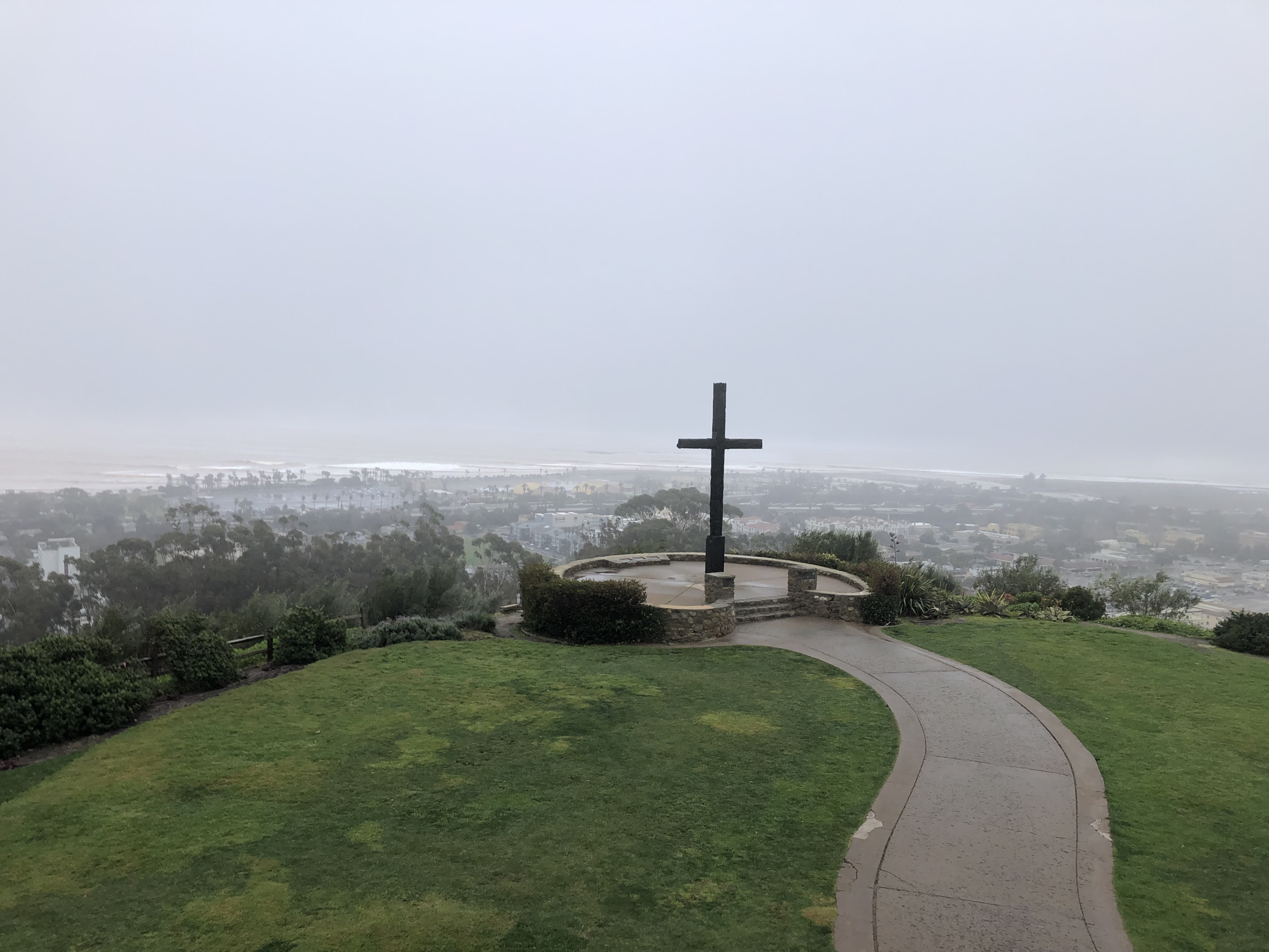
At work I'd go on walks during my lunch break, mostly to the Serra Cross that overlooks the city of Ventura. One day in mid February I decided to visit the cross in the rain. Got absolutely soaked. I went up there, took in the hazy views, enjoyed the solitude (ain't nobody was up there but me) and then ran all the way to the beach. I watched the brown surf, watched the Ventura River spill into the ocean, dragging with it rocks, earth, trees, and a fair amount of hypodermic needles. I ran down the promenade, out near the pier, and then circled back. Luckily, I had a change of clothes in the ol' car. When I returned, one of my coworkers looked at me, their face confused. "Did you take a shower or something?" "Yup, something like that."
 |
| Lake Casitas in March |
March also meant it was time to see Nick Shoulders. He was performing at the Ventura Music Hall. We'd bought tickets months in advance, anticipating his arrival with great excitement. He put on a good show, played all the hits, drank tea out of a chalice with a skull on it. He sang the songs, donned a spooky cloak, and then him and his band left the stage, never to return. I ended up seeing two more shows at that venue over the course of the year, each one bringing in a slightly different crowd.
April brought a marine layer that never seemed to go away. April was graypril. But by some cosmic miracle it was totally sunny on the day of the solar eclipse. The boss bought us all eclipse glasses so we could watch it. Being situated in SoCal meant that we'd only see a partial eclipse, but that was still plenty interesting. Carl, in particular, thought it was really cool. So cool, in fact, that he wanted to see it with his own eyes. Just seconds before the eclipse reached its peak, Carl darted across the street and took off his shoes. He stood in some grass on the other side of the street, barefoot, his toes digging into the dirt. Had to ground himself, you see. And then, with arms outstretched, Carl stared directly at the eclipse for a good fifteen seconds. When he came back from across the street he said, with blinking eyes, that it was one of the most beautiful things he'd ever seen. "There were sparklies" he said. "Thousands of sparkling, glittering things." I'll take his word for it. Next time there's an eclipse, I doubt I'll try his viewing methods.

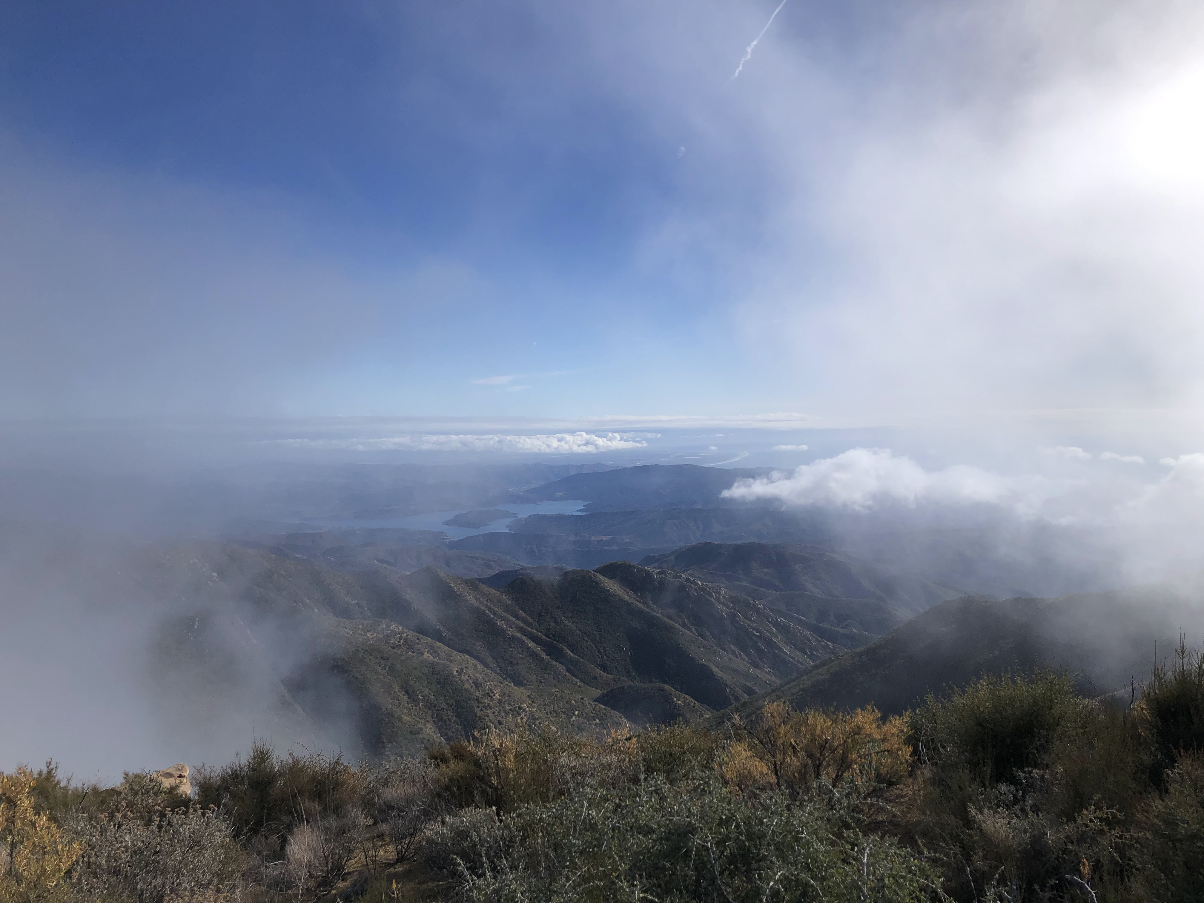
The marine layer lasted through May, which ended up having more gray days than April. May was Gray, in the truest sense. I remember reading in the VC Reporter that about 90% of the days in May were overcast. This was not always true for the mountain and valley communities. Some mornings I'd start the day with plenty of sun, and then I'd ride head first into the wall of the marine layer. I'm a firm enjoyer of the sun, and so every chance I got I'd drive up into the mountains to bathe my skin with its harsh rays. One day, Bill, Marco and I escaped the gray and visited the Sespe, hiking to this swim hole that's off the beaten path. Hadn't been there since the fabled Sespe Jaunt of 2022, and it was interesting to see how the rains had changed it. Less trees, less shade, more sand, less hole. A lot of it had filled in, unfortunately. But it still remained incredibly deep, allowing us to jump from precipitous heights, doing backflips, front flips, cannonballs. We spent a good chunk of the afternoon there, soaking in the creek, catching some rays, and then it was time to head back down the trail. Back to the car, back down the 33, back to the gray.
 |
| The marine layer as seen from Chief Peak |


June had some gloom, but as it progressed it finally brought the end of the marine layer. Soon is was sunny sunny hot hot hot. Carl and I decided on climbing Chief Peak on one of these broiling days. I do not know why. We just did it. Besides, he needed to train for a Whitney expedition that was happening just a few days later. Carl hadn't done a single hike yet this year. Chief Peak would give him all the training he needed. He has a saying: "If you can hike in these woods, you can hike pretty much anywhere." He ain't wrong about that, I tell yah.
We took the short way from Rose Valley. It was already in the upper 80's by the time we started, the morning still, not a single cool breeze in existence. Carl was dismayed at having forgotten his socks. He elected to hike in flip-flops, bringing his shoes along for the final push to the summit. We started at a brisk pace, and then the heat took over, bringing our pace to a crawl. Carl took off his shirt, now hiking in nothing but flip-flops and baggy shorts. A car drove up the road. They gave us a weird look. By the time we made it to the junction with the ridge we were both drenched in sweat. We hunkered down in what meager shade we could find, Carl had himself a smoke, put on a sun hoody, and then we stayed there, psyching ourselves up for the rest of the hike.
We reached the summit. It was hot alright, but thankfully there were no bugs. Carl had himself a celebratory smoke at the top. On the descent he elected to stay in his shoes. He taped up his feet the best he could and we trucked on down the road, the day only growing hotter.
Carl became uncharacteristically quiet on the descent. Started stumbling around. I remember asking if he was alright. "I'm done, but I'll make it" was all he said. When we got back to Rose Valley the temperatures were hovering in the low 100's. "Gimme a second" Carl said. "I gotta lay down for a second." He took off his shoes, his skin raw and bleeding from numerous heat blisters. Didn't complain once the whole way down; I had no idea his feet were that screwed up. And then he sprawled on a table and passed out for a good half hour. When he was done re-charging, he got up, wandered over to the shallow creek, and poured some water on his head. That was all he needed. Drove back into town with the windows down the whole way, and that was the end of that. He ended up successfully summiting Whitney a few days later. That man is built different.

Later on in the month, Gramps rented a pontoon boat and the fam spent a day gliding around Lake Casitas. The water was like glass. The whole lake looked like a giant reflection pool. The day started out overcast, and then, ever so slowly, the sun burned its way through, turning the gray waters into a brilliant deep blue. We circumnavigated the lake, checked out each and every nook and cranny. The water remained still, the day remained peaceful. I'd never seen the lake so still in my entire life. I'd be lucky to see it like that again.
Three days after this pontoon adventure, the fam trekked up to Solvang to for a duel celebration: Father's day and Grace's early birthday. We spent the first half of the day at a rope's course, riding the zip line, climbing around the obstacles like complete freaks. The next half of the day was spent walking around Solvang, poking in a few of the shops and having a grand ol' dinner at AJ Spurs. Had me a tomahawk steak that was under $100. Father's day special.


In July I took a mini vacation and flew out to Tennessee to visit the Grandparents. First time flying by myself. It wasn't anything to write home about. Smooth flight, no turbulence, no inflight drama. Tennessee was as green and humid as I remembered it, still laid back and quiet. Except for the 4th. My Uncle bought a whole bunch of mortars. I got a few cakes. Sparkers, dixie dynamite, and fireworks galore. As soon as the sun went down we were outside, soaking wet from the humidity, lighting off fireworks with reckless abandon. One in particular, called Vietnam in a Box, refused to ignite. We doused it in water and set it aside for later. In the morning, my Uncle and I tinkered with Vietnam in a Box and successfully ignited it. We did not warn anyone beforehand. It was a great way to start the day.
We relaxed most of the time while we were out there in Tennessee, lounging on the porch, reading books, saying hello to Sweetie-Pie, the stray cat that lingers around my Grandparent's property. We drove through the mountains, checked out Pigeon Forge, rode an "Alpine Coaster" and had some Cledis burgers in Nashville. It was a nice little vacation, the only one I took the whole year.
 |
| Johnson City |
In August my pumpkin finally died. Bought the thing in October of 2023 and kept it on the back porch. It was gigantic and it was beautiful; I didn't have the heart to carve it up for Halloween. And so it sat there for months as a decoration, refusing to rot, sitting tall and orange and bright. And then one day it started leaking fluid and that was the end of it. It slumped forward, sagged, emitted a foul oder, and died. Ten months it lasted. It was sad to see it go.
I continued biking to work, cloudy days a thing of the past. I'd see herons in the morning by the Ventura River, see the weird black beetles crossing the path in the evenings. Sometimes I'd get a flat, sometimes my chain would fly off, sometimes I'd get stuck in construction. I'd see all sorts of things, hear all sorts of sounds. One time I saw a homeless guy chopping up the wooden posts by the path with a hatchet. Dude had a project in mind. I'd never seen such focus. This other time an old oak tree decided to die and fall across the path. By evening it was already cleared. Maybe it was the handiwork of that homeless guy with the hatchet. The world may never know...
On one particularly hot day I drove down to Liam's new place in Burbank for a group barbecue. It was a grand ol' get together, Liam a gracious host, grilling up some Tri Tip with rice, vegetables, garlic bread and such. We walked around the neighborhood, stopped by the liquor store that was made famous in the movie Superbad. The night air was warm and spirits were high, people were out and about, some having barbecues of their own. Back at Liam's place we sat in a circle, talking about life, each one of us wearing a different one of Liam's hats for some reason. August slowly progressed, the days slowly growing shorter, the nights slowly growing longer, the weather hot and dry, the concept of rain foreign and strange.


In September I ran the community Three-miler at the Ojai Invitational, just three days after hiking White Ledge Peak from the Ventura River Preserve. It was one of the more painful three-milers I've ran, but if it weren't for that race I likely wouldn't have trained for the Joshua Tree Half in November. The thing woke me up and slapped me around. Put me right and set me on my way.
September was my last hurrah with the Sierra Nevada, my last hurrah for most things hiking now that I think of it. Once the month ended I was runnin, runnin, runnin, focusing all my additional energies on training for the Joshua Tree Half.
In October I went on a date for the very first time. Ate at a ramen place in downtown Ventura. Went on a lil' walk afterwards, taking in the absolutely stunning infrastructure and superfluous amenities of the positively gorgeous downtown area. Then we both drove to Santa Barbara to meet up with Daniel and Sofia. Turned into a double date.
I once again found myself on State Street, although this time it wasn't nearly as insane. We visited a quiet bar, a real hole-in-the-wall, the Tiburon Tavern. Most of the patrons were 40+. They had karaoke there. This old guy sang a bunch of Frank Sinatra songs. I sang two songs with Daniel. Meet in the Middle and Family Tradition. I was completely sober. Daniel was not. Afterwards he said, "Man, I'd never do that sober." I can see why. But it was fun nonetheless, the small crowd dancing around, the music at a comfortable loudness, the double date going very well. And Santa was there. He was drunk. No doubt stressed about Christmas. He sang a few songs in a drunkenly manner, stumbled around the small confines of the bar, and talked to Daniel for a long, long time. To this day I do not know what they talked about. I bet it was the most scintillating of conversation.

The year wrapped up fairly quickly after that. I stopped biking to work, too afraid of riding home in the dark. Started walking to the beach on my lunch break to watch the waves and the surfers and the birds and the clouds. There were these two big ol' black cats that would always say hello as I walked by. They lived in the reeds by the side of the river. Someone had left a bowl of food for them.
One day as I was squatting there saying hello to the cats, this guy rolled on by riding the longest skateboard I'd ever seen in my life. It had to be 20ft long. It looked homemade. Two long pieces of plywood joined together in the middle. He stood on the front edge of it, giving me this goofy grin as he rolled by. He was wearing a baggy brown sweatshirt and baggy brown pants, his long blond hair blowing in the wind. He rolled on by, hands on his hips like Jack Sparrow, riding toward the beach. Even the cats were impressed. They watched him the whole way down.

December ended with Ehab's wedding. Lots of dancing, lots of eating, and lots of caffeine. The caffeine man stood in the corner, brewing the strongest coffee I'd ever had in my entire life. No wonder everyone was dancing so much. That stuff was hardcore.
And that about wraps it up. It was a busy year. Next year will likely be even busier. I've got a whole lotta hikes planned for the future. Loose ends and unfinished business in the Los Padres and beyond.
Porro et sursum