The days of taking it easy are over. It's time to get back into the groove of masochist hikes. And what better way to do it than to hike up good ol' Hines Peak? It's been a while since I've been up there. November of 2021. That's a long time to avoid Hines. I needed to go back. Been suffering from Hines deficiency for a long while now...
On Monday, the 19th, our group met at the trailhead and we began the nice walk up Sisar. Everything was soaked in a nice thick blanket of clouds. The creek was still flowing nicely, although it's beginning to get choked with algae. Every now and again we'd hear the pitter-patter of water droplets falling from the roadside foliage. The clouds created a light, barely perceptible mist that provided the perfect hiking weather. We walked straight to White Ledge Camp, and it was there where we took the first break of the day.
From White Ledge the trail began its series of switchbacks up to the ridge. We eventually broke through the cloud layer about halfway through these switchbacks. To our surprise, it wasn't significantly warmer above the clouds. The weather was in our favor, so we pushed onward until we reached the little campsite along the ridge road.
From the campsite we continued along the Red Reef trail to the saddle in between Peak 6380 and Peak 6440. It still looked like April on this stretch of trail. Several wildflowers were in bloom. Blossoming elderberry dotted the side of the trail. Faint carpets of pink and purple could be seen on the side of the hills. Ceanothus (California Lilac) seemed to be the most popular flower on this stretch; it was everywhere and extremely fragrant.
 |
| Chief Peak center right |
 |
| Ceanothus |
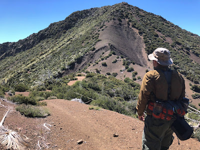
At the saddle we got our first glimpse of Hines. It looked intimidating, as always. The northwest ridge is steep as all get-out. Not a good sight for weary legs. We rested at the saddle for a bit, stretched our legs, gobbled down some energy bars and then began what I believe is the best part of the whole hike.
From the saddle the trail undulates across a ridge until curving away towards the base of Hines. On this ridge one is gifted with stunning views of the Sespe backcountry. We stopped every so often to take in these views. On this particular day we saw the marine layer slowly creeping along, swallowing everything from the lower Sespe to Johnston Ridge. After we passed a large ol' evergreen we shifted our focus to Hines. The closer we got to Hines, the worse it looked. It's not something you want to see after hiking uphill for almost 11 miles. We got the to the battered old Ladybug sign and then dropped our packs and took one last break before the inevitable ascent.
 |
| The Northwest ridge |
After our little break we picked up a conspicuous use trail and started the first part of the ascent: traversing across the razorback ridge. If you don't like heights this will likely be the turn around point for you. The trail is well worn into the ridge, but the exposure can be a little dizzying. A fall here could lead to injury, so a minor dose of caution is recommended.
 |
| Razorback Ridge |
After the ridge it's just a long slog up to the false summit. We kept following the use trail; it's very obvious and well marked. Part of this trail branches off to the left, avoiding a steeper section of the ascent. It joins the main trail at section of steep shale. At this point, we took turns climbing up the shale just in case we kicked down any rocks. After the shale section it was a nice zig-zag saunter to the rocky false summit.
 |
| Above the shale section |
 |
| False Summit |
 |
| True summit on the left |
There were several rock cairns that marked the route to the summit, even thought it was quite obvious where to go after surpassing the false summit. We found the register and signed our names. I don't know what happened up there, but the old register was missing and the 2018 register was all ripped up. There was a new register that was placed in 2022. After signing our names we moved to the rocky eastern part of Hines and took a nice long lunch break above the clouds.
We stayed on the summit for nearly an hour. Just before we began our descent, we ran into two people on the summit. Out of all the times I've climbed Hines, I've never once shared the summit. It was a little odd seeing these people and they looked just as surprised to see us there. We nodded, said hello, and then began the descent.
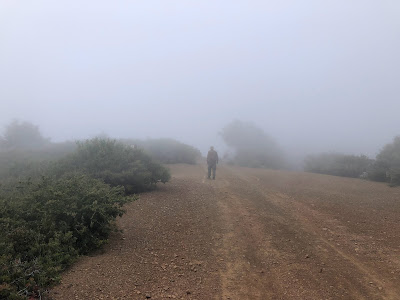
Somewhere on descent, Zach tweaked his knee, so we kept it slow the whole way back. Luckily, the weather was still very nice. Last June it would have been face melting hot. We took our time walking back across the ridge, noticing the ever creeping marine layer spreading through the valleys of the southern Los Padres. Lots of butterflies and hummingbirds were flyin' around. A light breeze kicked up, much to our delight. As we made our way down towards the campsite, we noticed that the clouds were rising. We couldn't even see the campsite; it was buried under a thick layer of clouds. Before we knew it, we were back in the clouds, our field of vision reduced to a few hundred feet.
 |
| Back in the clouds |
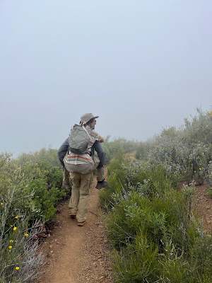
The switchbacks were really killin' Zach's knee so I tried to carry him a little ways. This did not work. So Zach got the idea to call his dad and ask him to bring a bike so he could ride it the rest of the way down. We found service, sent the text, and then proceeded towards White Ledge. Along the way, several trail runners passed by, one of them giving Zach his trekking poles. When we got to White Ledge it looked like a rain forest. The clouds were so thick that we couldn't see more than 50ft in either direction. Neither me nor Liam nor Zach had ever seen White Ledge like this before. We took a long break, enjoying the cool mist of the dense clouds.
 |
| Brief Piggyback |
 |
| White Ledge Camp, soaked in clouds |
We met up with Zach's dad a little ways past the second creek crossing on Sisar. As fate would have it, Zach's dad somehow injured his toe on the way up Sisar. What are the odds? So Liam and I took it slow with Zach's dad the rest of the way down, which was only around 2 miles or so. Everyone made it back to the trailhead without issue. All in all, it was a great day out on the trail with even greater weather. Hines is never easy, but it was good to finally get back up there after all this time.


