Sunday, December 31, 2023

Year in Review 2023


The year started with big storms and ended with big waves, each event serving as the bookends for a story of unusual mediocrity. Yup, 2023 was a goober of a year. Better than some, worse than others. And though I've tended to view the year through the lenses of pessimism, looking back I am unable to ignore the sparkles of absolute gold. Through the haze of indifference shine unforgettable memories, and it is these memories that defined much the year for me.


The January storms set the mood for the year. With the surplus of water came a surplus of life. The local country seemed to be beaming with energy. Green hills, blooming flowers, full creeks. There was snow on the mountains well into April, and spring seemed to last well into June. It was during this time where I finally managed to graduate college, the results of which caused a healthy degree of burnout and the reason as to why I wrote about half as many blog posts this year compared to last. 

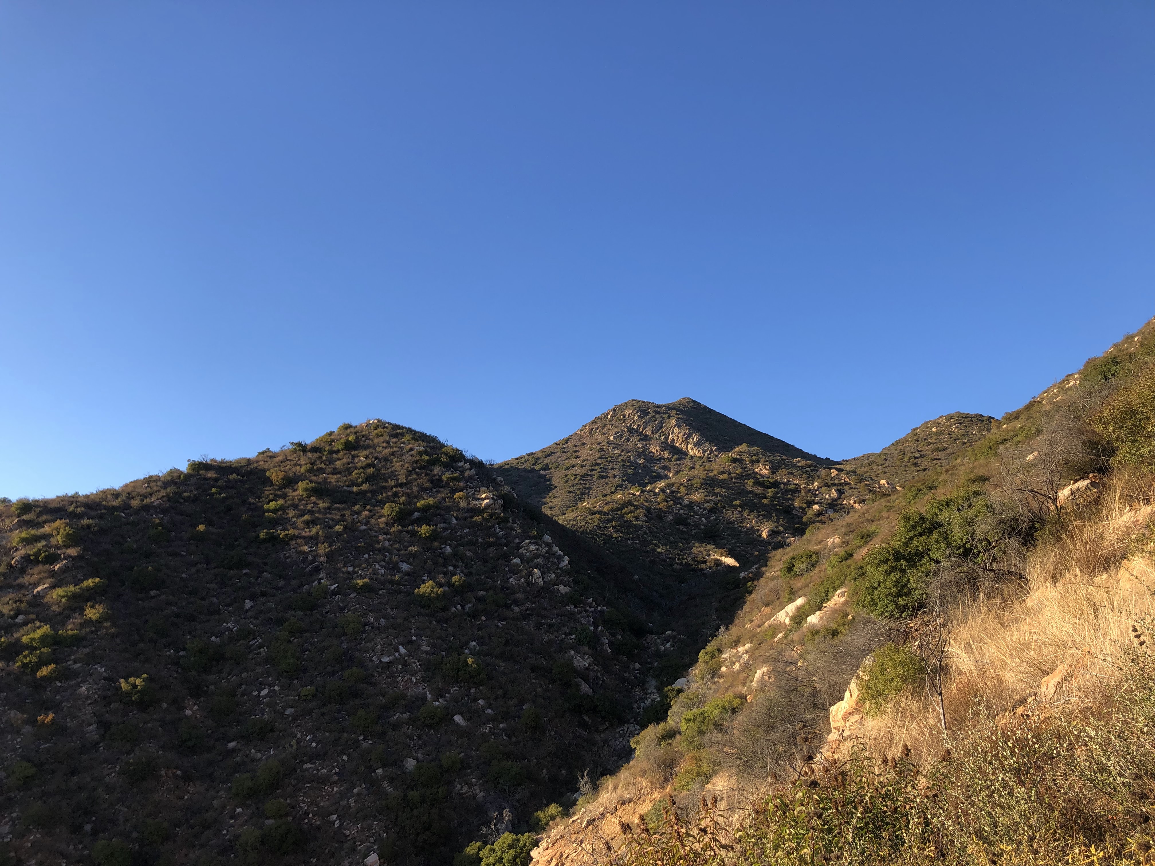
Almost immediately after graduating, Liam and I embarked on the second excursion to Billings. This one was much different than the first, which was done in March of last year. We began the trip with a visit to Zion, a place I try to see at least once every year. It was busy. Seems to get busier every year. But the place is straight magical and even a few hours spent within the park are enough to change one's mood for the better. 


From there we trucked onward to Billings. There was a lot more snow this year. It was late May and some of the roads into the mountains were still closed to the public. Skiing was still in season. I recall a drive into the mountains. We woke up early that morning after nearly staying up all night. Long drive. Backcountry roads. Snow on the peaks, lakes frozen over. Cold air that bit the face and wind that smacked the ears. We got out and walked in the snow in jeans and sneakers. Nearly fell through the ice of some hidden underground stream. It was a good time up there, Tom Petty and Nick Shoulders providing much of the soundtrack for the journey. 


Continuing with the theme of travel, in late June the fam and I made a drive out to Tennessee to visit the Grandparents. All I can say is gee, this country is BIG. And a whole lot of it is just empty. Flat, empty plains stretching for miles and miles and miles. They say that Montana is big sky country but I beg to differ. The Texas panhandle and much of the western part of Oklahoma is a world divided by one horizon: beneath it is the flat empty ground and above it is the flat empty sky. Having never been past the 100th meridian, it was interesting to see the vast differences between the topography of the west and the east. Tennessee possessed a laid back sort of charm, the rolling forest covered hills of Appalachia emitting an essence of a long lost time. Those mountains are old. Real old. Lot of geologic history in them. 

While we were there we made sure to see all the main sights. Went to the Smokies. Climbed Clingmans Dome. Avoided Dollywood at all costs. Stuff like that. On the way back we saw the Bass Pro Shop Pyramid in Memphis. I suppose this is a theme now. Last year I saw the Long Beach Pyramid. Now this. What's up with that? I don't know. 

Somewhere in Oklahoma

Hey look! Another pyramid

After Tennessee came a few concerts. Ain't never been to a concert before. Thought I'd give it a go this year. Saw Ween three times. Saw the Flaming Lips once. All of 'em were excellent. Being part of an audience is a unique experience. The audience becomes an organism of sorts, with you being a cell that makes up that organism. Weird stuff. Definitely gonna go to more concerts in the future.

Fox Theater

The Flips

In November of this year I went on a plane for the first time in nearly a decade. Flew out to Tennessee again to celebrate Thanksgiving. Driving would take too long so we flew. The change in scenery from summer to winter was a head trip. Out here in California we don't really get that many major fluctuations in weather. Out there, what was once a lush forest of bright brilliant green was a dead, gray, cold and rainy landscape that evoked feelings of uneasiness. I can see why those hills are a hub for unexplained sightings and disappearances. In the summer, they're great. In the winter, they're the the spookiest things I've ever seen. Wouldn't want to go wandering into those woods at night that's for sure. 

Margarette Falls in the summer

Margarette Falls in the winter

The Grand Canyon

And that pretty much sums up the year. Got a new job, made some new acquaintances, played some airsoft, stopped and smelled roses, stuff like that. Now that the 33 is open I'm gonna try and head up there as often as I can. Got a lot of adventures planned. Next year is gonna be a busy one. 

Omne Finis Novum Initium Est

Saturday, December 30, 2023

Slide Mountain Lookout

 12/17/23


The wind ripped through the canyon. A few folks were mingling around the gate, mostly fishermen. A few stumbled onwards towards the campgrounds at Frenchman's Flat. All were dressed in large jackets or windbreakers. It wasn't that cold, but the wind always makes things feel worse. We got out of the car, donned the packs, and set off on our journey to Slide Mountain Lookout.

This is one that I probably should have done years ago. I've always seen it from the I-5, nestled on top of a nice looking mountain behind the never empty Pyramid Lake. Swear that thing is always full no matter how dry the weather gets. And the lookout tower just sits there, willy-nilly, overlooking it all. Never thought to explore it. Never even crossed my mind. But I figured it would offer some neat views of Cobblestone Mountain and Cobblestone Mountain is something that's been on my mind recently so I figured I'd give it a go before the year's end.

The Road Walk

A 1.7 mile road walk is required to reach the turnoff for the route to the lookout tower. It's smooth as can be, nearly devoid of potholes. Very easy walking. Grace and I walked head-on into the wind, the canyon acting as a funnel that sucked it in from the north. We saw nobody. Next time it would be wise to bring a bike because for whatever reason time seemed to drag during this part. Though easy, this road walk was incredibly boring, and something that I was not really looking forward to on the way back.

The turnoff

We reached the turnoff and began the slow ascent. The beginning of the route was an old dirt road that appeared to have been graded a few months ago. Eventually this road turned into a well maintained single track. The wind died down as we progressed upwards. Toyan, black sage, and laurel sumac dotted the hillsides, offering a dry and crispy smell to the atmosphere. Much of the toyan was full of bright red berries, which is usual for this time of year. The skies were grey but gave no hint of any coming rain, and the weather was cool and gave no inclination that it would get any cooler. The higher we climbed, the more I thought about bringing a bike for next time. Would be much easier on the way down. Just straight cruisin'. 


The single track led to a ridge where we got our first view of Cobblestone Mountain and Piru Creek. Cobblestone looked cold and distant, despite it having no snow and only being about 5.5 miles away as the crow flies. Piru Creek looked wild and desolate, sharply meandering its way through rugged country all the way to the glistening teardrop of Lake Piru. I'd considered exploring this creek from Frenchman's Flat to Lake Piru as a day hike, but after looking at it from the ridge I've got second thoughts. An overnighter would definitely make things less painful should I ever decide to embark on such an excursion. 

After taking in these views, we continued onward, running into the first people we'd seen on the trail all day. They were two dudes dressed in nylon jackets, wearing baggy pants and carrying two trekking poles each. Both of them seemed to be in their mid 50's and were in good spirits. They warned us that they heard rustling near the summit and thought that it could be a mountain lion. We said we'd keep our eyes open and wished them happy trails. 

Cobblestone Mountain center

Piru Creek

From the ridge, the trail curves east, offering great views of Pyramid Lake. It was here where the wind started to pick up again. From there we curved along the south and then north, ascending the western side. As soon as we hit the western side of the mountain we were back in the full brunt of the wind. With hats fastened and hoods synched, we continued along, the lookout now in sight. 


The summit was empty when we arrived. We walked up to the base of the tower where there was a little metal stand which contained a summit register. We were the 3rd group to summit that day. Strange, since we only saw one other group on the trail. The first group must have done it super early. Morning people. Strange breed those are. 

Slide Mountain Lookout is still in use by volunteers and is therefore in excellent shape. Unlike the rusted skeletal corpse of the Nordhoff Tower or the dilapidated and decomposing Thorn Point, Slide Mountain is fully furnished and weather proof, offering a glimpse of what the towers of yore used to look like. The bottom door was open and swinging in the wind. Inside were a bunch of tools, two big tanks and a festive wreath. After looking in there we closed the door and headed upstairs.


Upstairs nobody was home, but the door was unlocked so we took a peak inside. The anemometer on the wall read a windspeed of 23mph. The digital clock in the corner was 2 hours ahead. The bed was folded nicely and a Smokey Bear hand puppet was hanging on the wall, along with a Condor plushie. The oven was full of old dusty boots. On one of the shelves sat a number of binders and booklets and what have you, each of them serving a specific purpose for the tower. I found a binder full of lookout reports and took a gander at a few of them, interested to see what it was like to volunteer at such a place. Seems like it's windy, according to most reports. Other than that it doesn't seem like all that much goes on up there. In one of the reports, though, a volunteer claimed to have found a perfectly rolled joint beneath the tower. They "got rid of it," never explaining exactly how, but clarified that they did not smoke it. Har, har har...


After taking our little looksie we locked the door and spent a few minutes walking around the outside of the tower. I spent most of them looking to the west at Cobblestone and Dome Mountain, wondering if either of the two could be reached from this location. Cobblestone is likely 100% out of the question but Dome seems feasible. To the southeast could be seen civilization; everywhere else seemed to be desolate, dreary, desaturated and destitute, the I-5 being the only line of connection between one point of society to another somewhere out of sight. Winter lighting provided a calm quietude to the surrounding country that could still be felt despite the ever present sound of rushing wind.  It was relaxing, in a strange wintery kind of way. After having our fill of the views we said our goodbyes to this neat little tower and made our way back down the trail. 


Northwest

Pyramid Lake as viewed from the tower


We zoomed down the trail, I for one wishing that I was on a bike the whole time. On our way down we passed one other hiker and his dog. We hit the dirt road, and soon enough we were back on the asphalt which meant it was time for that darling road walk back to Frenchman's Flat. That road walk went by surprisingly fast but seemed to add a few extra hours to our legs. I don't know if that makes any sense but Grace would know what I mean. Back at the car we talked to a couple of elderly fisherman who asked us where we had gone. After we told them of our travels, they said they had no desire to EVER go up there, no matter how nice it is. And nice it was. With excellent weather, decent mileage, and not much traffic, the hike to Slide Mountain lookout proved to be a good one. 


Thursday, December 14, 2023

Chief Peak and Twin Peaks Loop


I've been putting this one off for a while. Wanted to try this route back in October but just never got around to it. Told myself I'd do it next month. And then November rolled on by and I still hadn't done it. The mountain was only getting taller and the brush only growing thicker. Along came December and I knew if I didn't do it soon I'd likely never do it at all. Just needed to get out there and giver 'er a go. 

The route sounds simple enough: climb Chief Peak by way of Horn Canyon, descending the southern ridge to Twin Peaks, and then taking the trail from Twin Peaks back to Horn Canyon for a nice little loop. I had no idea how long this loop would be, how much elevation gain there would be, or how much brush there would be on the southern ridge. Six years after the Thomas Fire and the brush in the front country has made an astounding comeback. A few years ago, this loop would be fairly simple. But now, with all of this growth, I expected a battle. 

So last week, on the 7th, I parked on McAndrew Rd and began the long slog up Horn Canyon. My stomach wasn't feeling all that good on account of eating a spicy meal the previous night. Pro tip: if you're ever going on a long hike DON'T EAT SPICY FOOD the night before. Just don't. I should of known better but oh well. 

There was still a decent flow in the creek, despite it being covered with dried and stinking algae. Every so often I'd see a good sized pool along the trail that was algae free. I meandered my way through the canyon, dreading the inevitable switchbacks up to the Pines Camp. It was cool in the canyon and there wasn't a cloud in the sky. It was looking to be a great day weather-wise. Just before the start of the switchbacks I nabbed a few sycamore leaves and stuffed them in my pack. Given how my stomach situation wasn't improving in the slightest I figured I'd need these leaves later. 

The section of trail between the canyon floor and the Pines Camp just plain sucks. There's significant elevation gain with little relief, and the trail just keeps going and going. By the time I got to the Pines Camp I was honestly pretty beat and had exhausted most of my supply of sycamore leaves. I took a long break before continuing on. 

The Pines Camp

From the Pines Camp to Sisar Rd I simply moseyed along at a relaxed pace, taking several micro breaks in the process. This section of trail has gotten some attention and is in excellent shape. I can only imagine how miserable it must have been hauling up all the gear for this trail work. I give my thanks to whoever worked on this trail; it looks really, really good. 

When I got to Sisar Rd I plopped down in what shade I could find and took a little breather. I noticed two people walking up Sisar to the ridge road. Aside from a guy I saw near the horse corral by Thacher, these two were the only people I saw all day. I caught up to them at the ridge road junction and saw that they were making their way toward Red Reef. It appeared that I would have Chief Peak all to myself.

I walked along the ridge road to the turn off for Chief Peak. Unlike last year, there was hardly a cloud in the sky and had no trouble following the use trail all the way to the summit. 

Chief Peak

I spent a good half hour recuperating on the summit. A few crows were flying overhead and every now and then I'd hear the screech of a hawk somewhere in the distance. What I found most interesting, though, was that I could actually make out the sounds of civilization coming from Ojai and its surrounding communities. It was so quiet on the summit—no wind, no nothing—that I could actually make out the sounds of construction and sirens, not to mention the ever present steady hum of traffic. It was a little weird. Just goes to show just how far noise can travel. 


From the summit I was gifted full view of what needed to be done, that being the ridge descent to Twin Peaks. To the south I could see most of the ridge descent as well as the little knob that marked the summit. I knew that by going down this ridge I'd be saving myself from excess mileage, but the brush situation was still a mystery. If the brush was more than waist high it could possibly take me a few hours of bushwhacking to traverse this ridge, and since it was getting later in the day and because I didn't think to bring a headlamp, I could be ending this hike in the dark. 

Not wanting to lose any more daylight I said goodbye to Chief Peak and skipped my way down to the ridge road. I hit the ridge road in what seemed like no time and jogged the rest of the way to the turn off for the southern ridge. I left the road and walked up the ridge, the first section being mostly clear of brush. I crested a small rise and was gifted a view of the bushwhack to come. I turned around, took one last picture of Chief Peak, and then began the brushy descent.

Chief Peak as viewed from the top of the ridge

The southern ridge

To my surprise, the brush at the top of the ridge was not bad at all. Chamise, yerba santa, and tiny little bunches of manzanita were easily avoided. I followed animal trails when I could, and now and then I'd find a long rut that was totally clear of brush. If the rest of the ridge was like this, it would take no time at all to reach Twin Peaks!

Alas, this was not to be. I soon discovered that most of this ridge consisted of fairly thick, waist high brush. Brush of all kinds. Soft brush, hard brush, wispy brush, prickly brush. This ridge has it all. None of it was impenetrable, and there were only a few spots where it rose above my head. Using mostly my shins, with the assistance of gravity, I busted my way bit by bit, breaking my own trail as I went. Sometimes I'd hit a clearing, sometimes I'd find an animal trail, but for the most part it was a waist high wall of sticks. Skeleton arms of shrubs long dead and blackened by fire poked hither and thither from the green carpet of brush, poking and prodding me as I tore my way down the ridge. I was half expecting one of these skeleton arms to poke me right in the crotch, and as soon as this notion came into my head one of them stabbed my inner thigh. It was like the brush could read my thoughts. From then on I was more careful of where I tread. I was light on my feet, moving like water, trying to find the path of least resistance. 


I got used to the brush fairly quickly. Waist high brush ain't much of a big deal. I could see my destination and it was getting closer by the minute. Within an hour of starting this descent I was standing on the summit of Twin Peaks. The ridge looks very intimidating looking back at Chief Peak from the summit, but it was honestly not nearly as bad as I thought it would be. In a few years, this ridge descent will be a hell of a challenge and in a few decades (if there aren't any more fires) it will be damn near impossible. But for now it's highly doable and something that I will likely do again in the future; it's a fun little detour that's worth notice. 

The ridge and Chief Peak from Twin Peaks summit

There's a new summit register that was placed in February of this year. Most of the entries were from Thacher students. One person claimed to have spent the night on the summit in a bivy. That sounds like a cool idea. The views from the summit are pretty good and at night it would be neat to see the layout of the city. I signed my name, drank the last of my water, and then suddenly remembered to check for ticks. Even though they shouldn't really be out this time of year, I figured it wouldn't hurt to look. And wouldn't you know, I found two of the little buggers on the inside of my right pant leg. 


Twin Peaks summit, Chief Peak left

Twin Peaks

As I left the summit of Twin Peaks, I quickly learned that the trail was not in the best condition. A lot of it near the summit was overgrown and a few spots will likely be wiped out during the next rains. I counted six ticks by the time I made it out of the brushier section, two more by the time I made it back to Horn Canyon. Seems like most people stick to the lower part of the Twin Peaks trail as I saw multiple bootprints and bicycle tracks nearer to the junction with Horn Canyon

I got back to McAndrew Rd with daylight to spare. Loop complete, I felt a sense of accomplishment. Don't know why I put this one off for so long because it turned out to be a pretty cool adventure. The weather was great, never saw no snakes, and most of the day was spent in solitude. The only thing I'd do differently next time is eat a MILD dinner the night before. Ain't never repeating that mistake again...