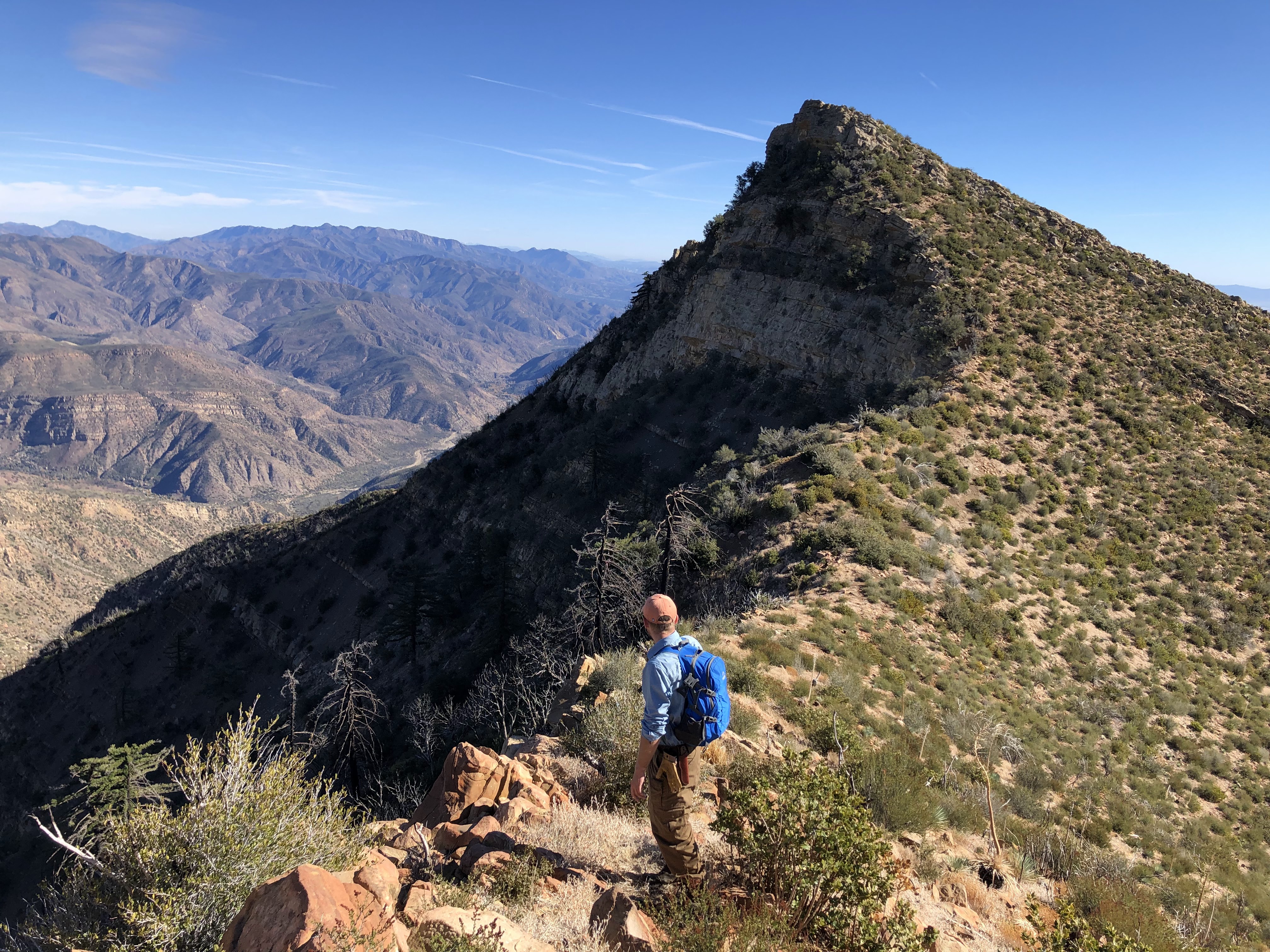
Last week I decided to take a little walk in the Ojai front country to see the condition of two of my favorite trails. I had a little bit of a late start at around 12:30pm. Several cars were lined up on Signal street, probably belonging to folks who were hiking Shelf Road. The parking area for the Pratt Trailhead was almost full, but luckily I nabbed a spot at the last minute.
I don't think I've ever seen the trail this crowded. Several people were out and about, most of them enjoying the roaring creek to the left of the trail. I don't blame them; it's rare to see it flowing with such force at this time of year. I would cross this creek a total of four times, something that I haven't been able to do for a VERY long time. Everything was hyper-green, and here and there were colorful blooms of ceanothus and California poppies.
As I progressed, it became noticeable that most people were hanging around the lower portions of the trail. I guess the junction with the Fuel Break road was the turnaround point for most folks. This was a welcome surprise for sure, as I definitely expected to be sharing the narrow single track with hordes of people.
 |
| Stewart Canyon |
Before long, I left the road and made a right on the narrow single track that continues up towards Nordhoff Peak. Way up on this trail, I could still hear the creek roaring from far down below. This was a little strange for me, for I have grown accustomed to hearing nothing but the crunching dirt beneath my shoes and maybe the occasional gust of wind while walking this trail. That creek is dry for most of the year and when it's not, it's typically pretty unassuming and dribbles out after month or so. Not today. The recent storms have turned this creek into a hulked-out version of its former self. Several waterfalls roared down Stewart Canyon, pouring into aqua pool after aqua pool. It looked like something that you would see in the foothills of the Sierra. Really puts into perspective just how much rain we got this year.

After walking for a bit I stumbled upon the infamous slide that took out three sections of the trail. I passed a group of Boy Scouts wearing heavy packs making their way across the first washed out section. It didn't look like they were doing trail maintenance, so I don't really know what they were doing up there. The first washed out section was pretty manageable, but the second required a little more caution.
 |
| 2nd washed out section. Boy Scouts on the left. |
The third washed out section was a little sketchy. It was the largest of the three; I'm guessing that it took out a good 40-50ft of trail, maybe more. It's also near the top of the slide, so a slip here would result in a nasty tumble down the side of the mountain. It looked like some people had kicked in little steps to get across, but the surface of the ground was incredibly crumbly and I didn't really trust any of them. In addition to being crumbly, underneath it was compact and solid, preventing me from skirting across like I would a shale or gravel slide. I took my time and made it across without issue. Should anyone attempt this before it's inevitably fixed, I recommend a healthy dose of common sense and caution.
 |
| The 3rd washed out section. Worst of the three. |
 |
| Picture doesn't capture steepness |
 |
Looking down from atop the slide. Nearly took out a fourth
section of trail where I'm standing. |
After the slide I only saw four other people on Pratt. Not surprising. That slide was a pretty scary obstacle. The reward for having traversed said obstacle was a nice view of the multiple waterfalls in Stewart Canyon. I took my time zig-zagging up the switchbacks, taking in the incredible views of the surrounding area.
 |
| Waterfalls in Stewart Canyon |
After a while, I reached the junction with the little trail that leads into Valley View Camp. Curious to see if the storms washed away the camp, I decided to do a little exploring. Near the bottom of the switchbacks on this little trail is a small drainage, and this drainage has done some minor damage. Two sections on the lower part of this trail are completely washed out, but are easily navigable. To my surprise, the camp was still there, fire pit, wooden seats and all. It just barely escaped getting washed away. The "little" creek next to it was rushing and ripping down towards Stewart Canyon, churning up the water in some of the pools so much so that they were completely opaque.
 |
| "Little" creek next to Valley View Camp |
 |
| This swim hole is likely chest deep |
This little creek ends at a cliff face that overlooks the Ojai Valley. I suppose that's how the camp got its name. Pouring over the side of this cliff was a massive waterfall. It looked like the kind of waterfall that you would see in Matilija Canyon or something like that. I can only imagine what THOSE falls look like now. In all the times that I've visited this camp, I've never seen this much water tumbling over the cliff. Usually, this waterfall is pretty small, consisting of a tiny stream. Not this time. It was truly a sight to behold. I did a little scrambling to get a full view of the fall. It poured into a small pool at the bottom, which then meandered down the canyon towards another waterfall. I don't know the total number of waterfalls in that canyon, but judging by how loud it was I'm assuming there's A LOT.
 |
| Top of the big falls |
 |
| WOW! |
I stayed in Valley View Camp for a little while and then slogged my way up to the ridge road. The section of trail from the campground to the ridge road is in excellent condition with very little damage. Once I got to the ridge road I was gifted with views of the Matilija backcountry. The snowcapped summits of Monte Arido and
Old Man Mountain were visible in the distance.
The remaining walk to the lookout tower was pretty uneventful. Near the top I passed some trail runners who were making their way back towards Pratt. At the top I talked with a kid who had rode his mountain bike up Gridley. He said that the trail was in great shape, and that he was grateful that his bike was electric. Those dang electric bikes sure are popular these days. Seems like everyone's ridin' them.
 |
| Nordhoff Tower |
The views from the tower are always exceptional, and on that day they were no different. The visibility wasn't the best I've seen but it was pretty dang clear. Santa Cruz, Anacapa, and a little bit of Santa Rosa were visible in the distance, along with the Santa Monica Mountains and the urban sprawl of the Oxnard Plain. The Ventura River stuck out like a sore thumb; the recent rains having stripped away most vegetation. Some of the trees on Pine Mountain Ridge still had a dusting of snow on them, which stood out in stark contrast with the vibrant green springtime wonderland that lay just to the south. It was quiet up there, with a little bit of clouds and a gentle breeze. Just how I like it.
 |
Pine Mountain Ridge
|
 |
| Lake Casitas looking great |
 |
| Looking towards Matilija Wilderness |
After soaking in the views, I began the knee-bashing decent down Gridley. Like the kid said, the trail was in great shape. There were several small waterfalls that I spotted in the many side canyons that dot the trail. I've never seen so much water on this trail. As I walked along throughout the day I slowly began to understand the significance of these recent storms. According to
vcwatershed.net, the season total for Nordhoff Ridge is almost 70.5 inches. That's completely insane! And I tell yah, it shows. Walking along these trails, it almost looked like the mountains were leaking. Like the mountains themselves were just huge bags filled with water and someone poked holes in 'em to let the water out.


Soon I heard the roar of the stream in Gridley Canyon. I heard this until the single track turns into dirt road. It was that loud. I can only imagine how many cool swim holes and waterfalls are hiding in that canyon. Several wildflowers were in bloom, providing the breezy air with a pleasant fragrance. In what seemed like no time at all, I made it to the famous bathtub. It looked like it got some much needed repairs. It actually holds water now and, to no one's surprise, it was completely full. The spring right next to it, instead of its usual dribble, was a small stream.
 |
The famous bathtub
|
 |
| Adjacent Spring |
 |
| More Waterfalls! |
 |
| Gridley Canyon |
A little ways past the bathtub was the worst of the slides that I encountered on Gridley. Most of the washed out sections on the trail that I had previously passed were very small and already fixed. This one was a little larger and a little sketchy because of a small drop off, but I saw two mountain bikers on the trail so if they could make it past this, so could a hiker. Compared to the slide on Pratt, this was a walk in the park!
 |
| The worst slide on Gridley. Not too bad at all. |
 |
| Looks more intense from afar, but don't let it scare you. |
 |
| So green! |
After the slide I just jogged the rest of the way back. Wanting a little more miles, I decided to continue down Gridley to Shelf Road instead of taking the Fuel Break back to Pratt. Shelf was crowded, but not as much as I'd expected. There were significantly fewer cars at the Pratt trailhead when I finally got back. I completed the whole loop in just over 5 hours, not too shabby for having done nothing in like three months. It was nice to finally get back out there. Gorgeous day, nice views, plenty of water. Wouldn't have had it any other way.
 |
| Shelf Road |