05/13/25

Ah man. I'm always overcome with an immense feeling of reluctance every time I wake up on the morning of a climb to White Ledge Peak. Every. Dang. Time. I sit in bed and think about the long miles, the crazy elevation gain, the bushwhack to the summit, the thousands of ticks. And I think to myself, "do I really want to do all that?" And the answer is always no, but I get up out of bed and get ready anyway. Getting out of bed, I've found, is the hardest part of the day. If you can get out of bed, you can conquer the world.
I organized my things, packed up three liters of water, some snacks, and then hit the road. The plan was to reach a sub peak of White Ledge Peak. It's a little rocky promontory with no name and, quite possibly, no ascents. It was an ambitious goal for sure. In order to get to this sub peak I'd have to climb White Ledge Peak first, an already difficult task. Then I'd have to descend a brushy ridge for a ways, encountering unknown obstacles along the way. I had no beta on the ridge other than the last time I saw it from the summit of White Ledge Peak. That was eight months ago. At the time, the thing looked untrammeled, steep, and very brushy. Eight months later, and it was likely even more brushy. But I had to give it a try. I've been lookin' at that sub peak for most of my life. Had to see what was up there, you know?
So I drove to the trailhead, noticing a thick layer of clouds covering much of the Santa Ynez Mountains. The morning was chilly and crisp, a thankful relief from the heat that had choked much of the area for the past few days. I started walking a little after 6am, walking up Matilija Canyon towards forest route 5N13. No one was out and about. Nothing but the sound of the creek and the dirt crunching under my feet. The early light of the rising sun shone pink on Old Man Mountain and its twin summit, turning bright and gold as the morning drew long.


The wildflowers were out in full force. Lupine, monkeyflower, ceanothus aplenty. I found myself stopping far too often to snap pictures of these flowers in the early morning light. Much of the surrounding foliage possessed a deep green hue, so the occasional patch of purple, pink, yellow, orange and blue really stood out—a feast for the eyes.
I walked along the washed out road, slowly gaining elevation. I noticed a small cairn that marked the junction with the Murietta Trail that I hadn't noticed last time. By this point, the sun was well beyond the reach of the eastern mountains, now able to pummel everything with its warmth uninhibited. I worked up quite the sweat walking up the steep grade in the sunshine. But I had done it before and I knew what to expect. I reached the Murietta Divide in good time, stopping briefly in the shade for water and a light snack.
 |
| Heading up the ridge |
Next came the steep slog up the Monte Arido trail to ridge line of the Santa Ynez Mountains. I'd only done this once before and remembered it being no fun at all. The second time around was no different, if not a little worse. The last time I slogged up this trail, it was soaked in fog and freezin' cold. This time it was nice and warm and sunny...and full of ticks. Ticks galore. Every time I walked through a chunk of brush I'd pick up a bunch of the unwanted hitchhikers. But that's just the way it is this time of year in the southern Los Padres. It's just something you gotta deal with.
 |
| Murietta Canyon |
 |
| Jameson Lake |

 |
| "King's Crest" |
The views, of course, were outstanding on the way up. To my left I could look all the way back down what I had just traveled—Murietta Canyon and Matilija Canyon—and beyond that the Topatopa mountains, Nordhoff Peak, and the vast swath of the rugged Sespe Wilderness. To my right I could see Jameson Lake and the long extension of the Santa Ynez Mountains, running west as far as the eye could see. The wild and remote Dick Smith Wilderness stretched before me, the names of its peaks and creeks and trails and camps a mystery to me. I am not too familiar with that tract of land. I've only ventured into its depths once, and that was eleven years ago. To me it is truly wild country, a mysterious and alluring place that I'll never fully understand.
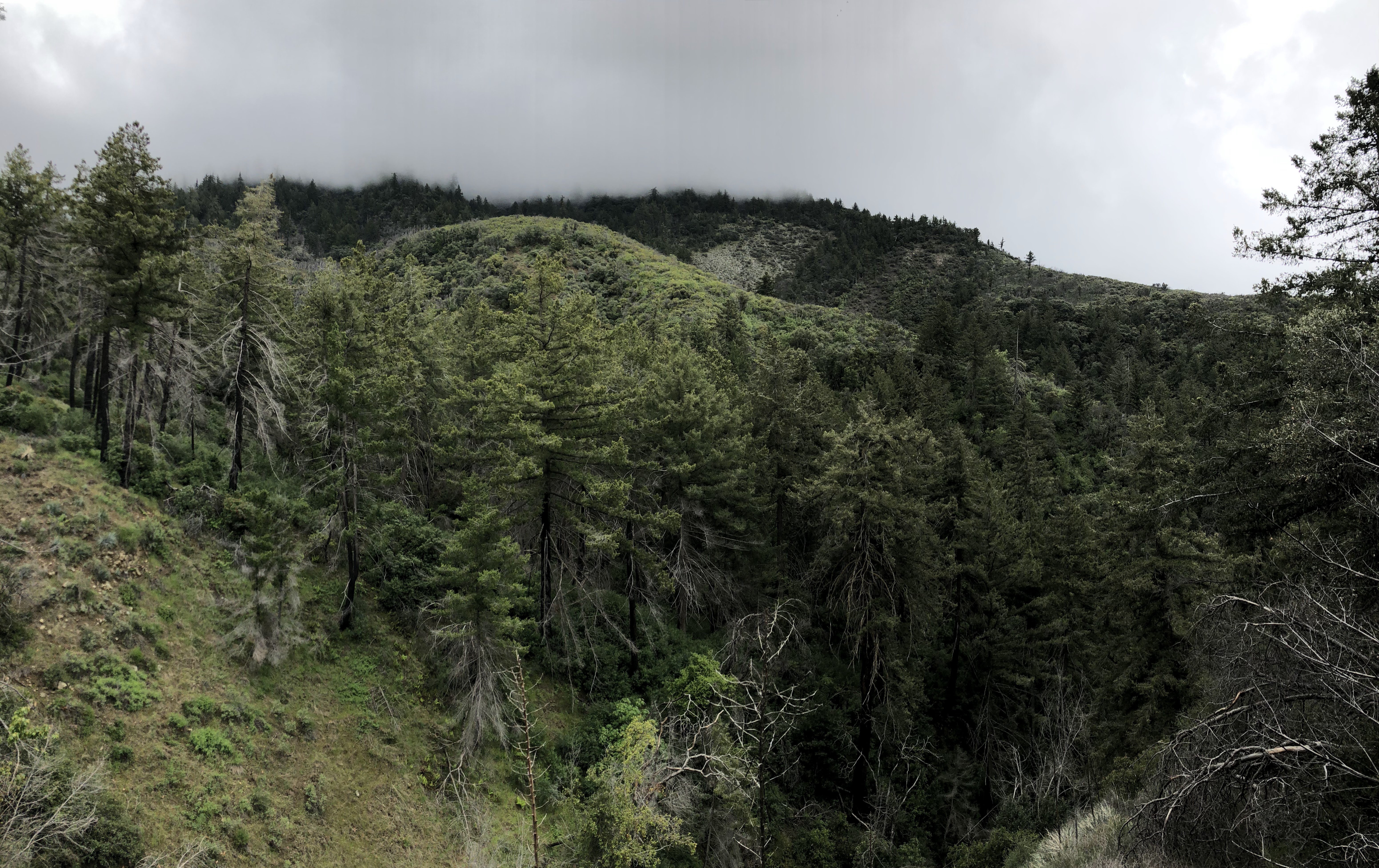
As I approached the ridge line of the Santa Ynez Mountains, I noticed a wall of clouds rushing over the tops of some of the higher peaks. Seems like the cloud cover I had observed earlier that morning hadn't burned away quite yet. Good news for me. I welcomed that cloud cover. It would protect me from the wrath of the sun.
 |
| Ocean View Trail Western Kiosk |

Sure enough, as soon as I gained the ridge, I was met with a wall of clouds. No view, but it was considerably cooler, dare I say a bit chilly. I reached the western kiosk of the Ocean View Trail and pressed on, heading east, following the undulating trail as it wound its way along the ridge. I knew I had to go about four miles to reach White Ledge Peak, and I knew it was somewhere out there, laying in wait. But I wouldn't see it until I got there; the clouds were too dense. So I put my head down and started banging away the miles, walking through the clouds, my shirt flapping in the wind.
 |
| Bench #11 |

 |
| Monkeyflower |
Elevation lost, elevation gained. I followed that trail, putting one foot in front of the other, following it up and down and down and up. It was in excellent shape, all thanks to the great efforts of the Get It Done Crew. Without them, this trail wouldn't exist, plain and simple.
This being my first time approaching White Ledge Peak from the west, I can definitely say that it's a whole lot easier and much more pleasant than the approach from the Ventura River Preserve. Excepting the horrible climb up to the Divide, much of the route was a nice, gentle up and down along a scenic ridge. Every now and then there'd be a break in the clouds and I would catch a glimpse of the view to the north. Murietta Canyon, Matlija Canyon, Cara Blanca, Old Man Mountain and beyond. The views to the south were still blocked by the clouds, and them clouds didn't look like they were gonna go away anytime soon. Fine by me. I kept trucking along, moving with the clouds, following the ridge as it took me towards my goal.
 |
| Bench #10 |


Before long, I reached the turn off for White Ledge Peak. It wasn't marked, but I knew where it was 'cause I'd already climbed the thing twice before. Some things you never forget. I couldn't see the peak, couldn't see much of anything really, but I knew it was out there, waiting. So I put away my trekking poles, rolled down the sleeves, and prepared for the minor bushwhack that separated me from the summit.
Sure enough, the brush was worse than I remembered. Head-high scrub oak, ceanothus, and some charred branches of chaparral long since burned in the Thomas Fire blocked my way. I used the charred remnants to pull myself through the sea of gnarly brush, making my way bit by bit, trying to find the path of least resistance. After making it through a particularly rough section, the rest of the way was pretty easy, all things considered. Animal trails through stomach high brush seemed to be the name of the game. The clouds cleared a little, the summit came into view. I imagined myself on the summit and—voilá—I was there.
 |
| White Ledge Peak summit |

 |
| Not much of a view... |
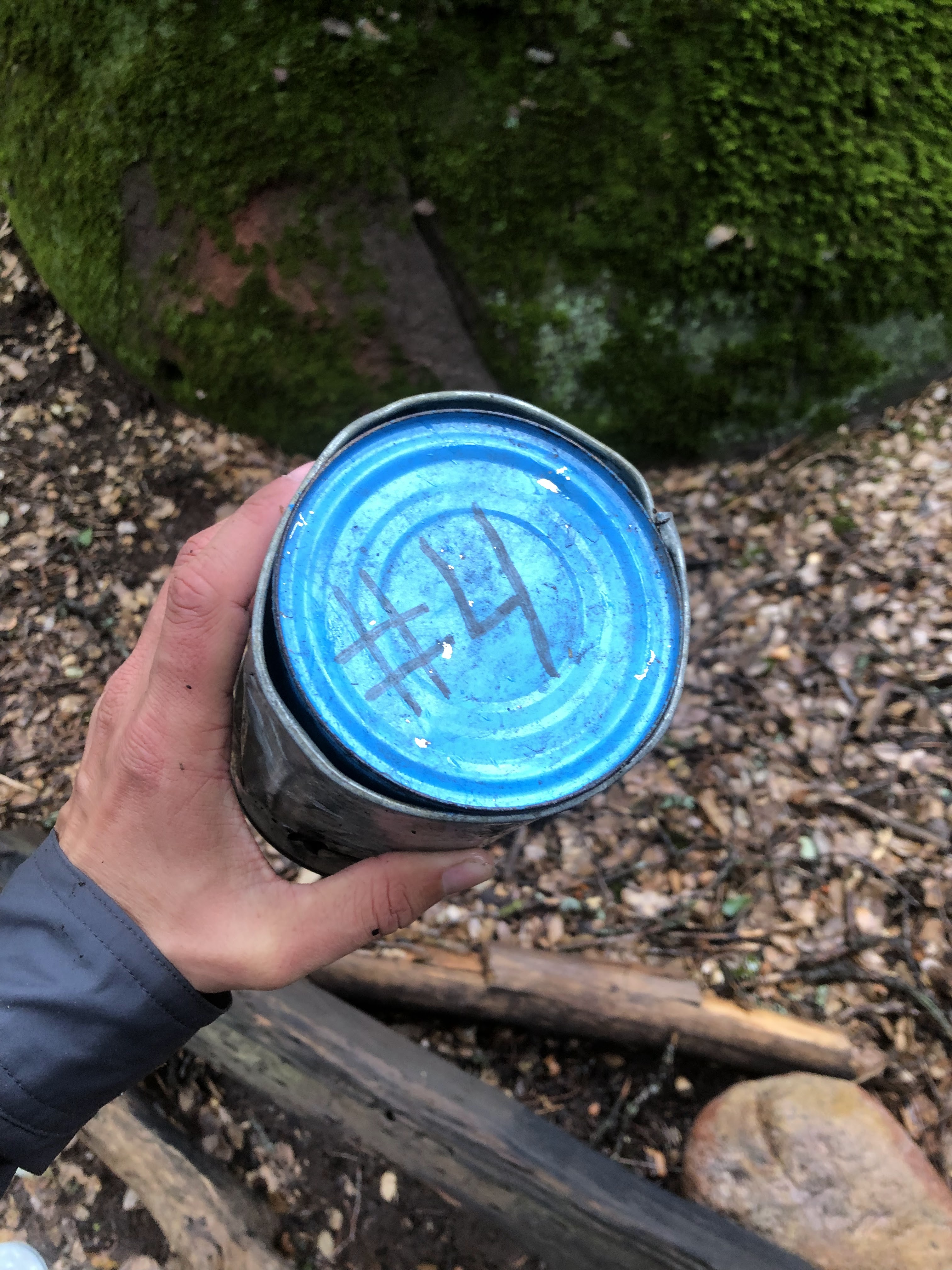
I couldn't find the register the last two times I was on this blasted mountain. Third time's the charm I guess. Unfortunately, whoever was up here last had placed the register upside down, the smaller of the two cans on top. The thing was filled with disgusting brown water and the register was completely soaked and severely water damaged. Many of the entries (which weren't that many to begin with; this mountain gets very little traffic) were completely illegible. Some of the pages were fused together, and when I handled the booklet, the thing threatened to fall apart at any moment.
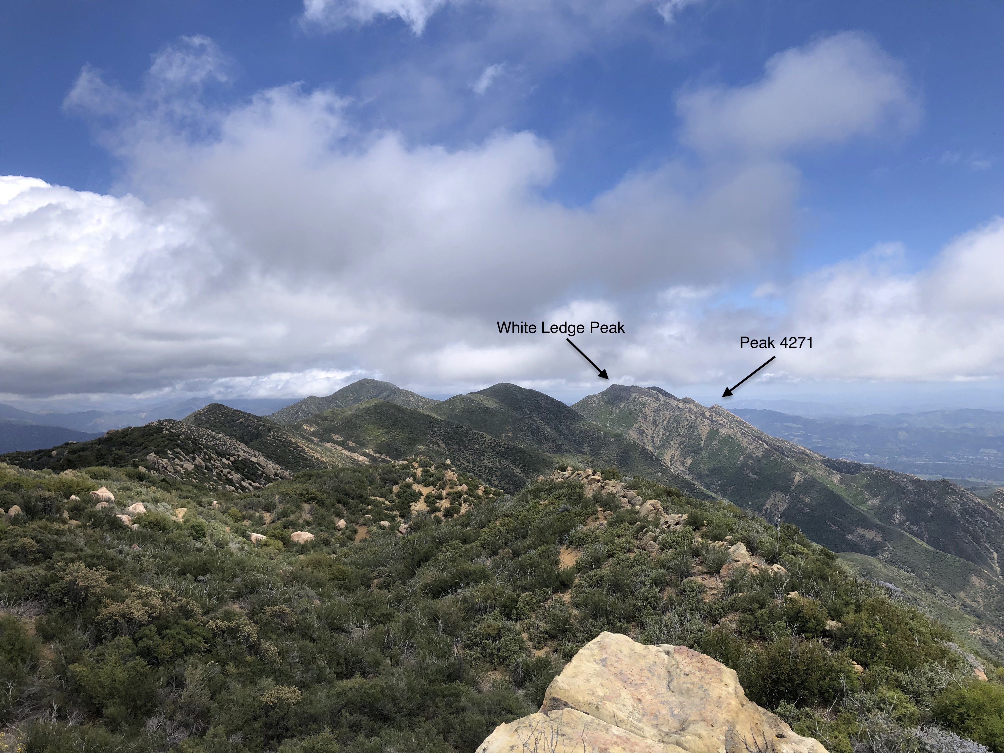
The last legible entry was from January 7th of 2023. I wanted to sign it, but I had to let it dry first. So I got out my stove and sat there on the foggy summit for a good 30 minutes drying it out, being careful not to burn the pages. I made some progress, but not much—the thing was far too soaked. So I let it air out a bit, let the wind dry it. The clouds had now lifted a little, and I could see clear, uninterrupted views to the south, including the route to Peak 4271. I thought that maybe by the time I got to that peak and back, that maybe, just maybe, the register would be dry enough to sign. So I ditched my trekking poles, laced up my shoes, and started for the adventurous descent into the unknown.

It's been awhile since I've done something new. It's quite exciting, I tell yah. Each step I took down that ridge was a step into the unknown. And maybe it was true that I was the first person to ever take those steps. Had anyone else travelled down to this sub peak? Maybe. It's probable. But you never know. All I can say is that my tired legs were no longer tired. I was high off the thrill of adventure, trotting down that brushy ridge and taking it all in, piece by piece.
The ridge itself was steep, but not too brushy. Ok, it was really brushy I'll admit, but it was easy to get through. Stomach-level seemed to be the average, some patches shorter, others head-high or taller. I was making excellent time down the ridge, the rocky summit of the peak in my sight. Each step farther down built up my confidence. "Wow," I thought, "I'm actually gonna do it."
And then I encountered the crux of the day, a small patch of brushy white boulders that severely inhibited my progress. They were a bit tricky to navigate, involving some mild scrambling and one section where I had to shimmy up and through a dense chunk of California Bay Leaf. After that, it was easy street—scootin' and jumpin' and sliding proved the best way to get through the remaining boulders.
Ahh, the summit was close. I could taste it. I just had to descend to a saddle and then climb up the damn thing. It didn't look bad at all, just a little brushy. I had been eating brush for the past half hour. I was used to it; this last little chunk wasn't gonna scare me off now. I was ready, the excitement of a possible first ascent fueling my legs with an energy that I didn't know they had.
 |
| Peak 4271 |
 |
| Summit boulders |
I banged out the last little climb to the summit in no time. Several boulders and sandstone formations rested on the top, wind-worn and full of holes and divots. There was a large, somewhat flat spot on one of the formations that would be great for pitching a tent. Why you would bring a tent all the way up there, well, I don't know. Probably wouldn't be worth the hassle to be honest.
I found no evidence of anyone having been up there at all. No register, no carvings, no graffiti, no trash, no cairns, no secret treasure. Absolutely nothing. Seems like everybody stops at White Ledge Peak. And that's a real shame, because the views from this peak are far superior in every way.
 |
| West |
 |
| South |
 |
| East |
 |
| North, looking back up the ridge to White Ledge Peak |
North, south, east and west, the views were more crisp, more vibrant, more hard-won than those on White Ledge Peak. The greatest views of all were of the Pacific Ocean. Though the day I summited wasn't particularly clear, I could still see three of the Channel Islands. I'd imagine on a clear day you could see all of them. Unobstructed views of the ocean stretched from Carpinteria all the way down to the Santa Monica Mountains. To the south was the best view of Lake Casitas I've ever seen from any peak, and to the east were tremendous views of the Ojai Valley and the Topatopa mountains.
As I sat there taking in the view, I decided to unofficially name the peak "Ocean View Peak" because of the spectacular ocean views. I don't know if this peak has another nickname or what, but that's what I'm calling it, and that's what I wrote on the brand-new register I placed on the summit. Ahh, but what's a register without a glaring mistake? This seems to be a pattern with me. Way back in 2022, when Liam and I placed the new register on Cara Blanca, I didn't notice until later that I had spelled "ammo can" incorrectly. Oh well. That can slide. The mistake I made on this one is far worse.
I'll be honest and say that I didn't really look too hard on the ol' map for the official elevation of this peak. Glancing at Bryan Conant's map of the Dick Smith and Matilija wilderness, I saw the elevation of 4,000ft on the summit of this peak. Ergo, I marked the elevation of the peak in the register as "Peak 4000." Unfortunately, it wasn't until after I had gotten back from the summit that I realized I'd made a silly, silly mistake. If I had looked only a little closer at the map I would've seen an extra contour line, and I would've discovered the true elevation as 4,271ft. Oh well. At least it's written in pencil. If anyone else makes it to the summit, feel free to correct my error.
 |
| Ignore the incorrect elevation... |
 |
| New register |
I placed the register near the highest of the summit boulders. First ascent or not, at least there's evidence of someone having been there now. I took one last sweeping view of the area, snapping a few pictures of the the cool erosion features on some of the rocks. It occurred to me that it was quite likely that I'd never set foot on this summit again. Time will pass, the brush will grow thick, the thing will become increasingly more difficult to reach. What to do upon this startling realization? Shrug your shoulders, say "ehh," touch a rock, and then leave. I added in a little salute before I left. Gotta show respect to the mountain.
 |
| The crux |
It took me about half an hour to go from the summit of White Ledge Peak to the summit of Ocean View Peak. Going back, it took nearly twice as long. Despite my hard-won knowledge of the route, I still had to contend with the steep grade. Believe it or not, going up is a lot more strenuous than going down. Ain't that something?
 |
| White Ledge Peak |

Back on White Ledge, I found the register flapping in the wind. It had gone from sopping wet to damp and moist. Not dry, not even close, but much better than when I'd first found it. I carefully etched my signature in the booklet, mindful not to tear the page. Then I put it back right side up, gathered my things, took one last look at Ocean View Peak, and then booked it off the summit. The clouds had come back now, and everything was once again soaked in a thick fog. Goodness gracious, what lucky weather! Doing this hike in the heat would absolutely suck.
 |
| Back on the trail... |
 |
| Ceanothus |

I was in great spirits on the way back. A successful summit is always great for morale, but this one felt particularly good for some reason. The clouds ripped across the ridge, pouring across the trail and then falling into Murietta Canyon. It was almost as if there was a giant invisible cheese grater in that canyon that shredded these clouds into tiny pieces and sent them on their way northeast. I stood on an overlook and watched the scene go down. I was now witnessing for the second time on this ridge the strange dance of the clouds. No brocken spectre this time, but it was interesting nonetheless.
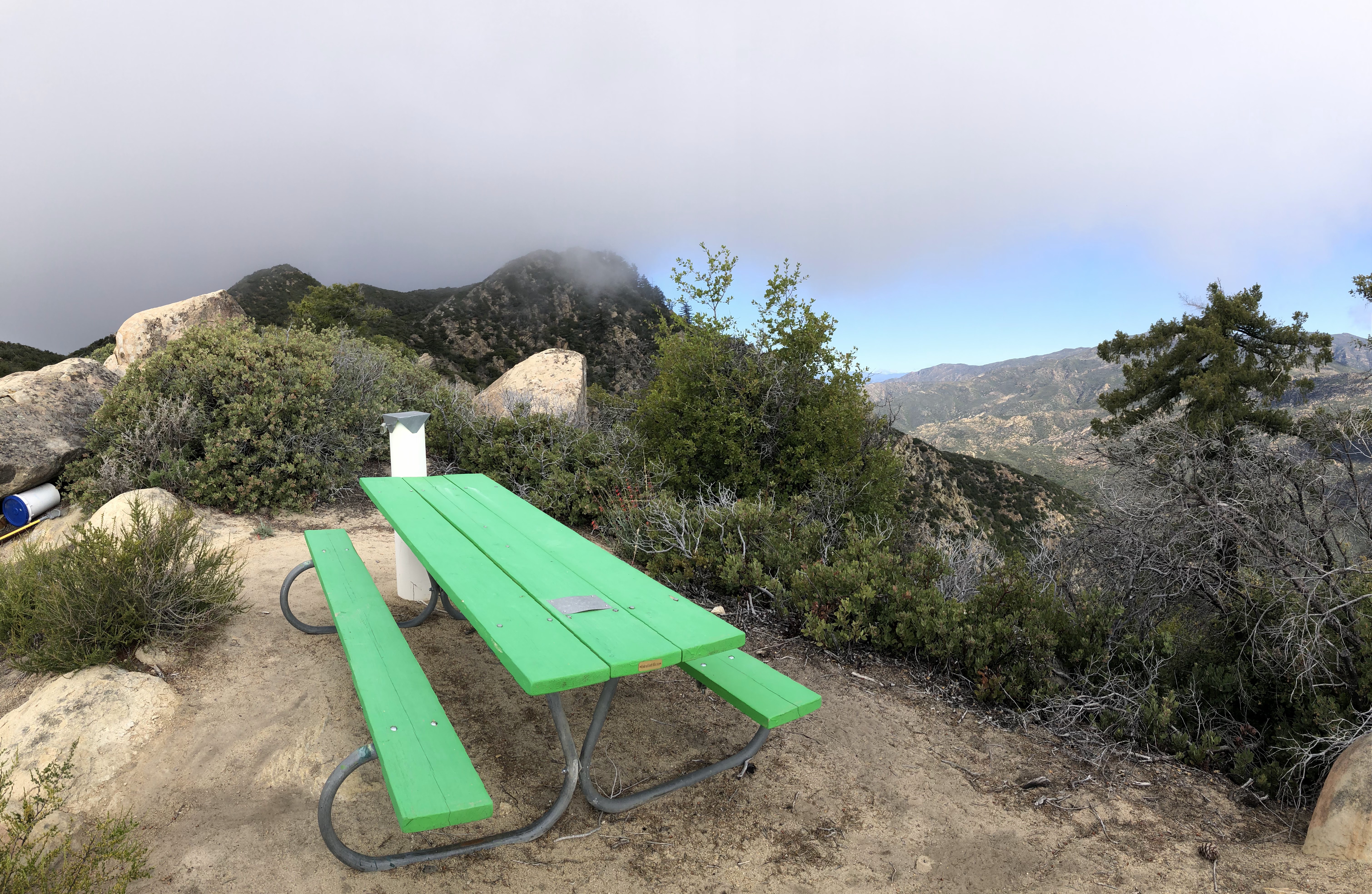
After some time wandering along the ridge in the grey void, I stumbled upon Bench #11. I decided to take a break there. The endorphins were beginning to wear off, the lactic acid in my legs now noticeable, the fatigue present. I downed more calories and electrolytes, sitting on the bench and staring at a blank wall of clouds.
And then, much like on Divide Peak last year, for absolutely no reason and with no warning, all of the clouds burned away. The Ocean View Trail soon lived up to its name as I was presently gifted breathtaking views of the mighty Pacific Ocean. Anacapa, Santa Cruz, Santa Rosa, and a very shy San Miguel were all in sight, little blotches of dark green and deep brown in the mass expanse of blue. I got going, the day not getting any longer, walking farther down the trail. White Ledge Peak and Ocean View Peak came into view, no longer encased in clouds. They stood a long ways off. I found it crazy that I'd actually climbed the things not too long ago. Had I been able to see how far away they were when I had started, I might have had second thoughts.
 |
| Rock formations near Divide Peak |
I updated my entry in the western kiosk, again mislabeling Ocean View Peak as "Peak 4000." Farther down the trail, I took a few minutes to observe some of the cool rock formations near Divide Peak. And then, for no particular reason, I decided to climb King's Crest. Why not? It was nearby and I knew the route and it would make a great end to a fantastic day. It was settled: I found the drainage, ditched my trekking poles yet again, and then scurried up through the pokey brush to the summit of King's Crest for the second time.
 |
| King's Crest: view west |
 |
| King's Crest: view east |
I was surprised to see two entries since the last time I was there; one on December 16th of 2024 and one from January 11th of 2025. I left my signature and a few details of the day, once again adding the incorrect elevation of Ocean View Peak. The weather had warmed a little, the sun now a little meaner, but my goodness were the colors fantastic. Afternoon sunlight paired with the shadows of puffy clouds made for an incredible scene, everything within sight vibrant, green, beautiful. I spent a good half hour on the summit, soaking in the views, watching the shadows dance on the hills and mountains. I didn't want to go. But it was getting late and I had no choice. Reluctantly, I packed up my things and said my goodbyes to the summit.
 |
| Back on the road... |
Downhill, down, down down, knees crying, legs shaking, feet aching. I took another break near the top of Murietta Divide, laying in what little shade I could find. I drank the rest of my electrolytes, ate the rest of my food. The hard part of the day was over. Now all that remained was the long downhill back to the trailhead. I turned off my brain and set off, flicking ticks off my pants every fifteen minutes or so.
 |
| Dodder! |

 |
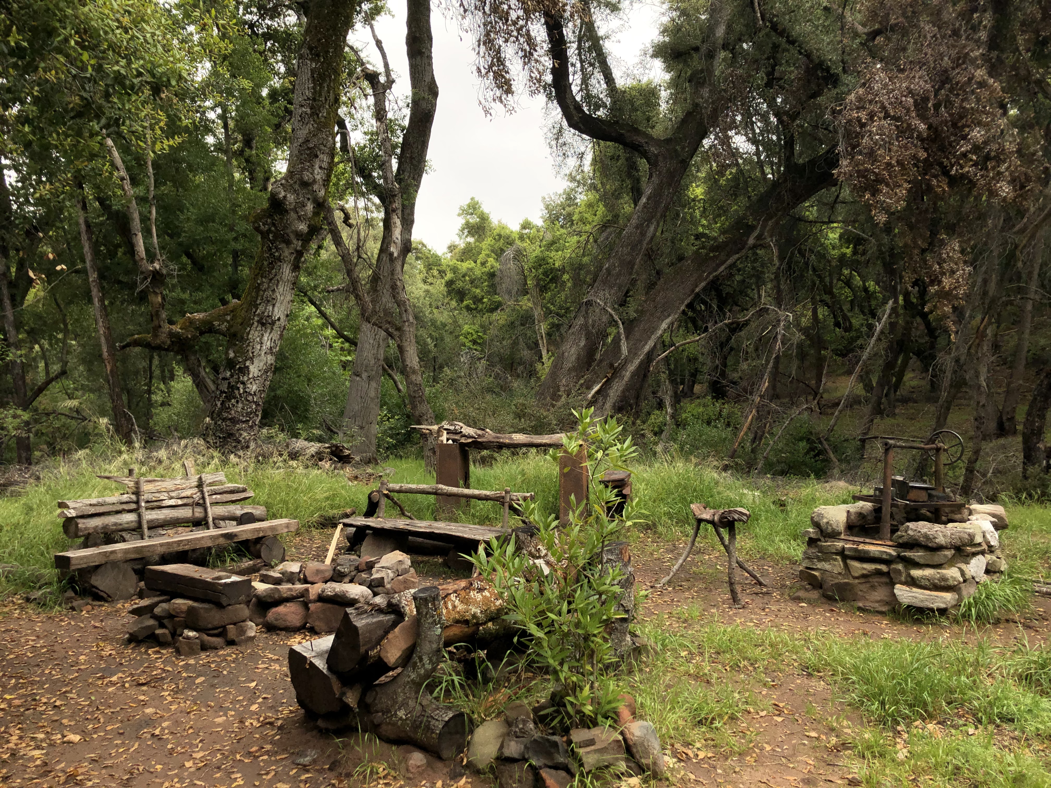
| Blue Heron Ranch |
There was a LPFA truck parked at the trailhead for the Murietta Trail that wasn't there that morning. Nobody was in it, nobody was around. I completed the day without seeing a single soul other than me, myself and I. The whole endeavor took a little over eleven hours, a combination of the difficulty of the hike and taking the time to enjoy the scenery (and drying out the register). It had been a spectacular day, one of the best day hikes I've ever done.
As I said at the beginning of this blog post, I'm always reluctant to make the trek to White Ledge Peak. But I forgot to mention that I'm also always reluctant to leave the summit. Every time I've been on that ridge it's been awesome, in every sense of the word. I love the sights, the sounds, the hardy feel of the brush and rocks on my fingers and the cool taste of the clouds on my tongue. Even the smell is great, no matter the season. It always smells fresh up there, a crisp, pleasing aroma of rugged soil and coastal chaparral. It's a magical, truly unique place, and one that I'm always bummed to leave.