Thursday, August 15, 2024

Cream Puff Peak


Somewhere in the empty recesses of my mind hatched the brilliant idea to do a time trial up Hines Peak. I don't know what it is with that mountain. It absolutely sucks but I keep coming back to it. So far, my fastest time from car to summit stands at 3 hours, fifty-five minutes, and seventeen seconds. This was three years ago when I did it as a part of the Topa Triple. That was a long time ago. And I wasn't really treatin' it as a time trial anyway. Since then, I've always wondered how long it would take if I actually put the peddle to the metal and treated it as a proper time trial. And since I've been cyclin' and whatnot, I felt like now would be a better time than any. I had to put my legs to the test. So I did.

Since it's been super hot these past few days I planned on waking up at 4:30am, hopefully starting the hike no later than 5:15am. I woke up at 4:30am, turned off my alarm, and immediately fell back into a deep slumber. I needed my beauty sleep. I woke up a few hours later, got my gear and then drove up to Sisar. It was the latest I've ever started a long day: 9:30am. The heat was already there, but it wasn't too bad. Mid to upper 80's. I could deal with that.

I breezed through the canyon, enjoying the shade, the bubbling creek, and the peace and quiet. Hardly anyone was out and about. Just a few locals out walking their dogs. I set a good pace, passed by "Howard's Place," and then dunked my shirt in the creek. It was my last opportunity to do so for a while, and by God, I took it. The next few miles were gonna be long, hot, and shadeless. I dunked my head, donned the pack, and kept on trucking. 


I felt a brief pang of regret for sleeping in. The cool morning air was long gone. It wasn't even warm anymore, just hot. Just plain ol' hot. The heat kept ramping up in intensity as I walked up the road, the rising temps uninhibited by nothing, not even a slight breeze. The Bluffs looked a long ways off, hot, dusty, foreboding. My shirt kept me cool for a while, but even cotton isn't a match for the Southern Los Padres. The thing dried up before I reached the junction with the Red Reef Trail. Just the pits and back remained doused in a steady stream of sweat. My head was like a shower, with drops spilling out of my forehead and dripping down my face, over my eyes and onto the dirt. Despite the heat I was still making good time. I had plenty of water, plenty of energy. The heat was just a mild nuisance. I continued on, walking up the switchbacks to White Ledge Camp. 

Just as I was walking into White Ledge, I got a little rush of adrenaline as I stepped right next to a big ol' rattler. Heard the rattle and nearly jumped 10 vertical feet. When I got back down to earth I saw it hiding in the tall grass, staring at me with villainous intent. I gave it a salute and continued on my journey.

I made it to White Ledge Camp and then walked down to the creek and dunked my head and soaked my shirt yet again. This would be the last time I'd be able to do this until returning, so I enjoyed it for as long as necessary for a time trial. It began to dawn on me that a time trial in the heat isn't such a good idea. Oh well. I was about five miles in and still on track to beat my previous time. So I took a quick break, downed some electrolytes, and pressed on, not looking forward to the next portion of the hike.

The stretch from White Ledge Camp to the ridge absolutely sucks. It's just switchback after switchback, all exposed, no shade, no nothing. I had to slow down and stop a few times. The heat was starting to bother me. Felt it in my head. When my head gets hot is how I know I'm on a downward spiral. It's the first sign of trouble. That stretch nearly defeated my confidence. But I made it to the ridge in a new personal best of two hours and fifteen minutes. The time trial was still on!

The Bluffs

I walked past Elder Camp, continued down the road, and then found some shade beneath an ol' scrub oak and took a little breather. I spent a good five minutes cooling my head, rehydrating, replenishing, the whole nine yards. I was already feeling better since gaining the ridge. There was a breeze now, a warm breeze but a breeze nonetheless. Plus it wasn't as steep so I wasn't exerting myself as much. A breeze and comfortable grade make all the difference. 

I reached road's end and hit the trail, walking up to the saddle between Peak 6440 and Peak 6380. I don't know if I was just losing it or what, but it felt a lot cooler walking this section. It was quite pleasant, with a lot of the chaparral sprouting some new growth, various birds calling out to one another, darting out of burnt trees off into the sky. Various elderberry bushes lined the trail, the violet berries looking ripe and read-to-eat. Even the poodle dog bush looked pretty, displaying new leaves in the noon sunlight.

Elderberry

I reached the saddle and pressed on, not stopping for even a second. I could see Hines now, and it looked intimidating as always. As I was rounding a corner I saw a large mass of tan fur dart off the trail into the bushes. I froze in my tracks. Did I just startle a mountain lion? Seemed unlikely, but you never know. I walked up to the tracks and was instantly relieved. It was a deer, a big one, probably a buck. What it was doing all the way up here I have no idea. Probably hiding from a mountain lion for all I know. 


I continued on the undulating ridge, enjoying the views of the Sespe Wilderness to the north. The closer I got to Hines, the stronger its siren song blared in my head. I was on track to crush my previous time by a little under half an hour. I was in the clear. All I had to do was climb it. But as I was walking along that trail, getting closer and closer to Hines, I noticed Cream Puff Peak standing quiet and lonely. I'd only climbed it once, as part of that Topa Triple adventure I'd undertaken all those years ago. I hadn't been back since. It just never seemed an interesting destination. If I was hikin' Sisar I was hikin' Hines. If not Hines, then the Bluff. That's just how it is. And that's probably why nobody else climbs it. It's overshadowed by Hines to the east and the Bluff to the west. 

I knew it was a good peak. Hell, I remember it being a better peak than Hines in terms of difficulty and views. And I'd only done it once before. I'd climbed Hines four times. This would be the fifth. And so, with great willpower, I left the trail for the summit of Cream Puff, resisting the alluring call of Hines. I looked at Hines, said, "I'll see you later," and began the steep ascent. 

Cream Puff Peak

Cream Puff is a mean little mountain. It's a 400ft slog up good for nothing scree at a 50° incline with no use trail. In some ways, it's even harder than the ascent up Hines. I sank with every step, a one step forward three steps back sort of deal. The peak was kickin' my butt. I was huffin' and puffin' and wheezin' and screechin' my way to the top. I didn't stop. The time trial was still on. Only now it was a Cream Puff time trial. I gave it my all, realizing that I'd probably never do a time trial up this mountain ever again. I scrambled up the last little section and hit the timer, completing the ascent from car to summit in three hours, twenty-four minutes, and thirty-five seconds. 

Hines Peak right

Santa Paula Peak center right

Backside of the Bluffs

Thorn Point, Reyes Peak n' such

It was hot at the summit. A weak breeze cooled the sweat on my face, but it didn't help much. I sat there sweating, the heat emanating from the summit rocks. I spotted the gargantuan summit register and signed my name. That's one thing that I love about this mountain. The register looks to be an ol' paint can. It has no reason to be so big, but it is. Started in 1999, the register has few entries, although it looks to be getting more popular these days. There were five entries so far this year, the most recent one dated two months prior on June 14th. My entry made it six for the year, a surprising amount for an SVS peak. Maybe Cream Puff is on the up and up.


I spent a little over half an hour on the summit, absorbing the heat, taking in the views. They were just as good as I remembered them. Hines peak to the east, the backside of the Topa Topa Bluffs to the west, the Sespe Wilderness to the north, and the whole spread of Santa Paula Canyon and the urban sprawl of Ventura County to the south. I could even make out the remains of Topa Topa Lodge, an ancient abandoned camp that Christopher Lord explored back in 2019. I performed one final 360 sweep of the summit, said my goodbyes, and then began the loose descent. 

The descent

The descent was more of a controlled fall. I boot skied down the slope, digging my heals in the loose shale. Sometimes my feet would give out underneath me and I'd slide for a bit, little pieces of shale scratching my legs and going up my pants. I got back to the trail in good time and then trucked on out of there, stopping only to take some pictures and remove annoying little rocks from my shoes. 


I jogged some parts, walked others. I only stopped once for a lil' breather in the shade and that was that. It was now well past noon and I was hikin' during the hottest part of the day. Good thing it was all downhill. On the way down I made sure to nab some elderberries. I ate several handfuls of them, my hands covered with red juice. They were delicious, although a little bitter at times. I made it back to White Ledge Camp in good time and considered scrambling down to the falls but decided to give it a pass. There were a few green pools down in Sisar Canyon, and a good dunk in one of those seemed more preferable. I walked through White Ledge without stopping, continuing onwards through the relentless heat. 


I left the Red Reef Trail and continued down the road. I was almost out of water and growing slightly dehydrated, but nothing too bad. I waltzed down the curvy road back down to the creek where I dunked my shirt earlier that morning. Sweet, sweet relief. I was just starting to feel the heat in my head and the water couldn't have come at a better time. 

I continued down the road, noticing a Subaru leaving Howard's Place. In all my times hiking up Sisar, I've never seen a car driving on the road. It passed me by, the folks inside waved, and they went on their way. I crossed the creek, hung to the right side of the road, spotted a pool, and that was that. I left the road and slid down a steep slope to the creek where I stripped down to my skivvies and immediately jumped in. It's insane the extent to which cool water replenishes the soul. I didn't keep track of the time. I just sat in that pool and soaked until I felt like a new man.


I dressed, put on the ol' shoes, and climbed up out of the creek back onto the road. The last chunk of the day went by without issue. Shaded, steady downhill. Easy peasy. Only saw one other person on the way down. Middle-aged dude riding a mountain bike. I made it back to the gate in excellent time, completing the whole day in seven hours, thirteen minutes, twenty-four seconds. If I didn't stop for a good soakin' I probably would've been able to break the seven hour mark. Oh well. That soak was worth it. 

The car thermometer read 95°. That seemed about right. It had been a long, hot, but rewarding day. Cream Puff Peak may not be the most sought-after destination, but those with the gumption and grit to reach the summit will be gifted with some of the best views the Los Padres has to offer. It's a goodun. Well worth the effort. 


Wednesday, July 31, 2024

Biking up Sisar to the Bluff


I've been going through a bit of a cycling phase lately. Been riding my bike to work for the past 4 months for no other reason than to save gas money. Reminds me of the good ol' days when I used to ride every morning to middle school. I loved it then, and now, over a decade later, I'm falling back into it. As such, I thought I'd give Sisar another try. I've only done it once before, and it was one of the worst outings I've ever experienced. The brief pang of mortal fear that I felt on Cobblestone? That ride up Sisar was the first and only other moment where I felt similar, if not a little worse.

It was four years ago, on July 22, 2020. I'd been working graveyard shifts at a grocery store for almost a month. On one of my "lunch" breaks, I decided that it would be feasible to bike up Sisar Rd, all the way to the ridge, off to road's end, and then to Hines Peak. So, after working all night and into the morning, I grabbed my bike and one bottle of water and headed up Sisar. By the time I made it to the ridge I was extremely dehydrated and exhausted. I almost made it to road's end, but decided to turn around because my legs were locking up and I felt like I was gonna pass out. It was a long, hot, dumb, and unsuccessful day. But no matter. Summited Hines three days later. But that's a story for another time...

This week, on Sunday, after a full night's rest, I put the ol' bike in the car and made my way to Sisar Rd. It was a very late start, 11:30am, but the weather wasn't too hot and I figured I'd be done in a few hours. I brought 3 liters of water this time, plus electrolytes. My plan was to bike up to road's end, and then, if I was still feeling good, maybe climb the Bluff. It all depended on how hot it would be, but so far everything was looking good. 

The lot was full, so I parked in the dirt on Highway 150. I hit the pavement, ran over the speed bumps, and then crossed the gate and began the slog to the ridge. I passed a few hikers moseying their way to the creek. It still had a decent amount of water in it, dark green, shaded and cold. Most of the people I saw on the road were either hiking to the water or already in it. I reached the second gate, crossed the creek, and continued up the steep grade. This first section of Sisar is mostly uphill, but it's nice and shady and runs close to the creek most of the time. 

A few sunburnt trail runners were zooming down the trail, coming back from a gnarly morning run I would imagine. I crossed the creek a second time, and walked my bike for a bit, my nearly bald rear tire not helping me get up the steep grade. I passed what is known as Howard's Place and then took a good break in the last shade I would see until returning. This was also the last opportunity for water, so I walked down to the creek, dunked my head, and completely soaked my shirt. I had already been sweating bullets by the time I got there so my shirt didn't look all that different after soaking it in the creek. 

The Bluffs

I dunked my helmet, donned the pack, and then set off into the sun. It was much hotter without any shade. There was a slight breeze, but for the most part it was just stale and stagnant heat. I continued up the road to the third gate, where I saw the last person I'd see all day until returning to the shady section. I took another break there, noticing the "new" sign at the start of the Red Reef trail. According to the sign, I had another four miles to go before reaching the ridge.


Nobody was out on the road. Not even the electric cyclists. It was just me, the bike, and the heat. Sweat was pouring into my eyes, coming off my scalp in steady drips. Jeans were not the smartest choice. They were sticking to my legs like a second layer of skin. My shirt stayed soaked, although it had lost the cooling effect of the creek long ago. If it were any hotter I would have turned around. But it felt like the temps were hovering in the high 80's to low 90's, which isn't great but not terrible. I pressed on, spinning out every ten minutes or so. It just might be time for a new tire!

Ojai and such

I found some partial shade in the form of a withered scrub oak. So far, I was feeling great. Four months of cycling really do pay off. I drank some electrolytes, hopped back on the bike, and continued along to the ridge. I passed the junction with the Horn Canyon trail and shortly thereafter hit the ridge road. From there it's about three miles to road's end. 

With the hardest part of the day over with, I moseyed along the ridge road, finally riding on terrain that agreed with my rear tire. Spinning out on an uphill grade over and over again gets old real quick. It was nice to have a break from that. 


I reached a brief downhill section, passed the junction with the Red Reef trail, zoomed past Elder Camp (at least I think that's what it's called), and then spun out like nobody's business on the last uphill to road's end. I was spinning out so bad I finally called it quits and walked the rest of the way. By this point, my legs were beginning to feel a wee bit fatigued. But I was feeling much better than last time, so I decided to push on to the Bluff. The weather was holding up great, the breeze had kicked up a bit, and I still had plenty of water. I took a ten minute break, fueled up on more electrolytes, and then set off for the Bluff. 

Road's end

My idea was to ride up the trail to the saddle and then on to the Bluff. After 25 minutes I discovered this was not a good idea. The trail was steep, my tire bald. I found myself pushing my bike up the trail more often than I wanted to. So I turned around and went back to road's end. I ditched the bike and then set off on foot for the summit.

I backtracked down the road for a moment to the base of the western ridge. This is the shortest way to the top of the Bluff. I usually use this as a descent route because it's steep as all get out. I've only gone up it once, and that was another horrible experience. In fact, it was part of the worst hike I've ever done. Graveyard shift, poor sleep, poor nutrition, exhaustion, dehydration, hazy weather, high mileage. Yup, it sucked. But that's yet another story for later...

This time, things were much better. It looked like there had been some recent maintenance on the numerous switchbacks that cut up the side of the Bluff. Fresh cut marks and boot prints dotted the trail, the views to the south and west expanding with each step. I made it halfway up and took a brief break, my legs on fire after biking up Sisar and now climbing the steep grade. I pushed on, one step after another leading me to the summit.


Final push

The summit

There's a pile of rocks and a bench made of flat stones on the summit. I conked out on the bench, suckin' wind and stretching my legs. I hadn't been on the Bluff in over three years, so it was nice to reacquaint myself with the view. It was a pretty clear day, with most of the haze resting near the coast. I could make out much of Santa Paula, the Oxnard Plain, the Santa Monica Mountains, Ventura, Lake Casitas, Lower and Upper Ojai. Chief Peak sat far below, a little slanted point jutting out on a long, rugged ridge. White Ledge Peak, Old Man Mountain, Monte Arido, and Madulce Peak could be seen to the west. Reyes Peak, Haddock Mountain, Thorn Point, and the mountains of the San Emigdio Range could be seen as well, looking rugged, hot, and distant. 


I didn't spend too long on the summit. Said my goodbyes and then hightailed it back to road's end. On my way down I saw a very strange lookin' plane flying up from Santa Paula over to Nordhoff ridge. It was tiny, blue, and made a lot of noise. Almost looked like a drone, but I could see a single pilot situated in the cockpit. It disappeared down the ridge and I never saw it again. 

Back at road's end I nabbed my bike and checked my tire pressure. In addition to the rear tire being nearly bald, the front tire had a slow leak. It normally took 8 hours for it to get completely flat, but you never know what could happen. After checking it, there was definitely less air than when I started, but it would be fine for the way down. I hopped on and rolled down the ridge road, beginning the exhilarating descent. 

Headin' back


At first, things were going great. I was zooming down the road, the wind in my hair, no more fatigue, no more sweat. Just sweet, sweet, downhill. And then I was back at the junction with Sisar Rd. And that's when my brakes decided to die. 

When I rode off of Hi Mountain earlier this year, I noticed that my brakes were nearly cooked. I was almost pressing them against my handlebars. But they worked just fine and got me down the road no problem, Since then, I figured that they still had some life left in 'em. Figured they'd last just a little longer. Figured they'd take me down Sisar no problem. Whelp, my brakes had other plans. Decided that it was time to die. And so they did. 

There wasn't a funeral. No remarks, no final words. I white-knuckled my way down Sisar, pressing the brake levers against the handlebars as tight as I could, squeezing every last bit of resistance out of my dead brakes. 

I almost crashed a few times. I'd round a corner and couldn't slow down fast enough, taking a wide turn onto the side of the road. Just before making it back to the shady section, I saw an old guy with a towel around his neck zooming up the road on an electric bike. I didn't envy his electricity. I envied his brakes. I lost all resistance just past Howard's Place. I hopped off the bike in a sprint and slowed it down to a walk. Dang. Now I had to walk the whole rest of the way back. 

Walkin' the bike


It occurred to me that I could tighten the brakes by loosening the screw near the handlebars. Why I didn't think of this sooner I do not know. But by that time my grip was shot from white-nuckling it down most of Sisar, so I couldn't unscrew nothin'. There were brief sections where it was flat enough to glide, so I hopped on the bike and rode for a bit until it got steep. As soon as it got steep, I'd hop off in a run and slow down to a walk. 

I didn't see anyone else out on the road until I got to the parking lot. There was a family walking back from the creek, the toddlers running around like crazy. I took my chances on the asphalt and glided the rest of the way back, hopping off the bike at Highway 150. 

Aside from the break malfunction, it was a very good day, much better than my last ride up Sisar. Views were great, weather wasn't too bad. I might just do it again in the future, although in all honesty I kinda prefer hiking in the mountains over biking in the mountains. 


Monday, July 22, 2024

Mt. Langley via New Army Pass


I left work on the 16th and hit the road, bound for the Cottonwood Lakes trailhead. Made a quick pit stop at home to pick up some forgotten supplies and then made my way over to San Francisquito Cyn. There were a lot of cars making their way up the narrow and windy canyon road. We were almost bumper to bumper. Someone was driving real slow up ahead, causing the buildup in the back. Once everyone got in the desert, things opened up a bit, with people turning off the road down mysterious side streets of which I knew nothing about. I drove to the 14 and took that to the 395, stopping in Mojave at a gas station to purchase tomorrow's breakfast. 

It was still hot in the evening, almost 100°. With the help of last rays of sunlight setting behind the mountains I was able make out a giant plume of smoke drenching much of the desert to the north. Oh great. That was exactly where I was heading. After I passed Ridgecrest I became enveloped in a wall of dense smoke. It almost looked like I was driving through a heavy marine layer, except that it smelled heavily of campfire. Hardly anyone was driving on the highway. I passed the Coso Junction rest stop, barely able to make out the lights and cars sitting far off through the haze. It was 95° at 9:00pm, smoky, silent and dark. If it was this smoky at the trailhead I would really be in for an interesting hike. 

I considered that the smoke was only sitting in the valley. But as I made my way up Horseshoe Meadows Rd, I was proven wrong. The smoke was just as thick in the mountains as it was in the valley, the nearly full moon looking like a burnt orange in the sky. I pulled into the parking lot and nabbed a spot really close to the trailhead and turned in for the night. 

I woke up just before 5:00am, had breakfast, and then laid around under my nice warm blanket for a while, waiting for the sun to come up just a little higher. I got out of the car and immediately noticed that the skies were clear and the air fresh and crisp. No smoke! Guess the wind blew it all away overnight. 

I set off on the trail a little while later, walking through a quiet pine forest. I spent much of the morning walking through this forest. It was a very gentle trail, not really gaining or losing much elevation. Nobody else was out on the trail. At around three miles I made it to the John Muir Wilderness, and a little ways beyond that I reached a fork in the trail. Turning right would take me to Old Army Pass, which I've heard is shorter but possibly harder since the pass trail isn't properly maintained and because it holds onto snow later in the year. Turning left would take me up New Army Pass, a little longer but very straightforward. I decided to take New Army on the way up and then check out Old Army on the way down. If it was blocked with snow I'd just have to turn around and take the long way back down New Army. 


I turned left and started gaining some elevation for the first time that day. I crossed a creek and then meandered my way through the pines, daydreaming about other things as I made my way up the trail. I eventually reached another fork in the trail and turned right, heading towards New Army pass. I got to the top of a rise and was gifted my first view of Langley and the stunning basin that lay before it. 

Mt Langley center right

I took my first break here, admiring the scenery. The whole basin was filled with alpine lakes and meadows, all of which were surrounded by towering peaks and cliffs and exposed granite. There were several marmots out and about. Some of them were scurrying around, others were loafing on rocks, and a few were just screeching into the sky, their cries a shrill whistle in the otherwise quite morning. 

I set off down the trail, passing Cottonwood Lake #2, marmots, boulders, and shrinking pines. Eventually I got to a spot where I could see Cirque Peak, which I had climbed back in September of last year. I reached Long Lake, passing the first people I'd seen all day. I re-filled my water supply, took another break, and then made towards the pass. 


Cottonwood Lake #2

Long Lake

There were more people on the trail, but nothing compared to Whitney. I noticed a group camped near the west end of Long Lake cooking breakfast and gearing up for what I assumed was a day hike to Langley. Cirque Peak was now in my full field of vision, towering above me like a giant granite pyramid. I reached the timberline and entered the zone of rocks, rocks, and more rocks. High Lake, the last one before the pass, was surrounded by 1,000ft cliffs on its northern shores.  There were two tents on its western shore; I could see people filtering water. A little ways past High Lake and I was on the many switchbacks that led to the top of the pass.

Cirque Peak

High Lake


I was making good time up the switchbacks. I passed two parties also making their way up, one a group of older guys carrying big packs and the other a duo of younger guys with small daypacks and neon glasses and sun hoodies. As I made my way up the switchbacks, I could make out the country that I had just travelled through. The lakes spread before my field of vision, glistening in the morning sun and spilling out from the reaches of an impressive glacial cirque. The Owen's Valley sat a far ways off, seemingly free of smoke. There was a bit of haze sitting beneath distant peaks to the east, and I could just make out a faint plume of smoke rising from the south. I reached the top of the pass without much difficulty and got a great view of the rest of what I had to hike. 

Mt Langley from New Army Pass

At 12,300ft, I didn't find much wildlife loafing around the top of the pass. Langley stood a few miles away, barren and impressive. I found a nice rock to sit against and chowed down on some yogurt covered pretzels. The two young guys caught up to me, took a break about 10ft away from where I was sitting, and then carried on towards the summit. Two french ladies carrying very large packs were walking up from Old Army Pass. I asked them if there was snow and they said there was no snow. Alright! Looks like I was definitely gonna take the short way back.

I set off a few moments later, losing about 300ft in elevation as I walked down some more switchbacks to the junction with Old Army pass. On my way down I saw some more marmots scurrying around and sitting on their haunches. What they were doing all the way up there I do not know. They, along with the birds, people, and some tiny little plants, were the only living things that could be found at this altitude. 

I reached the junction and turned left, following a well marked trail all the way to the base of Langley. This part of the trail was very similar to that which I walked earlier in the morning, except this time there were no pines. It slowly gained elevation over a long distance, taking me higher and higher into the land of wind and rock. 


Eventually, the trail did begin to get pretty steep. Some of it was like walking up a sand dune. My pace slowed significantly and my breathing started sounding like that of a redditor furiously typing away on their computer in an online argument about whether or not Glamrock Freddy could beat Captain America in a fight. I reached a sign informing the passersby not to remove or destroy the carefully constructed rock cairns that mark the route to the summit. These things were gigantic and very easy to spot. But their presence also told me that I had now entered the hardest part of the day. I'd have to climb about 1,400ft in a little over a mile to get to the summit.

I followed the trail for a bit and then decided to make a change. I wasn't really feeling like slogging up a steep, gravelly slope, so instead I left the trail for something more solid in the form of some class 2 boulders. I stashed the trekking poles and started my way up and through the boulders. Going from sea level to 14,000ft isn't a very wise thing to do, and I was really starting to feel the altitude. I had to stop every five minutes, conking out on the boulders and suckin' wind. I was waiting for the effects of altitude sickness to take hold, but they never did. Must have been my lucky day. 

The Boulders

The Summit!

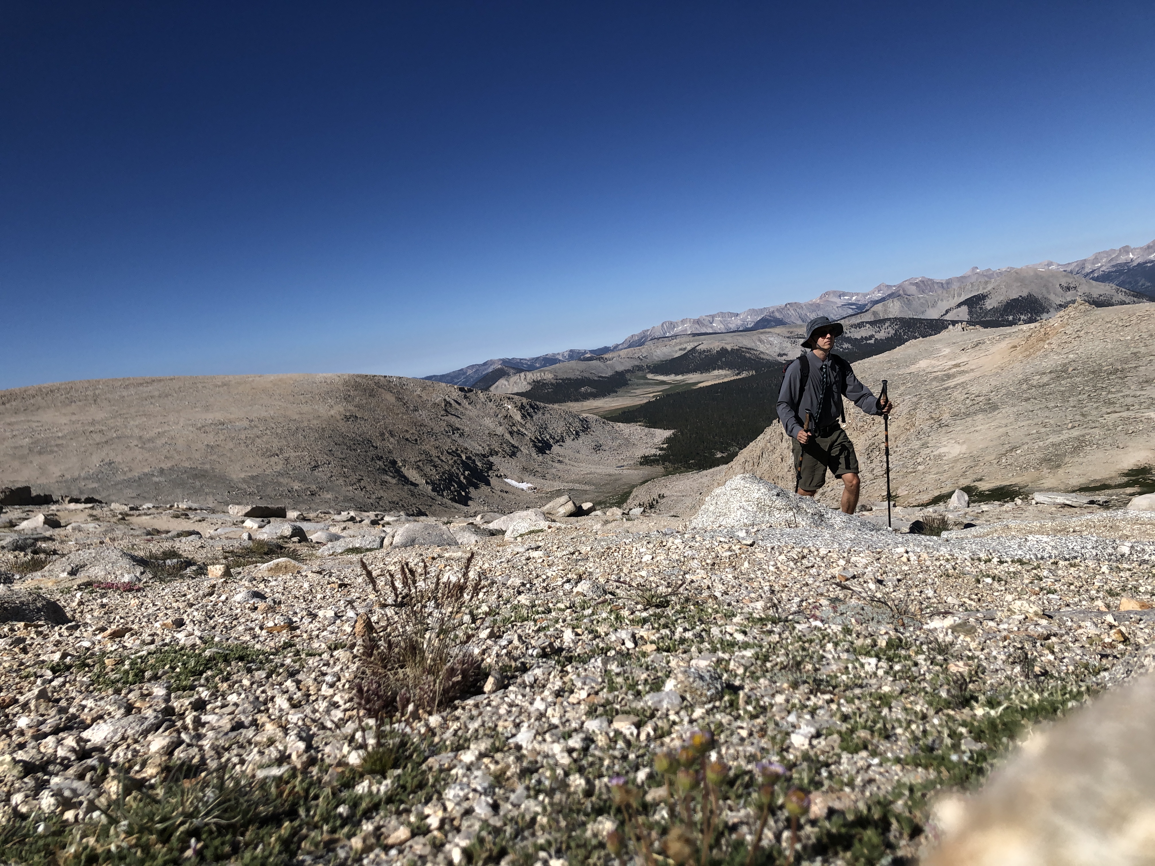
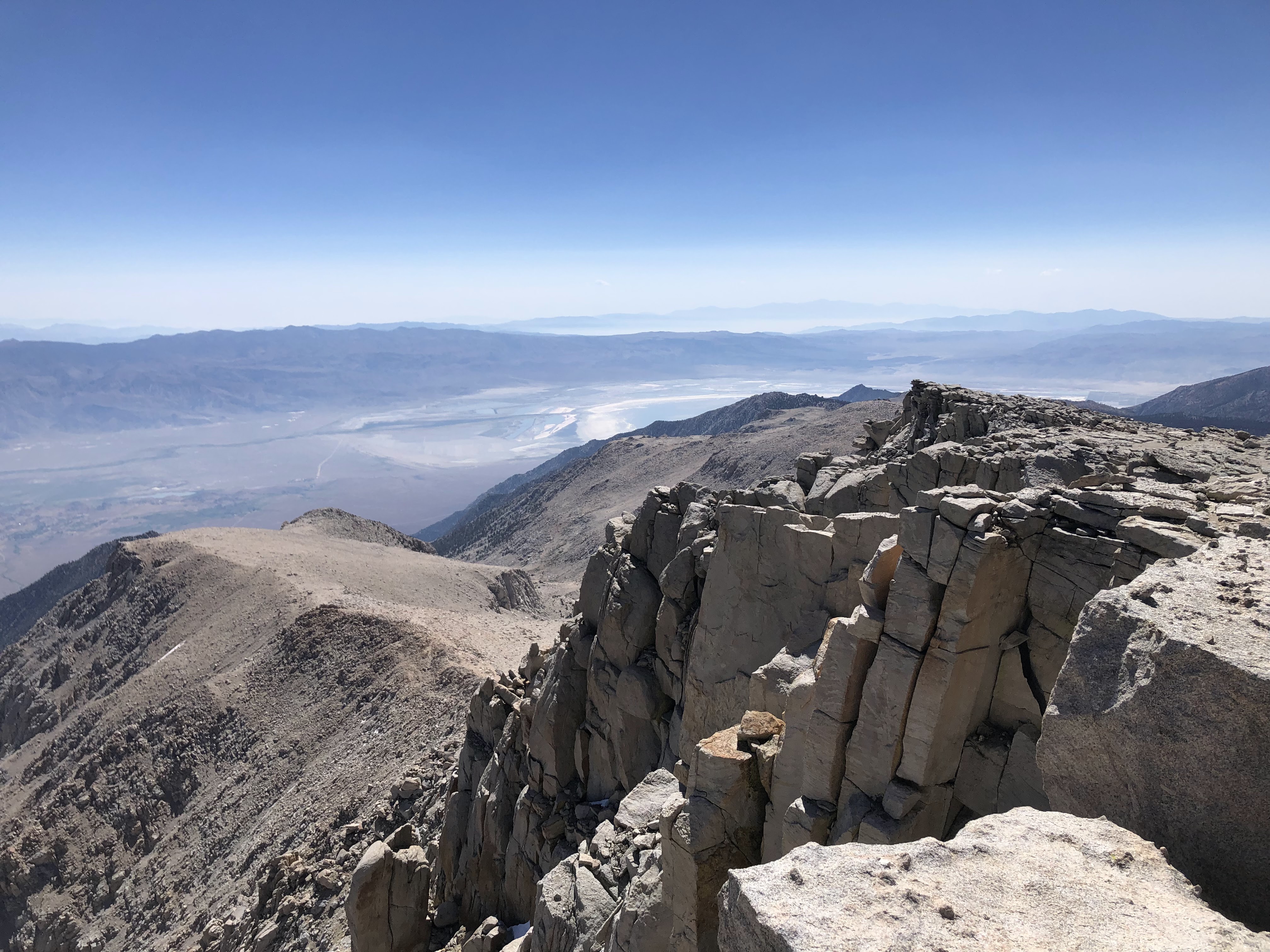
I managed to reach the summit in under 5 hours. There were two others up there. They thought I was Mormon what with my attire and all. We laughed a bit over that one. I sat down and took out my sandwich and checked out the view. There were cliffs all around the northern side of the summit, dropping 2,000ft down into Tuttle Creek. I could make out most of the major mountains to the north, including Whitney, Muir, Russell, Williamson, Lone Pine Peak, and Mt LeConte. I could even make out Middle Palisade and Split Mountain in the distance, looking remote and intimidating. To the east I could see the town of Lone Pine, appearing as smattering of green in an otherwise greenless valley. To the west were views of the Great Western Divide, an area of which I have hardly any knowledge. And to the south were views of pine forests, scattered peaks, and a large plume of smoke heading directly my way. The winds had changed and were blowing north, pushing the smoke from the south back to where it was yesterday. Olancha Peak, which was clear that morning, was starting to get overtaken by the smoky haze.

Southeast(ish)

Tuttle Creek and Lone Pine

Northwest(ish)


A few more people joined us on the summit: the two young guys (who I had passed again on the way up), a talkative woman, and a quiet older guy in a white sun shirt. I didn't spend too long up there; I wanted to beat the smoke on the way down. The wind was increasing in intensity with every passing moment. I took in the views one last time, soaked up the aura of the summit, and then hauled ass down the mountain. 


I made excellent time on the way down. I stuck to the use trail, following the cairns as if they were points in a connect the dots puzzle. I figured it would be easier sticking to the trail than down climbing the boulders. I boot skied though some of the gravel, grateful that I didn't have to climb up that nonsense. I reached a less sandy spot and emptied my shoes of rocks and sediment, and then jogged a good ways back to the junction with Old Army Pass. Clouds were starting to form overhead, casting large shadows over the vast expanse of sunlit granite. 


Joe Devel Peak, awash in sunlight

The French Ladies lied. There was a large snow drift covering the trail near the top of the pass. But no worries. It was easily bypassed. In fact, the entire pass wasn't that bad at all. Only a few parts were washed out, requiring some very easy scrambling. Granted, there was a pretty large drop off to my left but I didn't pay it much attention. Cottonwood lake #4 sat far below, encircled by an impressive cirque of which I was currently descending. Cottonwood lake #5 sat a little farther off, separated from the former lake by a narrow stretch of land. The two lakes looked like a pair of giant blue lungs. 

There was a father/son duo climbing up the pass. I informed them of the snow situation, and then carried on. I got down the pass without issue. It looks way more intimidating than it is. It's short, steep, and totally worth it. If I summit Langley again I'll definitely take this route on the way up instead. 


Old Army Pass center right

I chilled my legs in the bone chilling water of Cottonwood Lake #4. I was gonna go for a full dunk, but chickened out last minute. The wind was now ripping in steady gusts, and I figured that it wouldn't feel too good getting out of an ice cold lake with it blowing like that. Sitting on the shore, I could see wisps of smoke intermingling with the clouds in the sky. Oh well. Looks like it finally caught me. I gathered my things and set off on what would be the most scenic part of the day. 

Tail ends of Cottonwood lakes 4 (right) and 5 (left)


Cottonwood Lake #3

Each lake was spectacular. The waters were crystal clear, casting the reflections of clouds and the trees. Hardly anyone else was there in the basin; I practically had the whole thing to myself. I met with an older woman who was sitting near the north shore of Cottonwood Lake #3. We chatted a bit, each one describing what the other's day had been like. She was the last person I saw for a while. I walked through the basin, now back in a small pine forest. The smoke was getting thicker and thicker, but I didn't really mind. I was cruisin' down the trail, admiring the stunning scenery of forest, lake and meadow. As I walked along the shore of an unnamed lake I stopped and turned around, looking at Langley for one last time. It was starting to become enveloped in a thin sheet of smoke. Brother, I would NOT want to be up there right now. Altitude is one thing, but altitude+smoke is absolutely diabolical. I counted my blessings and kept on truckin'. 


Cirque Peak and company, lookin' smoky

The trail down to the fork with the New Army Pass trail was fairly steep, well marked, and smoky. I passed by a few miserable looking backpackers every once in a while. I eventually reached the fork and took one last break, finishing the rest of my sandwich that I started eating on the summit. I was beginning to feel the tell tale signs of an ensuing massive bowel movement, but I decided to take a gamble and see if I could make it to the pit toilets at the parking lot. It would be about an hour of walking, but I figured I could make it. 

Oh boy. Those last few miles were very intense. I speed walked through the pine forest, a man on a mission. I left the John Muir Wilderness, crossed a few creeks, and passed several more day hikers and backpackers, some of whom were very young children with packs that looked way to big for them. My trekking poles became a second pair of legs as I kicked it into overdrive to make it to those pit toilets. Sure I could have pulled off the trail at any time. I had the good ol' TP and trowel neatly tucked away in my pack. But I wanted to test my limits, see what I was made of, take myself right to the edge and peek into the unknown. About a mile away, there was serious doubt. A half mile, and I thought for sure I was a gonner. But somehow, by some miracle, I made it back to those pit toilets just in the nick of time. 

After nearly detonating the toilet with shear explosive force, I stretched my legs a bit and prepared for the long drive back. The smoke was just as thick as it was the night before, with tiny little pieces of ash falling like snow every now and then. An electric car dropped off two middle aged men and they remarked how much it "really smells like campfire." I started the car, waited for the engine to warm up, and then was on my way. 

Langley had proven to be an incredibly scenic peak with an even more scenic approach. Marmots, wildflowers, lakes, cliffs, and meadows. It was an incredible day. Couldn't have asked for anything more.