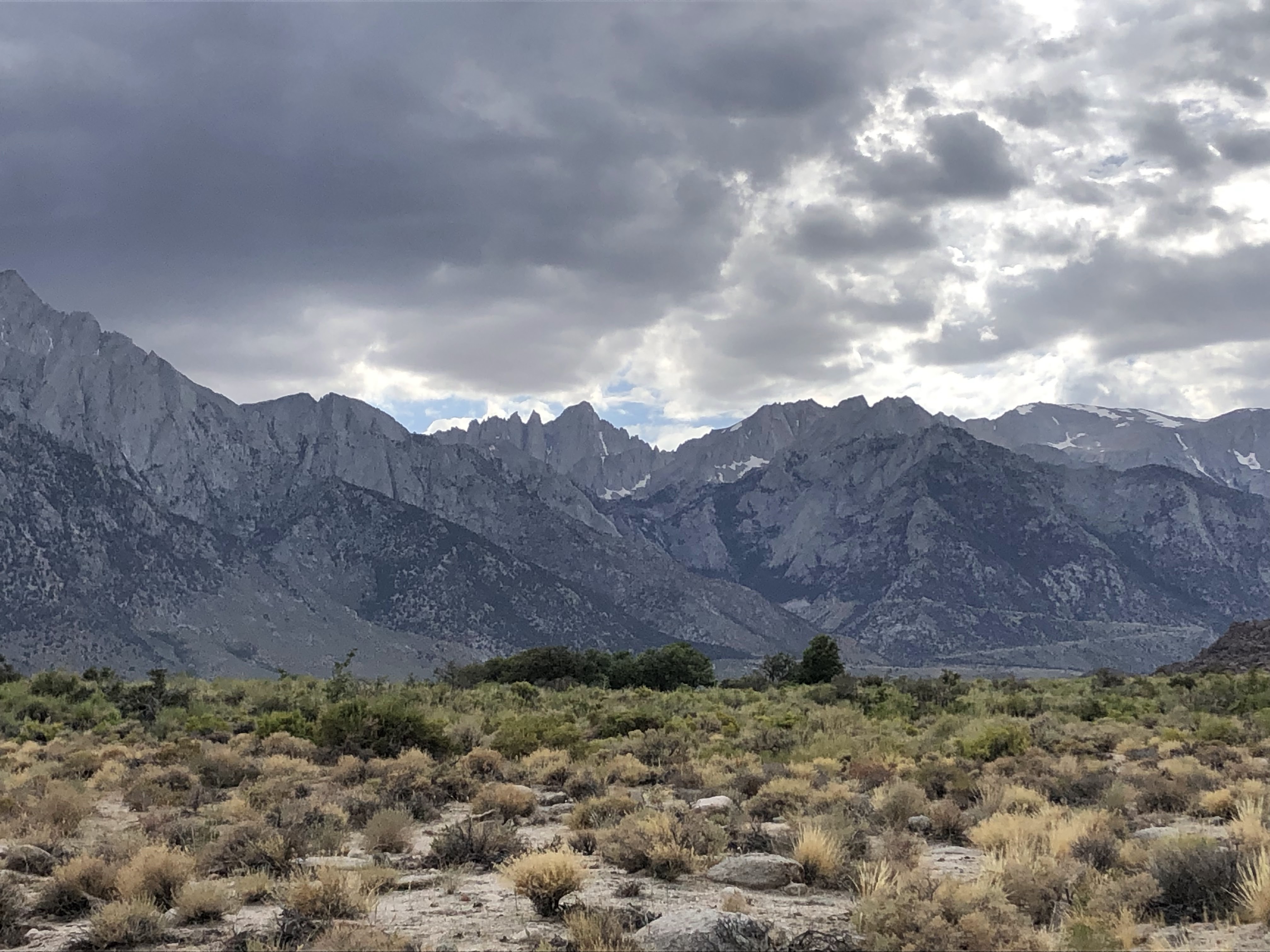
First I saw the clouds. Saw 'em while driving up the Whitney Portal Rd. They were looming over the mountains, dark and menacing, getting thicker and scarier by the minute. They were not in the forecast. They were an anomaly. An unexpected, unwelcome surprise. The wee hours of August 1st were supposed to be cloud free with a nearly full moon. This was not the case (except for the nearly full moon). On top of that I had forgotten an essential piece of gear: a tie. I packed the shirt, the ice axe, the energy bars, microspikes, trekking poles, extra socks, shoes, sunscreen, hat—even the Liquid I.V. But no tie. And when I forget to wear a tie, bad things are to follow. The clouds were the first sign of trouble.
The four of us arrived at the trailhead just after midnight. We packed our things, grabbed the Wag Bags conveniently located just past the start of the trail, and began the trek under the ever thickening clouds. The air was slightly warm and balmy, another unexpected meteorological surprise. Zach opted to hike this portion in a tank top and sandals. Hudson hiked it in flip flops. Both of 'em didn't want to get their hiking shoes wet. We had heard that the creek crossings were particularly bad this time of year, some of them knee deep. This was not the case. We trucked on up the switchbacks, crossing the creeks with ease. Conversations were kept at a minimum to conserve energy. The light of the near full moon, blurry behind the clouds, provided ample visibility as we made our way to Outpost Camp.
 |
| The beginning, a little past midnight |
We crossed the log bridge, skirted around a "snow bridge," and blazed though Outpost Camp. There were a few people camping here, all but one of them asleep. The one guy that was awake was preparing for the arduous climb to come, dressed in thick layers that we knew he would probably take off within the next three minutes.
We took a little breather a little ways past Outpost Camp. It was here where it started to drizzle. Uh oh. Not good. This was the second sign of trouble. It continued to drizzle off and on as the morning drew long. A clap of thunder would sure put a damper on our progress. We could only hope the weather would be in our favor, hope that it would blow over soon. Despite the disquieting conditions, my gut instinct felt nothing. My head was blaring alarms, but my gut stayed cool. Everyone else in our group wasn't perturbed by the weather at all. Zach was loving it. Said that it was "misty and nice." We kept our ears open for any sounds of electrical activity, hearing nothing more than the gentle pitter-patter of the early morning mist. We continued on our merry way, our pace slowing as the altitude began to make its presence more noticeable.
 |
| The first obstacle, 3:27am |
A little ways before reaching Trail Camp, we stumbled upon a traffic jam. The cause? The first sketchy section of trail—a 50ft horizontal trek up a snow bridge and across a snow bank, lay just ahead. The path was well worn and the snow provided a firm grip, but the thought of falling here was a little unnerving. People were putting on crampons, others used ice axes, and some just went across in sneakers and trekking poles. It was here where Zach and Hudson finally switched their shoes. Crazy dudes those two. Both of them nearly walked to Trail Camp in sandals and flip flops. Everyone got across without issue, and the added adrenaline rush helped propel us onwards to Trail Camp.
We arrived at Trail Camp just before 4:00am. Our group, as well as a few others, congregated near the lake to filter water. The drizzling mist continued to fall. As soon as we stopped walking the cold temperatures immediately took hold. We put on layers. It was cold up there, probably in the mid to high thirties. I know that don't sound that cold, but after getting used to 100+ degree temps of this blazing summer we've been having, thirty degree temps were quite a shock to the system.
Our group was planning on going up the chute, and the groups that were near us were debating whether or not to follow. We had all heard that the switchbacks to Trail Crest were nearly impassable, but the idea of climbing up a steep chute in the snow in the dark didn't sound too ideal either. Nobody was on the chute, but there were a few headlamp beams noticeable on the switchbacks. What to do, what to do. Just as we were about to leave, a random dude showed up and told us that the switchbacks were mostly clear; he had reliable beta from folks who had hiked them the day prior. This was a relief to many, as most of the people in the groups (including myself) had no prior mountaineering experience with snow. A little past 4:25am, we left Trail Camp and began the slog up the switchbacks. Things were looking good. The drizzling had stopped.
 |
| The Cables, 5:22am |
The switchbacks acted as a filter. The traffic jam of people slowly spread out, the altitude affecting everyone a little differently. The Mother-Daughter duo from New York became separated, the Hawaiians slowed their pace, while the lone solo hiker from Alabama joined our group, matching our pace as we moseyed on up the seemingly never ending switchbacks. Our group of four became a group of five: Zach, Hudson, Hayden, me, and the newcomer, Gage. We made a solid team. Conversations focused on brief and random subjects, anything to take our minds off the slog. Many a long silence fell upon our group, most of us now really feeling the affects of altitude.
A lot of the switchbacks were drenched in little streams of water. It's insane how quickly the conditions had changed over the past couple of days. Most of the snow on the switchbacks had melted away. Most of the snow. We encountered our second obstacle of the day at the cables. We took our time, meandering our way across the snow drift. It wasn't bad at all—no microspikes needed here.
After the cables the switchbacks steepened and as a result our pace slowed dramatically. The sun came up, hidden behind the clouds. We just kept going and going, up and up and up. We just put our heads down and kept on truckin'. It was the only thing to do.
 |
| View down towards Trail Camp and Consultation Lake |

 |
| First glimpse of the summit, center right |
The third obstacle of the day was a brief walk across an exposed snow bank. This one was sketchier than the cables, but not as sketchy as the first one we crossed in the early morning. I put on microspikes out of caution and carefully made my way across. There were deep footholds along the path; all I needed to do was watch my footing and to not look down. Everyone in our group made it across without issue. Better to go slow and careful in situations like these.
 |
| Gage walking across the 3rd obstacle |
After this third obstacle the switchbacks began to lessen in steepness. The going became easier, our breathing less labored. And then we came upon a weary sight. It was the final obstacle. It lay just before the end of the switchbacks. A long, partially steep snow bank separated us from the Trail Crest. In my opinion, this was by far the sketchiest part of the whole hike. Though there was ample footing and solid traction, a fall from this spot could lead to serious injury. We took our good sweet time crossing this section, Hudson and Hayden opting to use their crampons.
 |
| The final obstacle |
 |
| Zach crossing the obstacle |
 |
| Just past the last obstacle, at the top of the "chute" |
On the way over to the Crest, Zach checked out the condition of the chute. Said he would definitely glissade down it on the way back. I felt otherwise, as did Gage. The thing looked wayyy too steep for a beginner. I ain't never glissaded before and I didn't feel like testing the waters on that crazy lookin' chute. We arrived at Trail Crest just before 7:00am. There was one final tiny snow bank along the way to the Crest that was easily traversed. We took a long break at Trail Crest, preparing our bodies for the final 2 miles to the summit.
 |
| Trail Crest, 6:59am |
 |
| View East, Chute dead center |
 |
| View West, into Sequoia NP |
After 20 minutes, and a good helping of energy chews and yogurt covered pretzels, we began the final section of trail to the summit. The clouds were disappearing now, the drizzly morning a relic of the past. It was looking to be a sunny day. The views to the west were outstanding; lonely granite peaks, ice covered alpine lakes, and carpets of green forest were observable in most directions. Though this section of trail wasn't terribly steep, the altitude was definitely limiting our pace. We were nearing 14,000ft and we could unquestionably feel it. Luckily, everyone in our group was in good spirits, and though the altitude was undoubtably affecting our performance, none of us were showing symptoms of altitude sickness. Elevated heart rates, labored breathing, tired legs—I'll take these any day over dizzying nausea, crippling headaches, and extreme fatigue.
 |
| Alpine Lakes |
 |
| Gettin' closer |
 |
| Needles |
We took more frequent breaks on this final stretch of trail. Our goal was in sight—all we had to do was take our time and we would get there. We met a chipper Australian man coming back down the trail near one of the many Needles. He was completing the John Muir Trail. Dude was swarthy and lean and looked like he had just walked through hell and back. Looked glad to be almost done. He exclaimed to us that he finally realized why a particular Alpine lake is called "Guitar Lake." Looking down on it from this elevation, it looked like—you guessed it—a guitar. We asked him if there was a lot of snow on the JMT. He looked off into the distance, said yes, and nodded his head, then said yes again, a little quieter this time. He wished us good luck, told us we were nearly there.
 |
| Guitar Lake |

Before long we made it to the final push to the summit. Groups who had already summited and were on their way back advised us to scramble up the boulders to the right of the snow fields. This is what we did. Gage went first, zig-zagging up and across the boulder field. His mission to the summit was personal, and I suspect he wanted a small dose of privacy. I went next, trying to find the easiest path possible. Though there was no exposure or risk of a serious fall, this last slog proved exceedingly difficult. Not because of anything technical. Not because of wind. The altitude just plain sucked. I hadn't done any prior altitude training. Thought that I could take it. And so far, I had been able to take it. But this was the highest I'd ever been, and the altitude had other plans for my ego as I was starting to grow fatigued. A small headache spawned in the front of my head, causing me to slow my pace down to that of a meager stroll. Ah well. I guess that's what happens when you forget the dang tie, haha. But puttin' one foot in front of the other got me to where I wanted to go. Before I knew it, the hut came into view and the summit opened up before my weary eyes.
 |
| Nearly there! |
 |
| At long last... |
The summit was wide and blocky. Besides Gage, there was only one other dude up there. It was quiet, very quiet. A barely perceptible breeze fluttered across my face. The air was fresh, possessing a clean aroma unlike anything I've ever smelled before. The clouds gently rambled across the ocean blue sky. The country that lay around the summit spread out and away until it faded into the distant haze. Stoic, snow blotched peaks stood quiet. The crystalline blue, ice-peppered alpine lakes stood quiet. The clouds floated on soundlessly and even the weird sparrow lookin' bird that we saw at the top moved with an inaudible hop. The world seemingly stood still for a moment as we took in the views from the highest point in the contiguous United States. It ain't every day that you get to see a view such as this. And it's even more rare to share it during the summer months with so few people.
 |
| View East |
 |
| View North(west) |
 |
| View South |
Hayden summited next, meeting us with congratulatory high fives. A gregarious Slovakian man (who I had passed on the way up the final boulder slog) came next, raising his fists in accomplishment. Then came Hudson, and then Zach, who looked utterly exhausted. We had climbed the thing in eight hours and forty-seven minutes. And we needed a break. ASAP.
The Slovakian man was extremely funny, breaking the silence by discussing how he hates drinking Fanta at elevation and how he avoids eating energy bars at all costs because they give him gas. We asked him what he thought of peanut butter, and he said " What of it? It tastes like SH!T!" He told us of the previous summits he'd climbed, ranging from those in the Alps to those in the Himalayas. He was currently attempting the Pacific Crest Trail. He was getting close to his resupply; he informed us that he had hiked straight from Cajon pass. What a guy. We asked him how the desert was and he said "horrible... just... horrible." The conversation then turned to the conditions of the PCT, and he said that "This isn't just a bad year, this is the worst year to do it ever!"
 |
| View South(west) |
 |
| View North |
Hudson and Zach and Hayden continued to talk to him as more groups arrived. The Mother-Daughter duo arrived at the summit, much elated, followed by the group of Hawaiians. They all looked spent but content, overjoyed at having reached their goal. The daughter was particularly proud; she proclaimed how she truly believed that there was no way she could make it to the summit. And then the Mother started speaking Polish with the Slovakian man, and then the silence was no more. And though it was no longer quiet at the top, it was interesting to share the summit with these interesting folks. Seeing the jubilation on their faces was almost as great as the views of the valleys and cliffs and lakes and trees.


More and more groups arrived on the summit. The headache that had spawned was beginning to grow in intensity. It was time to go. I told Zach that Gage and I were gonna start making our way back down since we weren't gonna glissade. He said "Ok" and that was that. We said goodbye to the summit and began the long descent off the mountain.
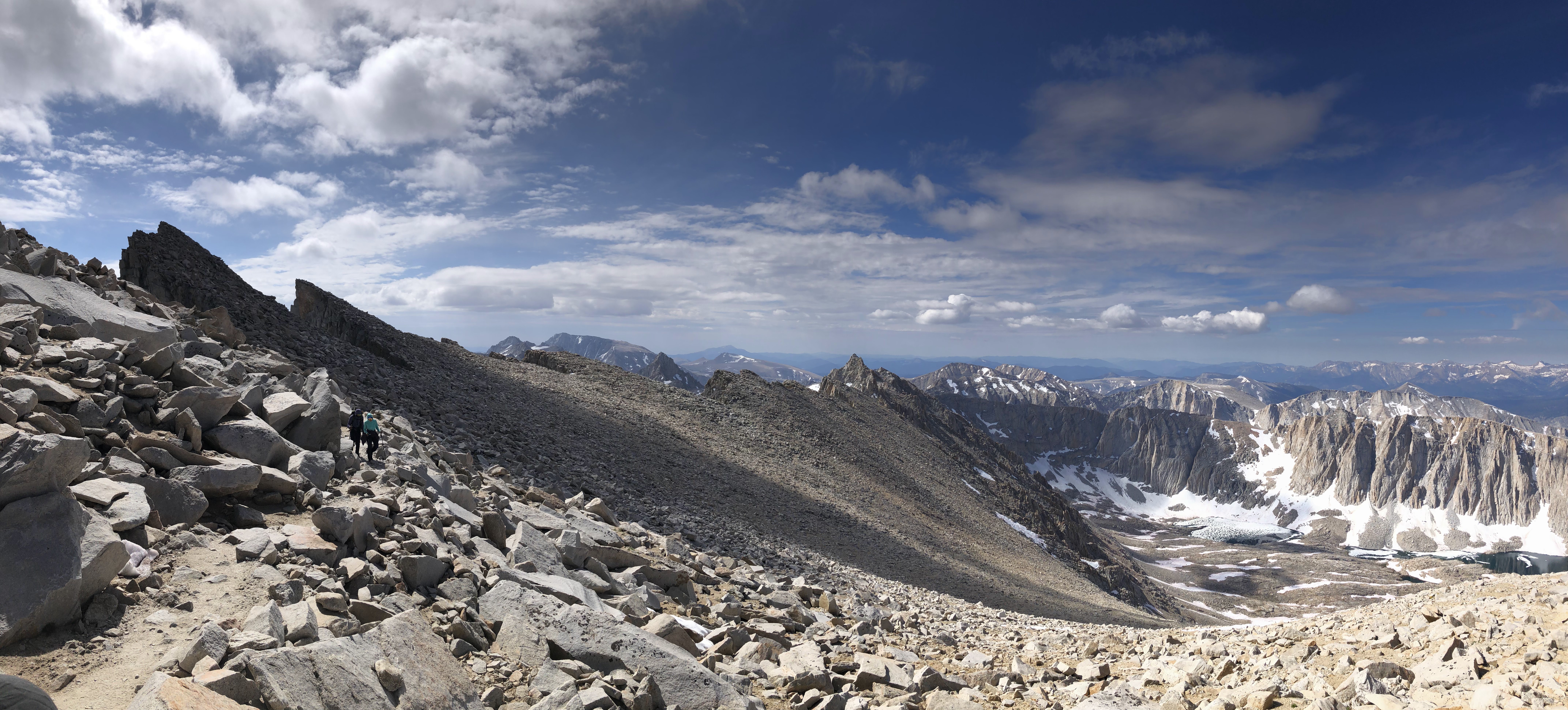
Along the way, we passed many a fatigued hiker, a lot of them asking how much farther it was to the summit. The headache never lessened in intensity, but at least it wasn't getting any worse. For the second time ever as a hiker on a trail, I popped some Advil to alleviate the discomfort. Gage did so as well, having been suffering from a headache of his own.
We made it back to Trail Crest. We eyed the chute one last time. It was extremely tempting to slide down that chute. We both knew that our legs would thank us for it in the future. No longer so afraid of the steepness, I sat down and pondered whether or not I should go. After three seconds, I decided not to. A lot of snow had melted in the chute, exposing several pointy rocks. The snow itself was slushy and soft, so I figured that I wouldn't be able to slow down given my inexperience with glissading. Had there been more snow, and if the snow was a little more compact, I probably would have tried it.
 |
| Back down the switchbacks |
As we were pounding down the switchbacks, I caught sight of Zach glissading down the chute. He moved slow and steadily, his figure microscopic compared to the towering country that surrounded him. After a while we saw another tiny figure glissading down the chute, and then another, and then another. It appeared that somebody had joined Zach, Hudson and Hayden in their glissading endeavor.

 |
| Mt. Muir and environs |
Zach and company made it to Trail Camp before us, but not by much. Gage and I had made some good time zooming down the switchbacks, the three snowbanks existing as the only impediments to our progress. Near the end of the switchbacks I decided to practice some glissading on a much more mellow slope. It wasn't as bad as I'd expected, but my pants got soaking wet in the process. Oh well. Didn't matter. It was likely to get hotter the farther we descended.
We made it back to Trail Camp just after 12:00pm, taking a long break to eat and filter water. There were three marmots hanging around, one of them busy eating all the food in some backpacker's open bear canister. Ate everything except the jerky. I asked Zach how the glissading went. He said it was rough. Said that he almost lost control, said that his hands got all scraped up. Said that the snow was too slushy and that there were chunks of ice everywhere. Said it was hard to slow down. And the more he talked about the chute the more glad I was I didn't do it!


The way back down was uneventful, just long miles of joint bustin', knee bashin', leg crushin' downhill. The snow on the sides of the mountains had a reddish/pinkish hue. It looked like it had been sprinkled with a mixture of cayenne pepper and pink sprinkles. We couldn't figure out why the snow looked like this. And as of this writing, it is still an intriguing mystery.


We left Trail Camp a little before 1pm, a little perturbed by the cold and the thunderclouds forming overhead. We made it back to the last sketchy part of the day in a little over 15 minutes. Looking at this snow bank in broad daylight made it a little less scary, although the snow bridge at the very end of it was still a little unnerving. We made it across much quicker than in the morning, Zach changing back into sandals once he crossed it. After our group made it across, we watched as a group of backpackers attempted to cross in the dumbest way possible. The dude in the group was standing on top of the bridge, dragging the rest of his group up and over. Other groups waiting behind them looked on with quizzical expressions. Not wanting to watch a disaster unfold, we threw on our packs and trucked on out of there, not looking forward to the miles and miles of switchbacks that lay in front of us.
 |
| Consultation Lake |

 |
| The last sketchy part. After this—easy street! |
The way back down was uneventful, just long miles of joint bustin', knee bashin', leg crushin' downhill. The snow on the sides of the mountains had a reddish/pinkish hue. It looked like it had been sprinkled with a mixture of cayenne pepper and pink sprinkles. We couldn't figure out why the snow looked like this. And as of this writing, it is still an intriguing mystery.
Near the very end of our journey, we ran into the first ranger we'd seen all day. In regards to our permit, Hudson jokingly remarked that we didn't need to get carded because we were all over 21. The ranger thought this was funny. We spoke for a while, discussing various things such as trail conditions and weather and how many people we'd seen and what not. The ranger brought up the discussion of farts for some reason, stating that they smell much worse at altitude. Why they smell so much worse is unknown. Along with the reddish/pink snow, this proved to be another mystery. But I can say for sure that it definitely exists. I for one released a few SBD's that could strip the varnish off a wooden floor.

 |
| Mirror Lake and Thor Peak |
 |
| Miles to go.... |
We bumbled on down the trail to the parking lot, finishing the entire thing in just under sixteen hours. I said goodbye to Gage and Zach, thanking the latter for inviting me on this awesome journey. I drove the 4½ hours back home, showered, and then promptly passed out in my bed. I'd been up for over 24 hours, and brother I could feel it. But I wasn't the only one who was low on sleep that day. Everyone on that trail was likely sleep deprived. Zach for one, by the time we finished, had been up for about 48 hours, functioning mostly on caffeine and a whole lotta Tylenol.
Whitney had been on my bucket list for a long time. I wanted to climb it just for the heck of it. Tallest mountain in the contiguous United States? Trail all the way to the top? Yep, I just had to climb it. It's popularity can be off-putting to those who seek solitude and privacy. There were a lot of people on that trail, many of them inexperienced to the outdoors. And as such, the trail was was littered with the detritus of society. Strewn backpacks, lost trekking poles, headlamps, water bottles, plastic wrappers. That's just what happens with a popular trail, ignorant people are gonna trash it. But a lot of the people I met on that day were really cool, and this was definitely my favorite part of the whole hike. When a large group of people engage in voluntary suffering in the outdoors, they turn cordial and convivial. You meet knew friends, swap stories, and share in the experience of observing some of the most beautiful country on earth.
I'm sure to go back someday, this time in a tie.


