Friday, March 31, 2023

Pratt and Gridley Loop


Last week I decided to take a little walk in the Ojai front country to see the condition of two of my favorite trails. I had a little bit of a late start at around 12:30pm. Several cars were lined up on Signal street, probably belonging to folks who were hiking Shelf Road. The parking area for the Pratt Trailhead was almost full, but luckily I nabbed a spot at the last minute.

I don't think I've ever seen the trail this crowded. Several people were out and about, most of them enjoying the roaring creek to the left of the trail. I don't blame them; it's rare to see it flowing with such force at this time of year. I would cross this creek a total of four times, something that I haven't been able to do for a VERY long time. Everything was hyper-green, and here and there were colorful blooms of ceanothus and California poppies. 

As I progressed, it became noticeable that most people were hanging around the lower portions of the trail. I guess the junction with the Fuel Break road was the turnaround point for most folks. This was a welcome surprise for sure, as I definitely expected to be sharing the narrow single track with hordes of people. 

Stewart Canyon


Before long, I left the road and made a right on the narrow single track that continues up towards Nordhoff Peak. Way up on this trail, I could still hear the creek roaring from far down below. This was a little strange for me, for I have grown accustomed to hearing nothing but the crunching dirt beneath my shoes and maybe the occasional gust of wind while walking this trail. That creek is dry for most of the year and when it's not, it's typically pretty unassuming and dribbles out after month or so. Not today. The recent storms have turned this creek into a hulked-out version of its former self. Several waterfalls roared down Stewart Canyon, pouring into aqua pool after aqua pool. It looked like something that you would see in the foothills of the Sierra. Really puts into perspective just how much rain we got this year. 


After walking for a bit I stumbled upon the infamous slide that took out three sections of the trail. I passed a group of Boy Scouts wearing heavy packs making their way across the first washed out section. It didn't look like they were doing trail maintenance, so I don't really know what they were doing up there. The first washed out section was pretty manageable, but the second required a little more caution.

2nd washed out section. Boy Scouts on the left.

The third washed out section was a little sketchy. It was the largest of the three; I'm guessing that it took out a good 40-50ft of trail, maybe more. It's also near the top of the slide, so a slip here would result in a nasty tumble down the side of the mountain. It looked like some people had kicked in little steps to get across, but the surface of the ground was incredibly crumbly and I didn't really trust any of them. In addition to being crumbly, underneath it was compact and solid, preventing me from skirting across like I would a shale or gravel slide. I took my time and made it across without issue. Should anyone attempt this before it's inevitably fixed, I recommend a healthy dose of common sense and caution. 

The 3rd washed out section. Worst of the three. 

Picture doesn't capture steepness

Looking down from atop the slide. Nearly took out a fourth
section of trail where I'm standing.

After the slide I only saw four other people on Pratt. Not surprising. That slide was a pretty scary obstacle. The reward for having traversed said obstacle was a nice view of the multiple waterfalls in Stewart Canyon. I took my time zig-zagging up the switchbacks, taking in the incredible views of the surrounding area. 

Waterfalls in Stewart Canyon

After a while, I reached the junction with the little trail that leads into Valley View Camp. Curious to see if the storms washed away the camp, I decided to do a little exploring. Near the bottom of the switchbacks on this little trail is a small drainage, and this drainage has done some minor damage. Two sections on the lower part of this trail are completely washed out, but are easily navigable. To my surprise, the camp was still there, fire pit, wooden seats and all. It just barely escaped getting washed away. The "little" creek next to it was rushing and ripping down towards Stewart Canyon, churning up the water in some of the pools so much so that they were completely opaque. 

"Little" creek next to Valley View Camp

This swim hole is likely chest deep

This little creek ends at a cliff face that overlooks the Ojai Valley. I suppose that's how the camp got its name. Pouring over the side of this cliff was a massive waterfall. It looked like the kind of waterfall that you would see in Matilija Canyon or something like that. I can only imagine what THOSE falls look like now. In all the times that I've visited this camp, I've never seen this much water tumbling over the cliff. Usually, this waterfall is pretty small, consisting of a tiny stream. Not this time. It was truly a sight to behold. I did a little scrambling to get a full view of the fall. It poured into a small pool at the bottom, which then meandered down the canyon towards another waterfall. I don't know the total number of waterfalls in that canyon, but judging by how loud it was I'm assuming there's A LOT.

Top of the big falls

WOW!
I stayed in Valley View Camp for a little while and then slogged my way up to the ridge road. The section of trail from the campground to the ridge road is in excellent condition with very little damage. Once I got to the ridge road I was gifted with views of the Matilija backcountry. The snowcapped summits of Monte Arido and Old Man Mountain were visible in the distance. 


The remaining walk to the lookout tower was pretty uneventful. Near the top I passed some trail runners who were making their way back towards Pratt. At the top I talked with a kid who had rode his mountain bike up Gridley. He said that the trail was in great shape, and that he was grateful that his bike was electric. Those dang electric bikes sure are popular these days. Seems like everyone's ridin' them. 

Nordhoff Tower

The views from the tower are always exceptional, and on that day they were no different. The visibility wasn't the best I've seen but it was pretty dang clear. Santa Cruz, Anacapa, and a little bit of Santa Rosa were visible in the distance, along with the Santa Monica Mountains and the urban sprawl of the Oxnard Plain. The Ventura River stuck out like a sore thumb; the recent rains having stripped away most vegetation. Some of the trees on Pine Mountain Ridge still had a dusting of snow on them, which stood out in stark contrast with the vibrant green springtime wonderland that lay just to the south. It was quiet up there, with a little bit of clouds and a gentle breeze. Just how I like it. 

Pine Mountain Ridge

Lake Casitas looking great

Looking towards Matilija Wilderness


After soaking in the views, I began the knee-bashing decent down Gridley. Like the kid said, the trail was in great shape. There were several small waterfalls that I spotted in the many side canyons that dot the trail. I've never seen so much water on this trail. As I walked along throughout the day I slowly began to understand the significance of these recent storms. According to vcwatershed.net, the season total for Nordhoff Ridge is almost 70.5 inches. That's completely insane! And I tell yah, it shows. Walking along these trails, it almost looked like the mountains were leaking. Like the mountains themselves were just huge bags filled with water and someone poked holes in 'em to let the water out.


Soon I heard the roar of the stream in Gridley Canyon. I heard this until the single track turns into dirt road. It was that loud. I can only imagine how many cool swim holes and waterfalls are hiding in that canyon. Several wildflowers were in bloom, providing the breezy air with a pleasant fragrance. In what seemed like no time at all, I made it to the famous bathtub. It looked like it got some much needed repairs. It actually holds water now and, to no one's surprise, it was completely full. The spring right next to it, instead of its usual dribble, was a small stream. 

The famous bathtub 

Adjacent Spring

More Waterfalls!

Gridley Canyon

A little ways past the bathtub was the worst of the slides that I encountered on Gridley. Most of the washed out sections on the trail that I had previously passed were very small and already fixed. This one was a little larger and a little sketchy because of a small drop off, but I saw two mountain bikers on the trail so if they could make it past this, so could a hiker. Compared to the slide on Pratt, this was a walk in the park!

The worst slide on Gridley. Not too bad at all.

Looks more intense from afar, but don't let it scare you.

So green!

After the slide I just jogged the rest of the way back. Wanting a little more miles, I decided to continue down Gridley to Shelf Road instead of taking the Fuel Break back to Pratt. Shelf was crowded, but not as much as I'd expected. There were significantly fewer cars at the Pratt trailhead when I finally got back. I completed the whole loop in just over 5 hours, not too shabby for having done nothing in like three months. It was nice to finally get back out there. Gorgeous day, nice views, plenty of water. Wouldn't have had it any other way. 

Shelf Road


Tuesday, February 28, 2023

Flashback: Old Man Mountain

 11/26/22


The allure of this mountain's twin summits has tempted my thirst for exploration for many years now. They look interesting, you know? Kind of like Chief Peak's rocky summit. And at 5,538ft, Old Man Mountain is practically the same height as Chief Peak. And Chief Peak, as I've learned through the years, is a super awesome mountain. So on the morning of the 26th, no longer able to quiet my desire to meet Old Man Mountain, I packed the bag, called a friend, and set off to see what it was all about. 

The parking lot at the end of Matilija Canyon road was almost full. This was because of the gigantic muddy puddle in the middle of the lot. It was causing some distress for a lot of people. Why? Don't know. Some people just don't like muddy puddles I guess. We breezed through the first section of the road and then made a hard left up towards the Murietta Divide. This is where the climbing began. It's up, up, up. And thanks to the Thomas fire, there's practically no shade the whole way up. Hiking this steep road in the summer would be "fun" no doubt...

On the way to the divide, a little ways past the pleasant Murietta Spring, we made acquaintance with the first people we'd seen all day. I guess everyone else was going to the popular Matilija Falls. After we made introductions, they asked us, to our surprise, how much farther it was to the falls. We told them that there were no falls up this way. Told them that they made a crucial wrong turn a long ways back. Oh well. Next time maybe they'll bring a map. 

Once we got to the divide we took a little breather and then made a hard right and began the long slog to the summit. The road was in great shape; it almost appeared as if somebody had recently driven a truck on it or something. It was very easy to follow with minimal brush.

Dang Mylar Balloons!


A little ways past what I guess is known as "Devarté Peak" was a large grouping of curious rock formations. Neither of us were expecting to find formations such as these in a place such as this. They looked akin to those formations near Pine Mountain Lodge or those on the Mishe Mokwa trail in the Santa Monica Mountains. It was a strange surprise, but a welcome one for sure. It would be worthwhile to go up there on another day to explore those formations. Who knows what wonders await!

One of the interesting formations

Matilija Canyon and Nordhoff Ridge


The road to the base of the summit was long, hot and dry with lots of gains and losses in elevation. Many a time I found myself wishing I had a mountain bike. It would've been a lot easier than walking. Especially for the way back; I could already tell that it would be a knee-basher. Nonetheless, through the basic act of putting one foot in front of the other, we finally made it to the base of the southern summit. This peak is the shorter of the two, but from the parking lot it looked really cool so you know we just had to climb it. We left the road and started off trailin' it to a small saddle where we decided to take a snack break. 


Shirt and Tie Adventures 

Our Route

Climbing the southern peak turned out to be easier than expected. The brush was minimal, the footing secure, and the wind—good-humored. We scrambled up there in no time. The summit was a little blustery, and had a serious drop off on its northern edge. It was rocky, barren and steep, and it had a big long wire sticking out of the tippy-top. Beneath this wire was a spattering of bird crap. And near the bird crap, a piece of a tin can lid that had markings on it dating back to the 60's. 


Summit of "Vulture Peak"

Near this ancient lid we found the teeny-tiny register that had been there since 1999. If Creampuff Peak has the largest register, this one definitely has the smallest. The whole thing was shorter than my hand for cryin' out loud. It was completely full, but this was expected given its small size. We also learned that what we were standing on had an unofficial name: "Vulture Peak." A very fitting name indeed. 


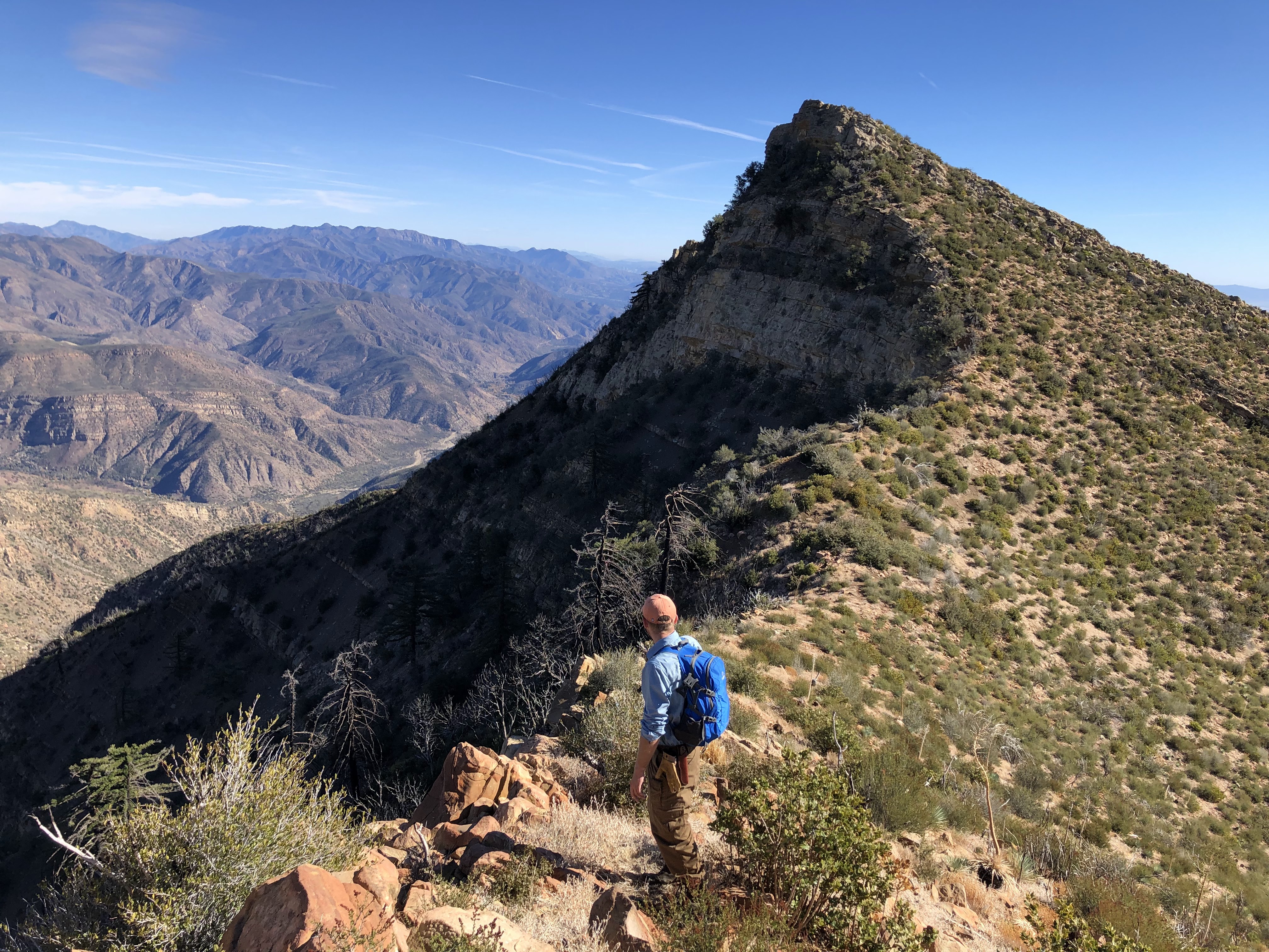
One down, one more to go. After saying our goodbyes to the very cool Vulture Peak, we moseyed on over towards our main objective. Climbing down the western side of the peak proved interesting, but we made good time and before we knew it we were between the two peaks. This space proved to be my favorite part of the day. There was something fascinating about gazing out into the abyss of Old Man Canyon and beyond whilst being sandwiched between two gargantuan pyramids of rock and brush. I felt small, very small, and without another sound except for the crunching of our steps, this space between the rocks offered immense quietude. Here was a place of solitude, a place of tranquility, a place where you could disappear for a bit and forget all of your troubles. 


The last push to the summit was like climbing up a slightly brushy ramp. It was sure easier than Vulture Peak, I can tell you that. The summit of Old Man Mountain isn't as pointy as Vulture, thus it provided us with ample space to stretch our legs and lay around and relax for a minute. Lunch on the summit consisted of a loaf of bread and jerky. 


View from the summit

The views from up there were, to put it simply, the absolute best I've ever seen on any Los Padres Peak. And I'll stand by that statement any time, any day. It was crystal clear that day; the conditions couldn't have been better. We could see forever; had a seemingly bird's-eye view of the entire surrounding area. We could even see Mt. San Antonio wayyy down off yonder. Wasn't expecting to see ol' Baldy that morning in the parking lot. But there we were, on the summit of Old Man Mountain, staring right at it. The summit register contained a paper that listed some of the surrounding landmarks. We could see every landmark listed on that paper. That's how clear it was. And the ocean lay sprawled as an immense plain of piercing blue, contrasted by the subdued green of the rugged mountains. Here and there in some of the canyons was a smattering of color: reds and yellows and oranges. Tiny little blobs of color in a vast ocean of green. It was a sight to behold. When I inevitably return to this summit, I will likely never see the land with such clearness and clarity again. We took it in as much as we could; sights like these are few and far between.

Anacapa and Santa Cruz

SC, Santa Rosa, and San Miguel

Jameson Lake and Fall Colors

The SLP

We could see everything listed on this paper!

After we said our last goodbyes to the summit we began the long descent. Instead of climbing back up and over Vulture Peak we decided to skirt on down between the two peaks, westward, back towards the road. And once we hit the road we put our heads down and started truckin' on out of there. Road miles are easy miles, but there's just something about them that makes them extremely unpleasant. Truckin' on out of there is the only remedy that I can think of that makes road miles more tolerable. 

Twin Summits

Fall Colors in Murietta Canyon

We passed the rock formations, hit the divide and then bashed our knees down the steep grade into Murietta Canyon. Once we reached the bottom, it was easy street all the way back to the parking lot. There were less cars than before and the mud puddle was still there, and it was still causing grief. Some bozo thought it was a good idea to bring their Mercedes Benz to that parking lot. They got stuck in the mud puddle, their tires digging deeper and deeper into the mud each time they tried to escape. With great effort, and with some help from a few good samaritans, they were able to escape that dreadful mud puddle. Thank goodness for that, haha. I hope they learned their lesson. 

Old Man Mountain was a good one. We felt like old men ourselves after climbing it. Lots of pain in the joints and whatnot. One of these days I'd like to venture up there again. It would be interesting to see the condition of that road after all of these storms. As of late I haven't been doin' much. But when the forest opens on March 13th you can bet that I'll be there, bumblin' around and dressed to impress. 


Tuesday, January 31, 2023

Rose Valley Falls and the Great Deluge

Rose Valley Falls 1/5/23

On the second day of the New Year my sister and I drove up the 33 to see how the recent rains had treated Rose Valley Falls. The road just outside of the campground was lined with vehicles; apparently we weren't the only ones who had this idea. The campground itself had a good amount of people in it, although it appeared that only two or three groups were there to stay the night. Everyone else seemed to be there just for the day, and a beautiful day it was. Cloudy, calm, and cozy—with a little bit of mist. Strange weather for Southern California.

The short walk to the lower falls went by without any difficulty. We passed all sorts of people, most of them families with little kids. At the base of the lower falls were a whole assortment of individuals that were standing around gawking and gazing. The falls had a nice flow, offering a dusting of mist to those who stood near the base. We got up close and reveled in the simple majesty of water rushing over the cliff face. 

Lower Falls

The lower falls were nice and all but I was in the mood to see something interesting, something that I had never seen before. That something was the upper falls, 150 some odd feet in height. I had heard somewhere that an adventure to these falls would require some minor scrambling. Given that it had been misting, it probably wasn't the smartest thing to do, but we took a chance and went for it.

Rose Valley Falls
Rose Valley Falls

Seasonal Falls

We found a well-worn use trail near the main trail that we took all the way to the falls. To our surprise, no scrambling was required at all. Mostly class 1 with a little class 2 sprinkled here and there. I will say, however, that this route would be a little sketchy to attempt in the rain. But in the mist—easy peasy. Before making our way over to the pièce de résistance we decided to check out the top of the lower falls. It was nice there, with plenty of room to sit and a nice view overlooking the surrounding area. 


We couldn't see the upper falls at first, but we could sure well hear them. They were loud and ominous, yet strangely beckoning. Something that loud would surely be a sight to behold, you know? The final push to the base of the upper falls proved to be the most difficult part of the day. This was where most of the class 2 "scrambling" occurred, if you could call it that.  After we traversed the side of a small hill and crossed the stream we finally caught our first glance of the upper falls. 

First Glimpse
                                         
Strange Rock Formations
                               
Wow, what can I say. There are just some things in life that can't be put into words. I could say that the falls took up my whole field of vision, drowning out every sound with a deafening roar. I could say that the water fell with enough force to explode into a storm of mist and wind that splattered over the jagged rocks and rushed into the valley below. I could say that I had to tilt my head wayyy back in order to take in the sheer size of these falls, having to crane my neck to see them in their full glory. I could say this, I could say that, but none of it will ever capture what I actually saw and experienced. These falls, at that particular moment, possessed the aura of the sublime, of the indescribable. I don't know if it was because of the cloud enshrouded mountains to the north or the rugged cliff face of the falls themselves or the knowledge of the coming atmospheric river that would make these falls even more insane. Whatever it was, whether it be the weather or the location or just the vibes—seeing these falls was something quite exceptional. Plus nobody else was there so that was nice. 


A few days later, on the 5th, we decided to go back up to see the falls once again. We passed a "road closed ahead" sign on Fairview, and we assumed that the 33 was closed at Wheeler Gorge or something like that. But we never saw nothin'. I guess CALTRANS just forgot to take down the sign 'cause the road was totally fine. It had rained a little more, and I could already tell that the coming storm would be an absolute doozy. While we were driving up the 33, I couldn't help but notice the several ephemeral waterfalls that seemed to inhabit every crack and crevice in the hills. Dry lakes ridge alone had about 5 or six little buggers; probably would never see water flowin' in those spots ever again. There were little cracks in parts of the road, as well as evidence of minor rockslides. Yep, with this new storm coming in, I figured it would most likely be a good long while before I drove this stretch of highway again. 

The Upper Falls, a few days later

There were only two cars parked at the campground. That was it. From the campground we could see the entirety of Rose Valley Falls, all 300ft, as well as several ephemeral falls that danced their way over the cliff face. The little stream next to the campground had now graduated to creek status. We crossed with caution, easing our way up the muddy trail to the lower falls. They were just as insane as the upper falls were a few days ago. They were loud, so loud that I couldn't even think. A lot of the moss had been stripped away, and a great mist had settled at the base. I could only imagine what the upper falls looked like. There was absolutely no way I was gonna climb up there to find out. I may be stupid, but I ain't that stupid. 


We stayed at the lower falls for about 15 minutes, and then the rain started screaming down from the sky and it was time to go. Driving out of that campground was a surreal experience. With this coming storm, that little creek would become a river, a river that would probably cause some damage. I took some time taking it in, for it would probably be the last time I'd see the place for a while. Who knows what that camp would look like after the storm. 

And storm it did.  It just kept on rainin' and rainin' and rainin'.  The sky just went up and dumped a years worth of water in the span of a few days. And some places got more rain than others. Like, an ungodly amount of rain. According to vcwatershed.net Nordhoff Ridge got 18.5'' of rain in just two days. Two days! That's totally insane. You can only imagine what those falls looked like then. It is also of note that both San Marcos Pass and Matilija Canyon both received over 17" of rain over the course of the same period. Holy jumpin' flapjacks, that's a lot of water my friend. Trying to wrap your mind around statistics like these is pretty much impossible. Why and how this much rain can fall, it's a mystery to me. It doesn't make sense. I guess it's just what happens sometimes here in SoCal. Albert Hammond really put it best:

"Seems it never rains in southern California
Seems I've often heard that kind of talk before
It never rains in California
But girl, don't they warn ya?
It pours, man it pours"

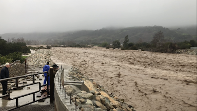
So on the 9th, in the midst of the storm, I decided to check out the Ventura River. The local news reported that it had reached flood capacity, and, having never seen a river reach flood capacity before, I was a little curious to find out what it looked like. What does 17" of rain from Matilija Canyon and 18.5" of rain from Nordhoff Ridge do to a quiet little river bed that's dry for most the year? 

Whoah!


It smelled like earth. There was a news van, ABC 7 Eyewitness news. A few people stood around. One old guy remarked "about time we got some rain." The river sounded just like the falling rain, only a tad angrier. Branches, garbage and other debris littered the surface. Huge boulders, hidden from the naked eye, rolled and smashed and tumbled beneath the surface. The water was almost touching the bottom of the Santa Ana bridge; had about 6ft to go. Suffice it to say, it was awesome, in the truest sense of the word. Huge, epic, powerful and terribly frightening all at the same time. 

Ventura County Fairgrounds

The next day, on the 10th, we drove to the beach to see the water meet the sea. It smelled strongly of earth; the familiar salty brine smell of the ocean was nowhere to be found. We walked along the bike path, passed a few search and rescue folks. The fairgrounds were flooded. About a half foot of water (deeper in some places) covered most of the western premises. The water in the fairgrounds was still, like a reflection pool, and there was one guy in there trying to work the pump. The river was raging, full throttle, into the Pacific. The ocean was brown and murky, the beaches buried beneath heaps of driftwood and other random detritus. I ain't never seen the river like that, and I probably ain't never gonna see it like that for a long time. This storm was one for the books, causing destruction and hardship for many who live in the backcountry. The road into Matilija Canyon was completely destroyed. The 33, well, lets just say it'll be under construction for a good long while. As for the trails and camps in the Los Padres...I do not know. As of January 13th, practically the whole damn forest is closed to the public. Personally, I think that's kind of lame, but what am I supposed to do about it, you know? 

So it'll be a while before I go moseyin' on back there to see what's happened. In the meantime, I'll write a few stories that I've been meanin' to write but just never got around to it. And that's all I have to say about the great deluge of 2023. 

Ventura River Mouth