03/04/25

I spent much of Tuesday morning last week contemplating whether or not I should venture into the local wilds. It had been over a week since running the half and my toe had only gotten worse, changing from purple to almost black. My legs were well recovered however, and the weather was absolutely gorgeous. I couldn't let the opportunity pass. So I racked my brain, trying to think of a hike that wouldn't further destroy my toe. I wanted something short, quick, with a great view and lots of sun. Enter Chief Peak.
I immediately thought of a route that I'd done only a few times before, a steep little jaunt that, as far as I know, provides the quickest route to the summit. It would be perfect for the day, especially with the weather so nice. So I grabbed just one bottle of water and set off on the 33, winding up the curves towards Rose Valley.
I arrived at the outskirts of the campground fifteen minutes before noon. Not a soul was around. I slipped on some old running shoes and began the trek up the mountain, walking through the campground towards forest route 5N42.2.
 |
| Rose Valley Falls + Campground |
 |
| The route |
I left forest route 5N42.2 and began the cross-country trek to the base of my chosen ridge. The ridge is very obvious, rising from the western end of the campground and stretching rather steeply for a ways before terminating at a point farther up forest route 5N42.2. It cuts a good amount of road walking out of the equation, which is the main reason why I like this route so much. Road miles are easy miles, but man, do they suck. I've walked up that ol' road more times than I can count, and I can say with confidence that it's just plain boring.
The ridge is more preferable, albiet much, much steeper. Even though I've climbed this ridge a few times in the past and have grown familiar with its idiosyncrasies, it is still a sight to behold. One look at it and you know that your legs are gonna be in for a world of hurt. But I planned on takin' it easy, to enjoy the afternoon sun, to mosey up this ridge without any worry or concern.
The route to the base of the ridge was a wee brushy, requiring me to get creative in my quest to find the path of least resistance. I suddenly found myself surrounded by brush on all sides, my path forward blocked by hundreds of thorny bushes. I jumped through these bushes, painting my legs with numerous scratches in the process. About halfway through I gave up. Why? Them thorns were catching on my shirt and shorts and tearing 'em to shreds.
So, not wanting to go through the hassle of buying new clothes, I backtracked through the prickly mess, careful not to rip my attire any more than I already had (luckily, the tie remained unscathed). I moseyed around for a bit, weaved in and around some more brush, and finally picked up a faded use trail that took me to the base of the ridge.
Should anyone want to attempt this route, my recommendation is to initially stick to the far right of the ridge. It's brushy at first, but it soon opens up as a fairly clear path. For the longest time I would just go straight up the thing, bursting my way through the manzanita and buckthorn and the burnt and charred skeletons of old chaparral long dead. I later learned, through some exploring, that hanging right avoids much of this mess. And so that's what I did on this occasion.

The initial slog to gain the ridge is one of the steepest parts of the whole day. I scrambled up the ridge, grabbing on to manzanita branches and whatnot, getting my breath under control, shoes sliding out underneath me from lack of tread. Through steady effort I gained the ridge, now gifted with a full view of what was to come.
I could see the whole rest of the ridge extending before me, the path obvious. The first chunk of this ridge walk is actually fairly pleasant, continuing at a comfortable grade for a while with hardly any brush to block swift progress. In fact, there's hardly any brush at all on the entire ridge; there exists a very well-defined use trail that leads all the way up the ridge to its terminus. As I continued along I noticed several sets of footprints etched into the loose ground; seems like this route has been getting some recent notice.
Eventually, the comfortable grade steepens considerably, and from then on it's just one huge slog until you reach the road. I put my head down and pretended that I was on a giant Stairmaster, putting one foot in front of the other in a steady rhythm. I quickly fell into a groove and attacked the ridge piece by piece, slowly gaining elevation, slowly rising into the heavens.

I took a few breaks on my way up, admiring the views as I made progress up the ridge. The campground lay far below, tiny and insignificant. I could see the paved road leading away from the campground, weaving across the country like a little gray snake. And of course there were the mountains to the north, the rocky south face of Thorn Point looking impressive as always. There was a slight breeze that afternoon, hardly any clouds, with temperatures hovering in the mid 50's. Absolutely perfect hiking weather. The day was shaping to be a good one.
And so I continued along the ridge, continued with my groove, marching up and up until finally reaching the road once again. From there I kept on going until I reached the junction with forest route 5N08. I had reached the junction in just over 40 minutes, the fastest time I've ever completed that stretch.
The rest of the way to Chief Peak went by in a blur. I've walked that chunk of road to the summit so many times that I don't even pay attention to anything else but the view. It's straightforward road walkin'; not complicated, not interesting. To the south are the cities of Ojai and Ventura and the Pacific Ocean and the Channel Islands, although the view of the islands that day was marred by a thick haze. I could see smoke rising from the Santa Paula area, perhaps a controlled burn of some kind. Who knows. I wasn't really paying attention. Before I knew it I had reached the point at which to leave the road to gain the summit.

I left the road and began the slog to the summit. I was surprised to see some snow still lingering in the shade, existing in defiance of everything. I gained the false summit and noticed that there was even more snow hiding on the north face of Chief Peak, existing in small patches here and there in only the shadiest of places. I banged out the last bit to the summit with the efficiency of a machine, the route forever burned into my brain from repeated ascent after repeated ascent. Before long I was standing on the breezy summit for the nth time, soaking in the same ol' view that never gets old no matter how many times I see it.

I sat down on the summit boulders and watched the moon and the clouds. Took off my shoe, examined the ol' toe. Didn't look too bad. Let it get some sun. Took off my other shoe, walked around barefoot for a while. I found one of my favorite spots on the summit, a little divot in the rocks that cradles the body in a way that is strangely more comfortable than the fluffiest of mattresses. I lay there, feet on the rocks in the sun, sheltered from the breeze, my gaze fixed upwards at the piercing blue sky. Other than the sound of the faint breeze there was nothing, absolutely no other sound that met my ears. I spent almost 40 minutes laying there, enjoying the sun and rocks and sky as much as I could.
 |
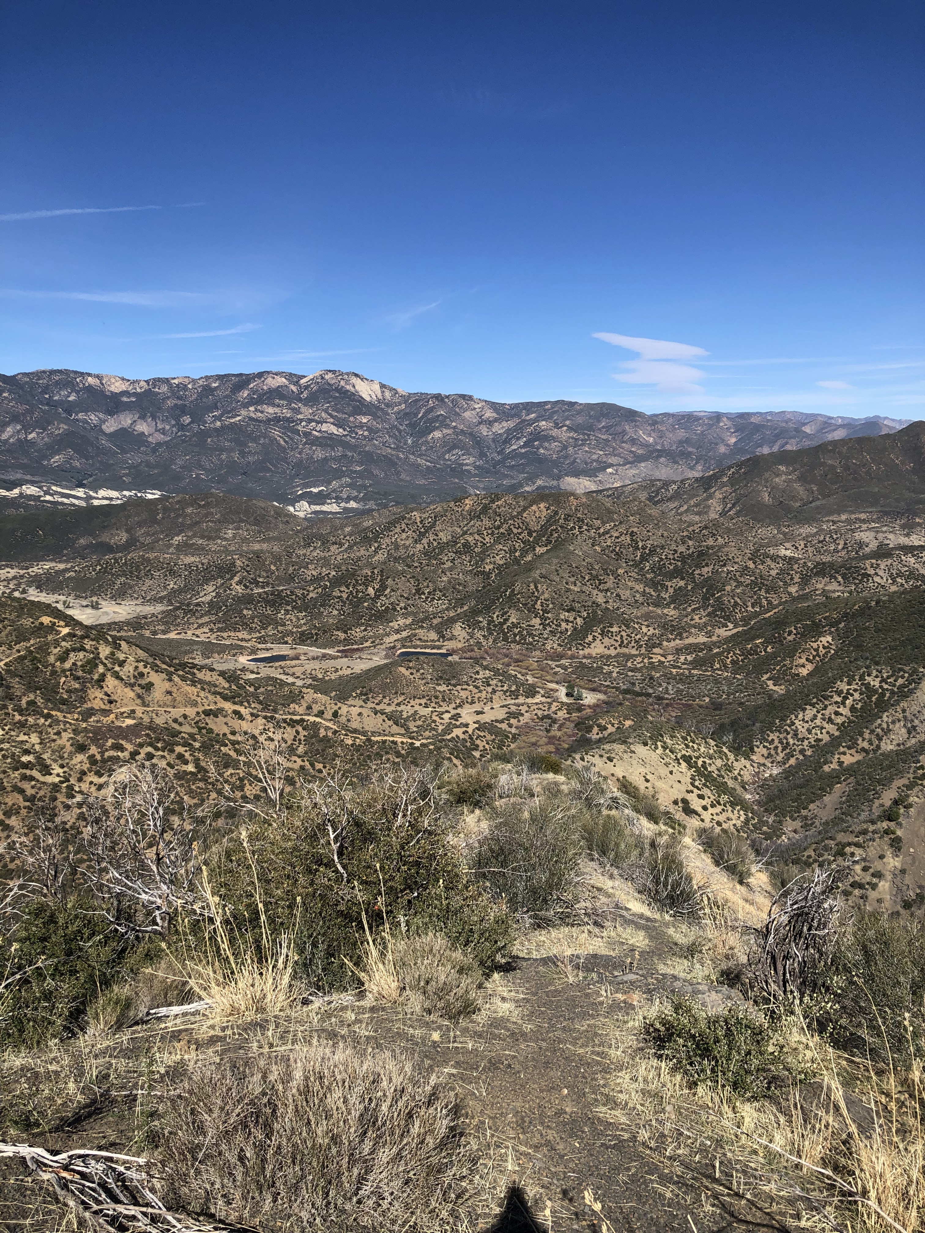
| Piedra Blanca + Thorn Point |
 |
| Topa Topa Bluffs |
But eventually I'd have to leave and so I did, finishing my water with a few big gulps. I zoomed off the summit, looking back occasionally, the water sloshing noisily in my stomach. Hadn't brought any food with me which was a huge mistake. I hoped my water-filled stomach would trick my brain into thinking it was full for a while. Alas, this did not work. By the time I was back on forest route 5N08 I was hungrier than ever, cursing myself for not bringing so much as a granola bar or some nuts.
So, rather impatient, I jogged most of the way back. Yeah it bothered my toe a little but hey, I was hungry. So I jogged down the road, up and down its various inclines. I reached the junction, made a right, and jogged some more. And then I veered off the road and started down the ridge, digging my heels in whatever loose dirt I could find.
 |
| Back on the ridge... |
I was in a perpetual squat most of the way down the ridge, hopping down the use trail in quick, little bitty steps, slippin' and slidin' and giving my toe something to complain about. My quads began to burn, growing tired from the steep and quick descent. Food was the only thing on my mind at that point; the trivial muscular pains in my legs of little concern. Eventually the grade calmed down, allowing me to jog more comfortably, and then I hung left and scooted down the last steep part of the ridge to its base.
Back in the brush, back to wandering around. I found a better and more efficient way through the brush on my return, a phenomenon that seems to happen quite often with me. I got back on the road, hopped around the gate, and then jogged the rest of the way to the car. When I finally reached it, I realized that I'd completed the whole thing, up and down, in under three hours—a new record for me. But I could care less. I had to eat.
And eat I did. Soon as I got home I cooked up some leftover pasta in the ol' microwave and gobbled up the whole mess in minutes. Pasta has never tasted so good, lemme tell yah. And later that evening, on a completely different note, I saw Ladysmith Black Mambazo perform at the Ventura Music Hall. Kind of random, but it was interesting nonetheless. Why this world-renowned South African a capella group would choose to perform in Ventura is beyond me, but hey, it happened and it was awesome. The dudes put on a great show. Immaculate vibes.

No comments:
Post a Comment