I've done a few things in the time since my arduous adventure up to Cobblestone Mountain. Climbed Chief Peak with a coworker in 96° weather. Went out in a pontoon on Lake Casitas (which is now full for the first time since 1998). Celebrated an early birthday celebration for my sister at a ropes course. But I hadn't really done anything of a serious nature in a while and figured that I should get after it soon before the temperatures here become unbearable. So, last week, on the 20th, I decided that I should finally tackle SoCal's highest peak: San Gorgonio.
This one is a very popular mountain, even more so in the summer time when it is free of snow. Several trails lead to the summit. I decided to take the Vivian Creek Trail, which seems to be the most popular of the bunch. It's the shortest route to the summit, steep, and apparently very scenic. I had never ventured anywhere near that neck of the woods so I didn't know what to expect. The Angeles National Forest, San Gorgonio Wilderness, Crestline, Big Bear, Yucaipa, all of it was a mystery to me. I had to go down there and see what it was all about.
I left at 4:15am and joined the other crazy early morning drivers on their commute to who knows where. Luckily, there was no traffic the entire way down. I made it to the trailhead in 2½ hours—not too shabby. There were several cars in the small parking lot, all of them displaying a pass of some kind. I had finally purchased an adventure pass the day prior, and it looked like I would need it. I didn't know how ornery the rangers here were so I wanted to play it safe.
 |
| Vivian Creek Trail |
The temps were hovering around the low 60's. The canyon was immersed in shade, with towering peaks on either side. It kind of looked like a miniature King's Canyon. I passed three people near the beginning of the trail. They would be the first of many interesting individuals that I would meet throughout the day. One of them was a large fellow, hiking with trekking poles and a backpack that looked too small for him. The others were just wearing fanny packs.
I eventually made a left, crossed the creek bed, and then passed a sign that said wilderness permits were required one mile ahead. Immediately after the sign was the worst part of the day: the switchbacks up out of the canyon. I didn't know this at the time, and figured that there was worse yet to come, but nope. That first mile of switchbacks is easily the hardest section of the trail. If you can make it up those, you can make it the rest of the way.
I wore my sweater for all of 12 minutes before taking it off. Before long, I was huffin' and puffin' and sweatin' like a fool until finally reaching the top of the switchbacks. Here there was a sign designating the entrance to the San Gorgonio Wilderness. A little ways past the sign and slightly off trail was a nice view of the canyon and a rushing waterfall. I took a break there before pressing on.
After the switchbacks the trail curved into a wooded area that proved to be my favorite part of the entire hike. Up until that point the terrain and the foliage reminded me of the rugged San Emigdio Mountains near PMC and Frazier Park. But those mountains up there, rugged as the are, are of no comparison to the ones that I now found myself traveling through. Not only are they much higher in elevation and retain snow for longer periods of time, but they're also much larger, much grander, and have a lot more water. Rounding that corner was like being transported into the foothills of the sierra. It honestly looked like I was on some trail in Sequoia National Park, but instead of being surrounded by Sequoias I was surrounded by gargantuan cedar and pine trees.
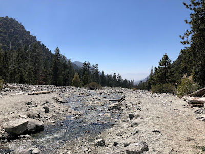
The trail followed Vivian Creek for a while, meandering its way through tall green grasses, ferns, cedars, pines, and other types of woodland flora of which I was unfamiliar. The water in the creek was ice cold, the sun slowly filtered though the canopy of pine needles, and the trail was clean of human detritus. This was surprising. Given the popularity of the route, I expected it to look a lot like the Whitney Trail. But it seems like people take good care of it. I only picked up three pieces of trash throughout the day.
I followed the steady grade of the trail, admiring the scenery. I'm a sucker for good trails. When they're well marked, well traveled, and cover beautiful terrain, it's nice to just turn your brain off and enjoy yourself. No route finding, no bush whacking...it's fantastic!
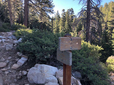
I passed some more people, some of whom were backpackers with really small packs, some of whom were day hikers with really big packs. I eventually reached the junction with Halfway Camp and took another break. Here the scenery was a little different. The cedars were gone. The air was dryer. It wasn't as brushy on the sides of the trail. Lots of tall pines and manzanita and ceanothus. I ate a peanut butter sandwich and continued on my journey.
After Halfway Camp the trail steepens considerably, but not anywhere near the extent of those first switchbacks. I went up and up, traveling through pines, firs, and every now and then a rocky outcrop of crumbly granite. Mt San Antonio sat far away to the west, a distant mass jutting out of the hazy valley. It looked hot down in that haze. On my way up I passed a father and son duo, who commented on my attire. After that I had much of the trail to myself until I reached High Camp.
 |
| Yucaipa Ridge |
High Camp seemed to be the place to be. There were lots of people up there, the most I'd seen all day. I began up a series of switchbacks after crossing the last source of water and seeing the first patch of snow of the day. These were, without exaggeration, the nicest switchbacks I've ever had the pleasure to walk. They were amazing, practically flat. I zoomed up them, passing many people who had probably spent the night at High Camp. There was a group of two middle-aged dudes and a kid that looked about twelve. They were heading back down because the kid was having cramping issues. I passed a guy in a stetson hat, a day hiker carrying a 50L pack, and woman who was attempting her 9th summit. She looked to be in her 60's, traveling light, dressed in tights and a neon pink long sleeve. We chatted a bit and wished each other luck, continuing up the trail with our different paces.
At the top of the switchbacks was my first good view of Mt. San Jacinto and the desert to the east. The towering Yucaipa Ridge that I had seen all morning looked small and distant from this vantage point. I still had a good ways to go before reaching the summit.
 |
| Mt San Antonio in the distance |
 |
| Mt San Jacinto middle right |
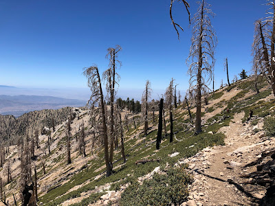
From this point I could see a good chunk of what had burned in the 2020 Apple Fire. Several trees, charred black, stood lonely and stiff in a dead forest. Cabazon, Palm Springs and Indio looked a long way off, hazy and hot in a dry and desiccated land.
From there the trail continued gaining elevation up a series of switchbacks made harder by the altitude. The foliage around me was short, bristly, and gnarly. I was approaching the timberline. The farther along I went, the shorter and gnarlier the trees. It looked like I had been teleported to the high sierra. Granite, patches of snow, and gnarly shrubs everywhere. Very similar to Cottonwood Pass out of Horseshoe Meadow.
I passed a gentleman dressed in black carrying an army backpack of sorts. He was moseying along at a leisurely pace, the altitude seemingly affecting his aerobic abilities. On a long stretch exposed to the sun, I passed four more people, two of whom were carrying heavy packs. Glad I wasn't doing that. Lugging a pack all the way to the summit just looked miserable.
I eventually reached a junction with the trails to the summit and Dollar Lake. Here the trees and shrubs were no higher than 5ft. Patches of snow were spread about, stubbornly resisting the onslaught of the summer sun. I took one last break here before completing the final stretch to the summit.
 |
| The summit! |
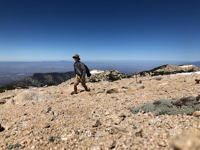
The last bit to the summit was the nicest portion of the entire hike. After going uphill for the majority of the day, it was nice to find myself walking along a vast expanse of (almost flat) granite. I rounded a corner and then I saw it: the summit. It looked pretty unassuming—just a large mound of loose granite piled up to a soft point. When I reached it I was surprised to see only one other person there. We chatted a little bit. He was a bartender in his mid 30's and it was his first time on the summit. He had climbed Mt. San Antonio the week prior and was planning on climbing "cactus to clouds" in October. We both exchanged some hiking stories, eating our respective lunches, and enjoyed the 360° panoramic views of the surrounding area.
It wasn't exceptionally clear that day, but it was clear enough. I could see pretty far in every direction, gazing upon lands of which I have no knowledge. I could see Big Bear Lake, Highway 18, Mt San Antonio, San Bernardino, much of the Inland Empire, Mt San Jacinto, Palm Springs, and Joshua Tree. Everything else was a mystery to me, just mounds of earth with a little dusting of civilization here and there. Distant peaks, hundreds of miles away and shrouded in haze, stood mysterious and beckoning. I wished I knew more about the local topography so as to get a better understanding of what I was lookin' at, but the view was stellar nonetheless.
 |
| West(ish) |
 |
| Big Bear Lake |
 |
| Mt San Jacinto |
Eventually, the summit became more and more crowded. That lone hiker dressed in black carrying the army pack came next, looking very fatigued. He was a young guy, looked to be in his late teens/early twenties. Apparently he had gotten a 3am start but got lost in the dark. Said he did some scrambling off trail. Lots of backtracking, lots of bush whacking. Said he reached a summit of sorts and turned around. The dude had climbed two mountains that day, something that was not planned or wanted.
Then came the four people, the two carrying the heavy packs tossing them off with great satisfaction. Then the lone day hiker with the 50L pack. Then came the lady in the neon pink, successfully making her 9th summit. More people showed up, so I moved east along the summit, heading towards the numerous wind shelters built of stones stacked on top of one another. I found a small one, sat down, and ate the rest of my lunch in privacy, gazing east upon the vast expanse of broiling desert and rugged mountains.
I spent over an hour on the summit. I didn't want to leave. But I knew that it would take a while to get back down and the drive would likely be long and miserable what with all the traffic. So I took a few more pictures, said my goodbyes, and then I was off and away.
The thing that I liked most about this trail was that it was very simple. All up on the way there, all down on the way back. I cruised most of the way, stopping only to pee or take more pictures. A lot of the people that I had passed earlier that morning recognized me and asked how much farther it was to the summit. I saw the stetson hat guy, the day hikers with the huge packs, and the father son duo. I even saw the large fellow with the trekking poles and tiny pack, whose accomplices had apparently abandoned him. He asked me how far it was. I told him about 2 hours. He said he'd been putting this hike off for a long time and that it was now or never. I said that he'd picked the best day possible. It was the solstice, the longest day of the year. I wished him luck and trotted down the trail, descending the switchbacks, watching the foliage grow taller and wider and greener and more varied.
I forgot to bring trekking poles and the downhill was starting to kill my knees. So, a little ways after passing Halfway Camp, I ditched the trail and made for the creek. There was a small pool about three feet wide and three feet deep, with soft mud on one side and a jagged rock on the other. I don't know how I managed this, but I somehow lost my footing, fell into the creek, landing on the jagged rock. It scraped up my right thigh pretty good, leaving a nice bruise for later. Oh well. Sometimes those things happen. I sat in the ice cold creek for a bit before continuing on, my bruised leg not enjoying the downhill all that much.
Going back was considerably easier and I made excellent time. Most people I met at this time of day were red faced backpackers making there way to Halfway Camp. It was noticeably warmer the more I descended. Glad I wasn't hikin' up at that time of day, especially on those first switchbacks. I passed a few sorry souls who were slogging their way up them, drenched in sweat, faces blank, eyes fixed on the ground. One guy was hauling up a pack, his dog, and a big ol' cooler.
I reached the base of the switchbacks and doused my face in the creek one last time. It was the home stretch. I crossed the creek, turned right, and sauntered along the last bit to the parking lot. I saw a lone river shoe sitting in the middle of the trail. Somebody was gonna be disappointed when they reached camp.
I got to the parking lot in good time, walking an hour faster down than I did on the way up. The army pack guy was sitting at the trailhead, looking distraught. Apparently he was locked out of his own car. He had configured it in such a way that he needed his phone to unlock the car, but alas, his phone was dead. So I charged it up for him and it took forever. That phone was super dead.
In the meantime we chatted a bit, I finding out that he was from San Diego and was working a desk job of sorts as a marine. Said that he didn't get a wink of sleep the night before and that this was his first hike ever. Got his phone charged up to 2% but then found out he didn't have service. The dude needed service to unlock his car too. The last I saw of him he was wandering around the parking lot, phone held up high, looking for service. He's probably still there to this day...
I drove out of the parking lot, down through the town of Forest Falls, and out into the valley. It was 75° in the mountains, 91° in the valley. The drive back was long and tedious, with lots of that good ol' SoCal traffic. Stopped at Inn-N-Out on the way back. That stuff hits different after a long day. The hike to San Gorgonio was extremely pleasant. I can see why that trail is so popular. It's absolutely beautiful, and is easily one of the top 3 trails I've ever walked. I'll definitely be back.


