No, this is not an eating competition to see who can wolf down the most cuts of barbecued tri-tip in 30 minutes. It's a legit hiking challenge that real people do from time to time. I have no idea the origins of this challenge. My guess is that Cal Poly students most likely came up with it out of boredom. There are three high points that surround the city of San Luis Obispo: the Cal Poly "P", Cerro San Luis Obispo (AKA Madonna Peak), and the tallest—Bishop Peak. The object of the challenge is to climb all of them in one day. How one goes about this is entirely up to the individual. Driving to each trailhead is a great option, but I decided it would be more of a challenge to walk the whole thing.
Last week, on the 21st, I drove up to Grace's place where she kindly let me stay the night. In the morning the following day, she waved me goodbye as I started the challenge on Highland Dr, heading towards my first objective: Bishop Peak. The morning was cool and calm, with several Cal Poly students either walking or biking to campus. The summit of Bishop was obscured in a wispy marine layer that would probably burn off within the next half hour.
 |
| Bishop Peak obscured by marine layer |
Highland Dr. continued to increase in steepness before terminating in a dead end at the Bishop Peak trailhead. The walk transitioned from asphalt to dirt, the trail lined with lots of green plants and shady oak trees. One elderly lady was out walking her dog. She was the only person I saw on the lower portion of the trail.
At first, the trail meanders its way through this oaky woodland, with several small boulders scattered around that I assume are popular with the weekend rock climbers. Eventually, the grade increases as the trail slowly wraps up and around the base of the peak. At one point there was a break in the trees where I saw the entirety of Bishop Peak in the morning sun, the marine layer having finally burned off.
 |
| Cerro San Luis Obispo on the left |
After walking through shady woodland for a bit the trail started making a series of switchbacks up the side of the peak. I left the shelter of the trees for the exposed brushy terrain that defined the remainder of the hike to the summit. I could now see most of the city of San Luis Obispo, the Cal Poly "P", and my next objective, Cerro San Luis.
I could tell that this trail gets a lot of traffic; it was clear of brush and so worn in some spots that the dirt was slick. I passed one other guy on the final set of switchbacks and almost caught another near the summit. At the top I took a little breather while enjoying the outstanding view of the surrounding country.
 |
| Summit Boulders |
 |
| Bishop Summit |
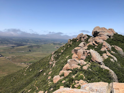
I've climbed Bishop Peak a few times in the past, and each time was awesome. The views on the summit are amazing for such a small peak. The whole spread of San Luis Obispo can be seen to the east, as well as a good chunk of Highway 1 to the north and west. Grassy fields and farmland are spread out in the south, and on a clear day, the Pacific Ocean can be seen in the distance, a shimmering blue jewel. On this particular day, the marine layer hadn't receded far enough for me to see the ocean; nevertheless, the view was as stunning as always.
I stayed on the summit for a little over 10 minutes, savoring what I assumed would probably be the best view I'd see all day. Once I had my fill I strapped on the ol' pack and made my way off the mountain, heading towards Cerro San Luis. One down, two to go.
 |
| View West(ish) |
 |
| View Northwest |
On the way down I passed a few parties who were slogging their way up the switchbacks. There were several lizards scurrying around, most of them staring at me while doing a rather intimidating set of pushups. There was this big one that was standing on a sunny rock, staring me down, seemingly unafraid of my presence. It should've—it was very easy to catch. I flipped it over to look at its magnificent blue belly, glimmering in the morning light. It was one of the most beautiful lizards I've had the pleasure to catch. I put it back on the rock and it scurried off into the bushes, never looking back, its hubris shattered.
I reached a junction where I headed right on the southeastern trail. I'm not sure if this is an established trail, but it's a lot shorter (and therefore a whole lot steeper) than the main one I'd been walking all morning. The trail basically goes straight down the side of the peak, offering little relief from the punishing grade. On my way down, I met with a father and his two teenage sons who were struggling up the trail. I told them that they were almost to the junction, but they seemed a little weary. The father looked at me and asked if I thought he could make it in his shoes, which looked like Vans. I told him maybe, as I was having no trouble skirting down the side in my beat-to-crap, treadless, perforated Altra's. One of the sons went ahead to "scout the route" and that was the last I saw of them.
I passed more groups on the way down, one party consisting of two heavily tattooed individuals with dyed hair, and a cluster of middle aged folks resting in the shade of some oaks. I reached Foothill Blvd in what seemed like no time and began the urban portion of the hike.
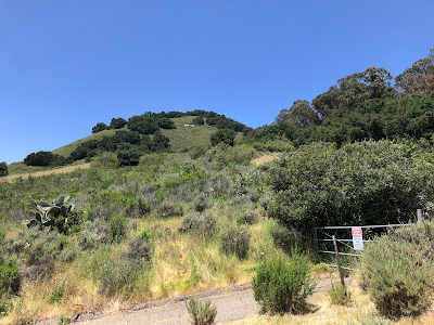
From Foothill I turned right on La Entrada Ave to Luneta Dr, where I thought I could access a trail to the summit of Cerro San Luis. But alas, there was a gate with barbed wire and a big ol' sign that said "No Trespassing. Oh well. Perhaps there was another way.
I walked east down Luneta Dr and then made a sharp right on South Tassajara Dr, which was very steep. The road reached a dead end at yet another gate, this one covered with No Trespassing signs as well. Dangit. Looks like I'd have to walk all the way around to the eastern side of the peak.
 |
| Urban Hiking |
 |
| Shut down |
And so began my adventures through suburbia. I returned to Luneta Dr and followed it all the way to Palomar Ave, which I then took to Serrano Dr. Lots of fancy houses on that street. I walked on Serrano Drive to Broad St, which took me most of the way to where I needed to go. Cars zoomed by, some people were cycling, but I was the only one out walking around, probably looking a little goofy in the process what with my garb and all.
I made a right on Lincoln St, passing the famous Lincoln Market and Deli (which was packed). I took Lincoln to Hill St, which took me to a weird little road that abruptly turned into a trail. I had finally made it to a place where I could legally access the summit.
 |
| Cerro San Luis Obispo |
 |
| Back on the trail |
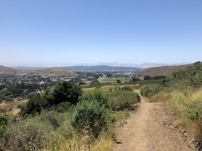
The first part of the trail was rather nice, everything was drenched in the shade of towering eucalyptus trees. This didn't last long, however, as I soon began the long walk up and out of the shade and into the sun. I followed a path that took me to the main trail to the summit, which is actually a well graded dirt road. I only saw a few people on my way to the summit. I guess everyone else was out to lunch at the Lincoln Street Deli.
The way to Cerro San Luis is not as steep as Bishop Peak, but it's much longer. I started on the east side of the mountain, curved my way up and around to the south and then west, and then finally headed back east to the summit. The route is in the shape of a giant fishing hook. I eventually made it to the blustery summit, gifted with views of Bishop Peak, San Luis Obispo, the Cal Poly "P", Highway 101 and beyond. There was a little stage right at the base of the summit boulders, where I saw a guy resting alongside his mountain bike. No one else was up there. I enjoyed the solitude, resting on the boulders and observing my next objective, the Cal Poly "P". Two down, one to go.
 |
| Bishop Peak |
 |
| Cal Poly "P" center |
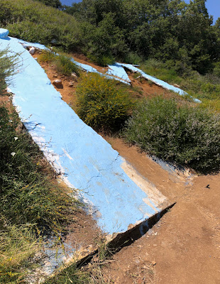
I didn't see any lizards on my way off Cerro San Luis Obispo. The one I caught that morning must have spread the word through the lizard grapevine. As I was walking down the road, I decided to do some extra credit and take the "M" trail over to the giant "M" that rests on the northeast side of the peak. Popular to contrary belief, the "M" does not stand for "Madonna" but rather "Mission Prep High School", according to historycenterslo.org. Who woulda known?
I continued to follow the "M" trail, which turned into a series of lovely shaded switchbacks that lead me back down to the trailhead. Only two other people were out walking the trail, both of them elderly, both of them solo. I made it back to Lincoln St and turned left on Broad St, preparing for another long walk through civilization.
I followed Broad St all the way to Foothill Blvd, which was jam packed with traffic. A lot of people were out and about, walking, cycling, eating lunch at the numerous restaurants that lined the street. As I made my way towards Cal Poly Campus, I found myself walking with a large crowd of students, all of whom were heading in the same direction I was.
 |
| The "M" |
 |
| The "M" trail |
 |
| Back to civilization |
I followed Broad St all the way to Foothill Blvd, which was jam packed with traffic. A lot of people were out and about, walking, cycling, eating lunch at the numerous restaurants that lined the street. As I made my way towards Cal Poly Campus, I found myself walking with a large crowd of students, all of whom were heading in the same direction I was.
There must have been something going on at the campus, because it was packed. Over by the rock climbing wall was a group with fancy cameras and microphones and lights and everything. Looked like they were filming a documentary or something. The smells of cafeteria food drifted through the air, the whole campus like a miniature city with all of the people walking in every direction. I left all this hullabaloo behind me, walking up a road to a parking lot at the base of my final climb.
 |
| Cal Poly Campus |
 |
| The "P" |
The walk to the "P" is the easiest of the three. It takes less than half a mile of walking to reach it. I zoomed up there in no time, almost catching up with a group of shirtless dudes. There's a nice little boardwalk beneath the "P", with two sets of wooden stairs and a couch that some crazy students hauled up there. An information sign has a panoramic photo of the surrounding area, describing each of the "seven summits" as well as a few extra. Since the "P" isn't a high point, I decided to do a little extra and climb the rest of the way to the top of the hill. A brief slog later and I was done, having completed the whole thing in under 5 hours.
I walked along the ridge of the hill for a bit, finding a "throne" on top of one of the rocks. I sat in the throne and took the longest break of the day, enjoying the marvelous view of the city and the two peaks I had climbed. Three down, challenge complete!
 |
| The Throne |
Two other people showed up on top of the hill. They walked over to me, passed me by, and continued down the ridge, talking about cigarettes and their correlation to lung cancer. I enjoyed the throne for a brief while longer, and then made my way off the hill. Back at the "P", I tried out the rope swing that was looped up on a branch of a lone eucalyptus tree. I also managed to catch another lizard, this one apparently not getting the warning message from the other lizards.
I walked back through campus and all of the hullabaloo, turned onto Highland Dr, and that was that. No more peaks, no more walking. I hung out with Ry for a while, talking about life and stuff. Haven't seen the dude in a while and it was nice catching up. I had dinner with Grace, where I spent wayyy too much money on a Tri-Tip sandwich. It was delicious, but super overpriced for what it was. Oh well. That's SLO for yah. Overall, it was an excellent day. The hike was a fun one, offering a decent challenge and nice views. Later this summer I might do it again with Grace. She's been wanting to do it for a while, just hasn't found the time.


All that just for some overpriced tri-tip
ReplyDeleteRight? Haha
Delete