09/26/24

It was a restless night in the Onion Valley parking lot. Tossing and turning, moving from the driver's seat to the back seats trying to get comfortable. Finally, at around 3:00am, I gave up with the tossing and turning and decided to put the seats down and spread out. Why didn't I do this earlier? I'd forgotten to bring a pad. And them's seats is hard on their back sides. My hips and back would pay for it later. But I didn't care. I drifted in and out of consciousness, my head filled with hazy dreams and thoughts of the coming trek.
The sun began to tease its inevitable appearance at around 6:00am. Hidden far below the horizon, its light washed the morning sky with this deep red color. That meant it was time to go. I gathered my measly belongings, payed a quick visit to the freezing pit toilet, and then set off on the trail.
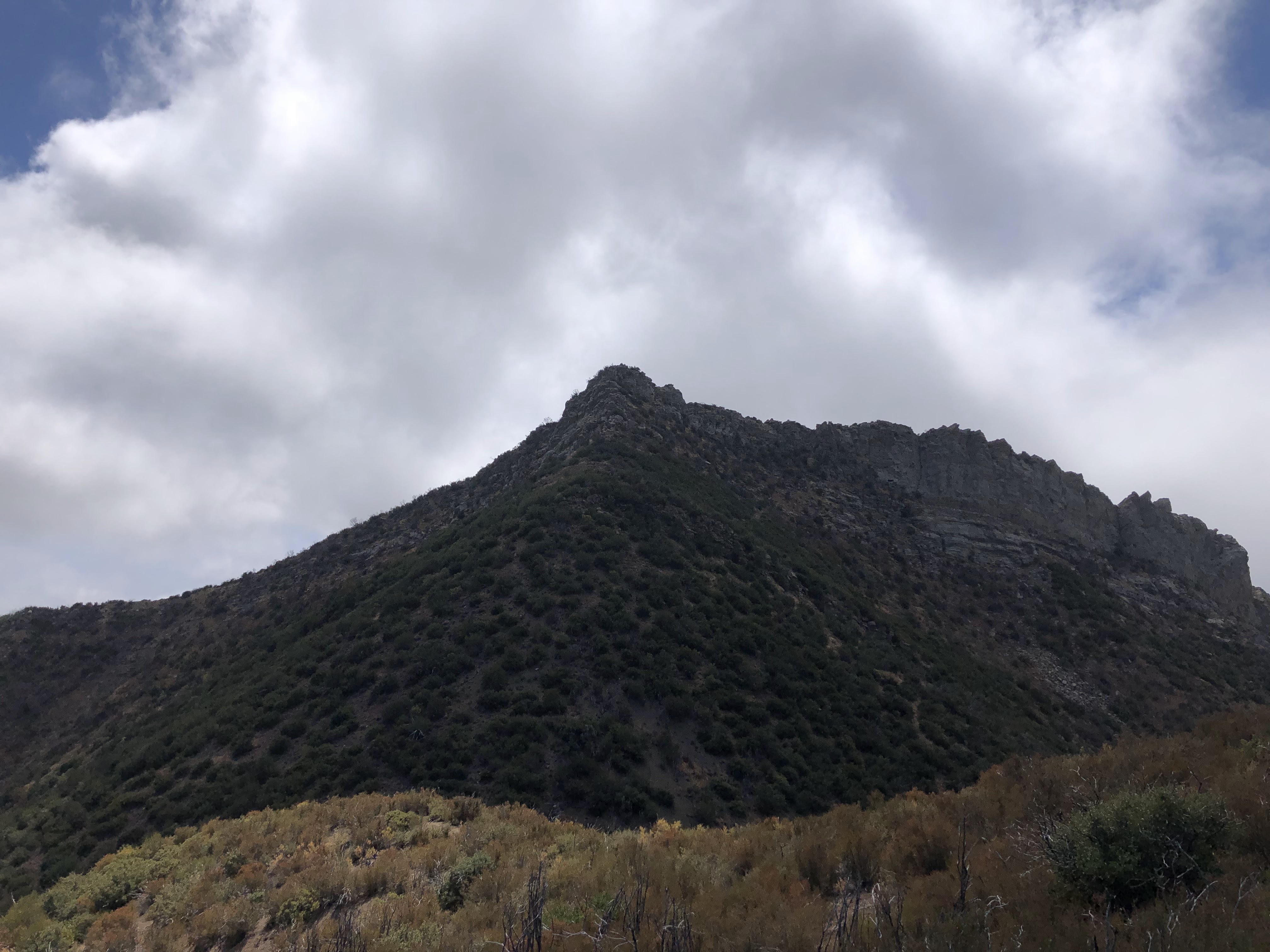
The sun took its sweet time climbing over the horizon. Though it was only late September, the surrounding temperatures shivered my timbers a good deal. I walked fast, hoping that strenuous exercise would warm me up quick. A faint pink alpenglow illuminated the summits of the surrounding peaks. University Peak was particularly stunning. Its north face was still covered in a thick dusting of snow, courtesy of the storm that blew in last week. This was the storm that made me chicken out of that JMT section hike. Looking at that lingering snow while I was hiking up the trail reaffirmed my decision in not going. Looked like it was a cold, cold storm. Glad I avoided it.

 |
| University Peak |
The current weather, so far, was holding up great. Early morning alpenglow gave way to a golden hour of gleaming light. The sun had crested the horizon, bathing the surrounding peaks and trees and rocks and flowers in a warm, golden shower of light. No clouds, no wind. It was looking to be a fantastic day. I pressed on, stopping near Gilbert Lake for a quick breakfast.
I continued up the trail, passing the junction that goes to Flower and Matlock Lakes. I hadn't seen a single person so far, a rare feat given the popularity of the trail. Surely there'd be people at the pass. It was finally starting to warm up now, so I took off the ol' jacket and stuffed it in the pack. I wouldn't need it for the rest of the day.
I went up a series of switchbacks and then got my first view of Kearsarge Pass and Mt. Gould. The pass looked to be devoid of people. Very interesting. I'd never seen the pass empty. I walked up to the pass, the altitude starting to make its presence felt. I'd driven to the trailhead directly from sea level just twelve hours prior. Going from sea level to 11,709ft isn't the best idea. You'd think I'd have learned my lesson by now, but I haven't. That's because there's no lesson to be learned. You see, I've found that the best way to deal with altitude is to just suck it up and keep trekkin'. And by suck it up I mean air. Lots of it. Big ol' heaping gulps. That usually does the trick.

I stopped at the pass and admired the view. I had it all to myself, save for a little pika that scurried in and out of sight. There wasn't a single person up there, nor were there any down on the trail on either side of the pass. Where was everyone? Who knows. I savored this moment of rare solitude, enjoying the views of University Peak and the Owens Valley. But I spent most of my time staring at my destination to the west, Mt. Rixford, planning out a route that would require the least effort. It was lookin' like I'd take the south face, zig-zag up some loose talus for the majority of the climb, hit the ridge, and then traverse the ridge to the summit. Grace had climbed this peak back in 2016 and said it was very difficult. I'd see about that soon enough.
I left the pass, realizing almost immediately that it was a lot steeper on its western side. Oh well. That was gonna be a fun climb on the way back. I zoomed down the switchbacks, my mind only thinking of how I'd have to climb back up them in a few hours. The trail continued to move down, down, down, going deeper into the valley. Just before I reached the junction with the Kearsarge Lakes trail I saw the first person I'd seen all day. Dude was wearing baggy pants, a sun hoody, and had this backpack that looked like it only had enough room for a Gatorade bottle. The guy must have been a trail runner of some kind. He nodded and continued up to the pass. I stuck to the right, heading towards Charlotte Lake and the JMT.
The trail continued to move in a downward fashion, so much so that I began to worry that I'd lose too much elevation and have to climb extra. I could see the south face of Mt. Rixford from the trail. Without much thought or care, I left the trail at a random point and made my way towards the mountain. I weaved through the short pines without much difficulty. Bushwhacking was not on the menu that morning. Ahh, the joys of high altitude...
 |
| Off trail |
I hit the bottom of the south face and began the climb. At first it was mostly solid, my feet sliding out from under me only occasionally. And then I hit this super sandy section and my pace slowed dramatically. After surpassing this obstacle, all that was left was a 1,000ft+ slog through loose talus. Nothing scary. Nothing precarious. Just a long, long, long slog up a steep slope with no relief. Just as I predicted earlier that day, I spent the majority of the morning zig-zagging up this steep slope of loose talus, careful not to roll my ankle or break a trekking pole. It was slow and exhausting work.

 |
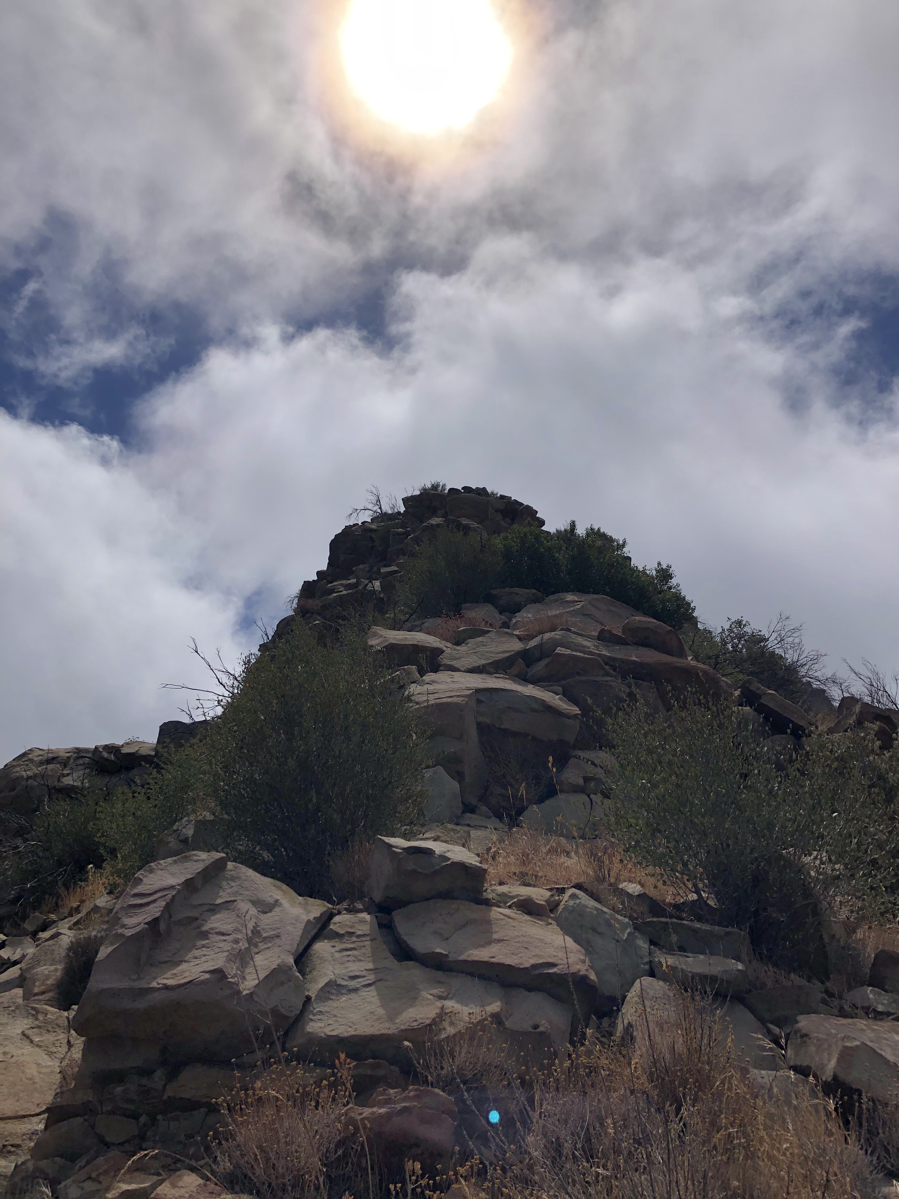
| "Falcor Peak" |
I crested the south face, reaching the ridge in a huff and a wheeze. My heart was beating out my chest, my head dizzy and heavy. That was one sucky talus slog. Made for a hell of a morning workout. Luckily, that slog was the hardest part of the day. I could see the summit from my vantage point on the ridge. Looked like some fun scrambling stood between me and my destination. I rested a bit, catching my breath and observing the tremendous views to the south. After a good five minutes of just sittin' there, I gathered my things and started the awesome ridge traverse.
 |
| Mt. Rixford |
The ridge proved to be very fun. Even saw a tiny little bristlecone nestled in some rocks. How it got up there I do not know. But it looked healthy and that's all that matters. I found the ridge to be mostly class 1-2, with one easy class 3 section near the base of the summit. This section could likely be avoided, but I didn't feel like looking around for an easier route. I surpassed this obstacle without much difficulty, dropping my pack in the shade of a large boulder. I pushed through the last few hundred feet to the summit, scrambling and hopping and having a jolly good time. This was much better than the slog up the south face.
I reached the summit in no time. It was surprisingly flat and open, offering expansive 360° views of the surrounding area. I found the register (placed in 2012) and signed my name, noticing that the previous entry was from five days prior. Skimming the pages, I found Grace's entry from 2016. I'll stand by her assertion that Rixford is a difficult summit. It certainly ain't no walk in the park. In terms of route-finding and scrambling it's pretty easy. But it sure is one hell of a slog. This mountain is a stair master on steroids.
 |
| West |
 |
| Rae Lakes (view north) |
 |
| South |
 |
| East |
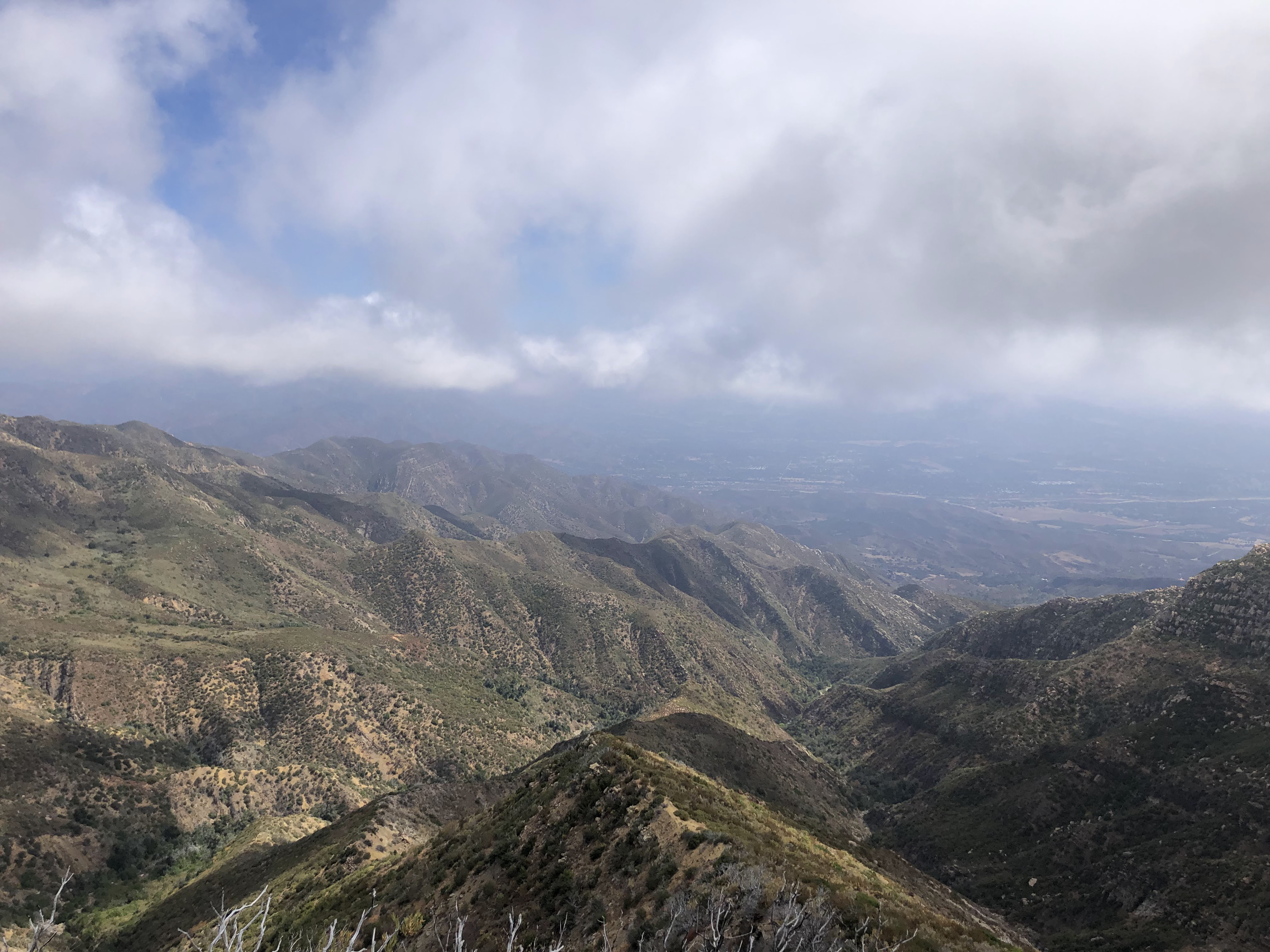
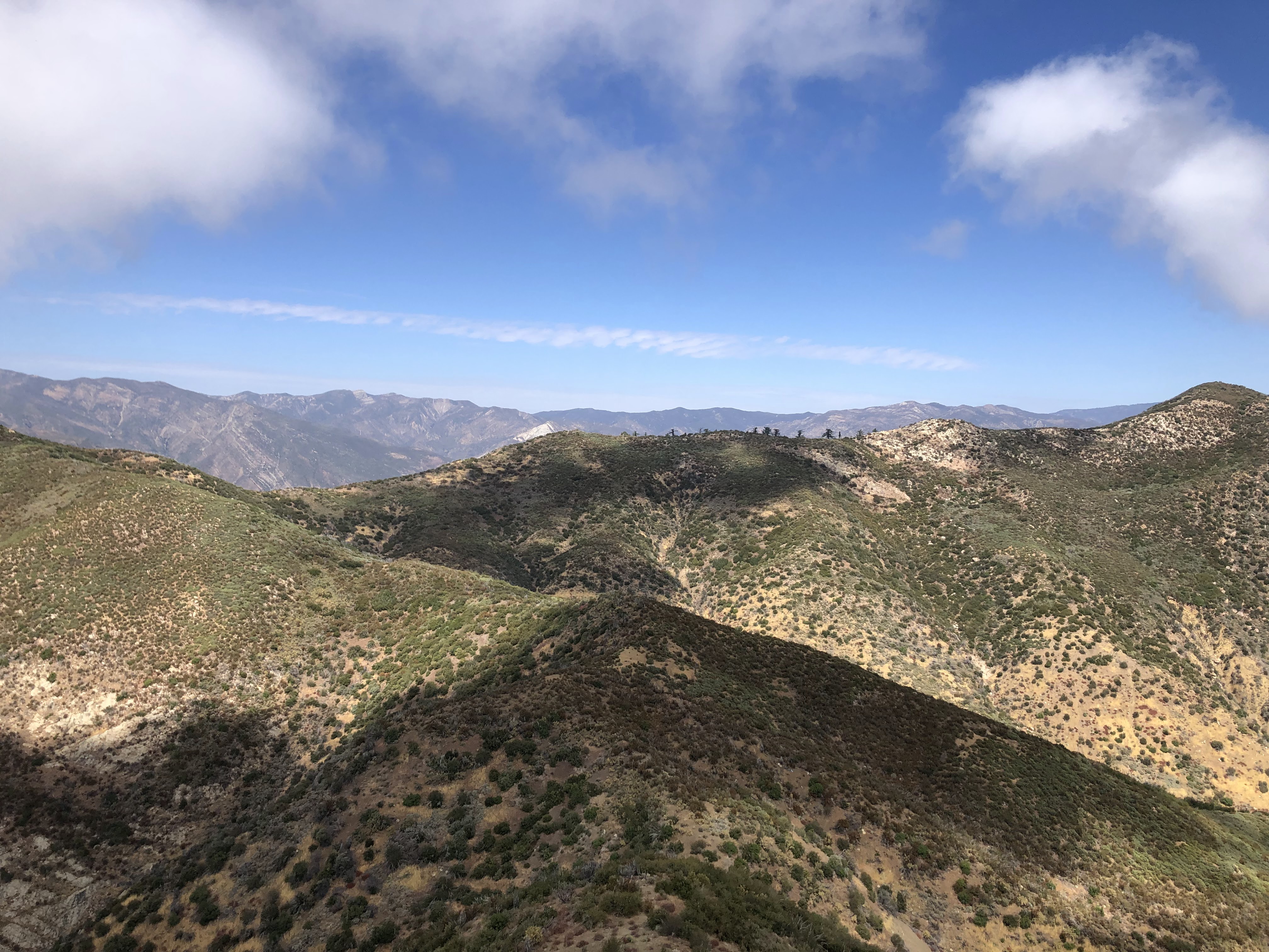
It was dead silent on the summit. No wind, no clouds, no weather of any kind. It was surreal. Could almost hear the blood coursing through my veins. I sat and took it all in, trying to associate all those pointy bumps and spires and bodies of water with names on the map. To the north sat Rae Lakes. I could make out Fin Dome, Mt. Cotter, Mt. Clarence King, Diamond Peak, and wayy off in the distance: the formidable Palisades. It was so clear I could even make out the southwest chutes on Mt. Sill.
Looking east I could see Dragon Peak, Mt. Gould and Kearsarge Pass. Looking in a southern direction gifted me with what I considered the most scenic view: University Peak to the southeast, the sparkling blue jewel of Kearsarge Lake, the numerous, snow dusted Kearsarge Pinnacles, Mt. Keith and Center Peak, East Vidette and Bubbs Creek. Off in the distance, covered in a dusting of snow and looking foreboding and intimidating sat Junction Peak, Deerhorn Mountain and Mt. Brewer. And to the west sat the expanse of King's Canyon. I could even make out the road that winds down into the canyon itself, a tiny brown line etched in an expanse of grayish green.

I spent a little over twenty minutes on the summit. And then it was time to say goodbye. I took one last 360° sweep and then started down the mountain. It was a lot easier going down than going up. I zoomed down the ridge in what seemed like seconds, finding my pack and making my way to the talus-covered south face. A tedious, slow-moving, ankle-killing descent awaited me.
 |
| A fun class 3 obstacle |

I ate it on the way down. Lost my footing, tripped up on my feet, and fell face-first on the sharp talus. I was a lot more careful after that little set back. I skied what I could ski, I slid down what I could slid, but for the most part it was slow work stepping down loose rock after loose rock. My quads were cooked by the time I made it off the south face. I needed to eat something. Take a long rest. So I found this sweet spot by this big ol' rock face and rehydrated me a freeze-dried meal. I took off my shoes, shook out all the rocks and dust, and took a nice long lunch break.
 |
| University Peak and Kearsarge Pinnacles |


 |
| Gilbert Lake |

 |
| Fall colors beneath Independence Peak |
It was an uneventful walk back to the parking lot. The trail was back to its regular quantity of human traffic. I saw rangers, trail runners, day hikers, backpackers. Even saw some people working on the trail, hauling up tools, digging up rocks, putting in steps. Looked like a gnarly job. As I was walking down the trail, I notice that most of the deciduous foliage was beginning to turn yellow. Fall colors were sprouting in the hills, with little rivers of gold and orange carving through the evergreens.
I made it back to the parking lot, the whole trek taking a little over eight hours. It had been a fantastic day. The weather couldn't have been any better. No wind, no clouds, crystal clear conditions. And the peak turned out to be pretty cool too. Had some of the best views I've ever seen on a mountain summit. It was a good way to end my season in the Sierra, that is, if I stand by that claim. I told myself that this would be the last Sierra peak I'd bag this year. But those blasted mountains have a way of dragging me back. It'll be hard to resist to call.